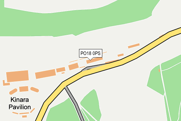
PO18 0PS is located in the Goodwood electoral ward, within the local authority district of Chichester and the English Parliamentary constituency of Chichester. The Sub Integrated Care Board (ICB) Location is NHS Sussex ICB - 70F and the police force is Sussex. This postcode has been in use since January 1980.


GetTheData
Source: OS OpenMap – Local (Ordnance Survey)
Source: OS VectorMap District (Ordnance Survey)
Licence: Open Government Licence (requires attribution)
| Easting | 488590 |
| Northing | 111067 |
| Latitude | 50.892295 |
| Longitude | -0.741768 |
GetTheData
Source: Open Postcode Geo
Licence: Open Government Licence
| Country | England |
| Postcode District | PO18 |
| ➜ PO18 open data dashboard ➜ See where PO18 is on a map | |
GetTheData
Source: Land Registry Price Paid Data
Licence: Open Government Licence
Elevation or altitude of PO18 0PS as distance above sea level:
| Metres | Feet | |
|---|---|---|
| Elevation | 160m | 525ft |
Elevation is measured from the approximate centre of the postcode, to the nearest point on an OS contour line from OS Terrain 50, which has contour spacing of ten vertical metres.
➜ How high above sea level am I? Find the elevation of your current position using your device's GPS.
GetTheData
Source: Open Postcode Elevation
Licence: Open Government Licence
| Ward | Goodwood |
| Constituency | Chichester |
GetTheData
Source: ONS Postcode Database
Licence: Open Government Licence
| Race Course (Road Past Racecourse Entrance) | Goodwood Park | 102m |
| Race Course (Road Past Racecourse Entrance) | Goodwood Park | 109m |
| Race Course (Park Rd) | Goodwood Park | 155m |
GetTheData
Source: NaPTAN
Licence: Open Government Licence
GetTheData
Source: ONS Postcode Database
Licence: Open Government Licence


➜ Get more ratings from the Food Standards Agency
GetTheData
Source: Food Standards Agency
Licence: FSA terms & conditions
| Last Collection | |||
|---|---|---|---|
| Location | Mon-Fri | Sat | Distance |
| Bus Stop Charlton | 16:40 | 08:00 | 1,949m |
| Charlton Road Singleton | 16:30 | 08:00 | 2,270m |
| Singleton Post Office | 16:45 | 10:25 | 2,324m |
GetTheData
Source: Dracos
Licence: Creative Commons Attribution-ShareAlike
| Facility | Distance |
|---|---|
| Goodwood Cricket Club Goodwood, Chichester Grass Pitches | 2.2km |
| Gasson Meadow Droke Lane, East Dean, Chichester Grass Pitches | 2.9km |
| The Goodwood Hotel And Health Club Hat Hill Road, Goodwood, Chichester Health and Fitness Gym, Swimming Pool, Golf, Studio, Outdoor Tennis Courts | 3km |
GetTheData
Source: Active Places
Licence: Open Government Licence
| School | Phase of Education | Distance |
|---|---|---|
| Singleton CofE Primary School Charlton Road, Singleton CE Primary School, Singleton, PO18 0HP | Primary | 2.2km |
| West Dean CofE Primary School West Dean, West Dean Ce Primary School, Chichester, PO18 0RJ | Primary | 3.2km |
| Lavant Primary School West Stoke Road, Lavant, Chichester, PO18 0BW | Primary | 4km |
GetTheData
Source: Edubase
Licence: Open Government Licence
The below table lists the International Territorial Level (ITL) codes (formerly Nomenclature of Territorial Units for Statistics (NUTS) codes) and Local Administrative Units (LAU) codes for PO18 0PS:
| ITL 1 Code | Name |
|---|---|
| TLJ | South East (England) |
| ITL 2 Code | Name |
| TLJ2 | Surrey, East and West Sussex |
| ITL 3 Code | Name |
| TLJ27 | West Sussex (South West) |
| LAU 1 Code | Name |
| E07000225 | Chichester |
GetTheData
Source: ONS Postcode Directory
Licence: Open Government Licence
The below table lists the Census Output Area (OA), Lower Layer Super Output Area (LSOA), and Middle Layer Super Output Area (MSOA) for PO18 0PS:
| Code | Name | |
|---|---|---|
| OA | E00160524 | |
| LSOA | E01031477 | Chichester 006A |
| MSOA | E02006566 | Chichester 006 |
GetTheData
Source: ONS Postcode Directory
Licence: Open Government Licence
| PO18 0SP | Town Lane | 1529m |
| PO18 0HY | Charlton Mill Way | 1788m |
| PO18 0QE | 1908m | |
| PO18 0HU | 1924m | |
| PO18 0HX | 1930m | |
| PO18 0ET | Church Way | 2106m |
| PO18 0HR | The Leys | 2129m |
| PO18 0EY | 2175m | |
| PO18 0HW | 2175m | |
| PO18 0EZ | 2177m |
GetTheData
Source: Open Postcode Geo; Land Registry Price Paid Data
Licence: Open Government Licence