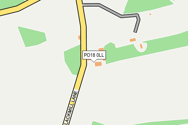
PO18 0LL is located in the Arundel & Walberton electoral ward, within the local authority district of Arun and the English Parliamentary constituency of Arundel and South Downs. The Sub Integrated Care Board (ICB) Location is NHS Sussex ICB - 70F and the police force is Sussex. This postcode has been in use since January 1980.


GetTheData
Source: OS OpenMap – Local (Ordnance Survey)
Source: OS VectorMap District (Ordnance Survey)
Licence: Open Government Licence (requires attribution)
| Easting | 493210 |
| Northing | 107879 |
| Latitude | 50.862916 |
| Longitude | -0.676930 |
GetTheData
Source: Open Postcode Geo
Licence: Open Government Licence
| Country | England |
| Postcode District | PO18 |
| ➜ PO18 open data dashboard ➜ See where PO18 is on a map | |
GetTheData
Source: Land Registry Price Paid Data
Licence: Open Government Licence
Elevation or altitude of PO18 0LL as distance above sea level:
| Metres | Feet | |
|---|---|---|
| Elevation | 30m | 98ft |
Elevation is measured from the approximate centre of the postcode, to the nearest point on an OS contour line from OS Terrain 50, which has contour spacing of ten vertical metres.
➜ How high above sea level am I? Find the elevation of your current position using your device's GPS.
GetTheData
Source: Open Postcode Elevation
Licence: Open Government Licence
| Ward | Arundel & Walberton |
| Constituency | Arundel And South Downs |
GetTheData
Source: ONS Postcode Database
Licence: Open Government Licence
| Thicket Lane (Un-named Road) | Eartham | 566m |
| Thicket Lane (Un-named Road) | Eartham | 615m |
| Chaff Barn (Un-named Road) | Eartham | 916m |
| Warehead Stud Farm (Thicket Lane) | Halnaker | 1,014m |
| Winterton Arms (A27) | Crockerhill | 1,301m |
| Barnham Station | 4.4km |
GetTheData
Source: NaPTAN
Licence: Open Government Licence
GetTheData
Source: ONS Postcode Database
Licence: Open Government Licence


➜ Get more ratings from the Food Standards Agency
GetTheData
Source: Food Standards Agency
Licence: FSA terms & conditions
| Last Collection | |||
|---|---|---|---|
| Location | Mon-Fri | Sat | Distance |
| Dukes Road | 16:15 | 07:45 | 1,332m |
| Crockerhill | 17:10 | 08:00 | 1,335m |
| Norton Lane Norton | 16:45 | 07:30 | 1,458m |
GetTheData
Source: Dracos
Licence: Creative Commons Attribution-ShareAlike
| Facility | Distance |
|---|---|
| Great Ballard School Eartham, Chichester Swimming Pool, Grass Pitches, Artificial Grass Pitch, Outdoor Tennis Courts | 1.6km |
| Boxgrove Village Hall And Community Centre The Street, Boxgrove, Chichester Sports Hall, Grass Pitches | 2.6km |
| Ormiston Six Villages Academy Lime Avenue, Westergate, Chichester Grass Pitches | 2.6km |
GetTheData
Source: Active Places
Licence: Open Government Licence
| School | Phase of Education | Distance |
|---|---|---|
| Great Ballard School Eartham, Chichester, PO18 0LR | Not applicable | 1.6km |
| The Amicus School The Coach House, Arundel Road, Fontwell, Arundel, BN18 0SX | Not applicable | 1.8km |
| Boxgrove CofE Primary School The Street, Boxgrove, Chichester, PO18 0EE | Primary | 2.6km |
GetTheData
Source: Edubase
Licence: Open Government Licence
The below table lists the International Territorial Level (ITL) codes (formerly Nomenclature of Territorial Units for Statistics (NUTS) codes) and Local Administrative Units (LAU) codes for PO18 0LL:
| ITL 1 Code | Name |
|---|---|
| TLJ | South East (England) |
| ITL 2 Code | Name |
| TLJ2 | Surrey, East and West Sussex |
| ITL 3 Code | Name |
| TLJ27 | West Sussex (South West) |
| LAU 1 Code | Name |
| E07000224 | Arun |
GetTheData
Source: ONS Postcode Directory
Licence: Open Government Licence
The below table lists the Census Output Area (OA), Lower Layer Super Output Area (LSOA), and Middle Layer Super Output Area (MSOA) for PO18 0LL:
| Code | Name | |
|---|---|---|
| OA | E00160079 | |
| LSOA | E01031397 | Arun 003E |
| MSOA | E02006544 | Arun 003 |
GetTheData
Source: ONS Postcode Directory
Licence: Open Government Licence
| PO18 0LN | The Steps | 568m |
| PO18 0LG | Aldingbourne Drive | 772m |
| PO18 0LQ | Aldingbourne Drive | 776m |
| PO18 0JU | Blackmill Lane | 838m |
| BN18 0ST | Brittens Lane | 893m |
| PO18 0SD | Aldingbourne Drive | 1046m |
| PO18 0JX | Arundel Road | 1056m |
| PO18 0LH | 1234m | |
| BN18 0SR | Little Heath Road | 1345m |
| PO20 3SB | Level Mare Lane | 1365m |
GetTheData
Source: Open Postcode Geo; Land Registry Price Paid Data
Licence: Open Government Licence