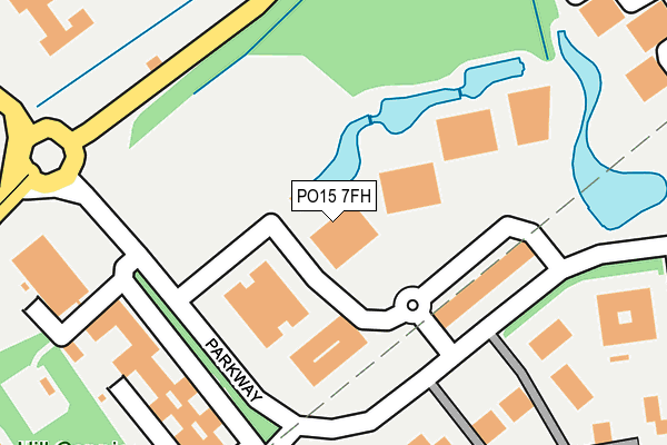
PO15 7FH is located in the Whiteley and Shedfield electoral ward, within the local authority district of Winchester and the English Parliamentary constituency of Meon Valley. The Sub Integrated Care Board (ICB) Location is NHS Hampshire and Isle of Wight ICB - D9Y0V and the police force is Hampshire. This postcode has been in use since August 2004.


GetTheData
Source: OS OpenMap – Local (Ordnance Survey)
Source: OS VectorMap District (Ordnance Survey)
Licence: Open Government Licence (requires attribution)
| Easting | 453202 |
| Northing | 108984 |
| Latitude | 50.877910 |
| Longitude | -1.245179 |
GetTheData
Source: Open Postcode Geo
Licence: Open Government Licence
| Country | England |
| Postcode District | PO15 |
| ➜ PO15 open data dashboard ➜ See where PO15 is on a map ➜ Where is Whiteley? | |
GetTheData
Source: Land Registry Price Paid Data
Licence: Open Government Licence
Elevation or altitude of PO15 7FH as distance above sea level:
| Metres | Feet | |
|---|---|---|
| Elevation | 20m | 66ft |
Elevation is measured from the approximate centre of the postcode, to the nearest point on an OS contour line from OS Terrain 50, which has contour spacing of ten vertical metres.
➜ How high above sea level am I? Find the elevation of your current position using your device's GPS.
GetTheData
Source: Open Postcode Elevation
Licence: Open Government Licence
| Ward | Whiteley And Shedfield |
| Constituency | Meon Valley |
GetTheData
Source: ONS Postcode Database
Licence: Open Government Licence
| October 2023 | Anti-social behaviour | On or near Leafy Lane | 358m |
| October 2023 | Public order | On or near Leafy Lane | 358m |
| June 2023 | Violence and sexual offences | On or near Leafy Lane | 358m |
| ➜ Get more crime data in our Crime section | |||
GetTheData
Source: data.police.uk
Licence: Open Government Licence
| Solent Business Park (Parkway) | Whiteley | 150m |
| Solent Business Park (Parkway) | Whiteley | 166m |
| Whiteley Parkway (Whiteley Way) | Whiteley | 177m |
| Solent Business Park (Parkway) | Whiteley | 190m |
| Whiteley Way Roundabout (Whiteley Way) | Whiteley | 207m |
| Swanwick Station | 1.5km |
| Bursledon Station | 4.3km |
| Botley Station | 4.4km |
GetTheData
Source: NaPTAN
Licence: Open Government Licence
GetTheData
Source: ONS Postcode Database
Licence: Open Government Licence


➜ Get more ratings from the Food Standards Agency
GetTheData
Source: Food Standards Agency
Licence: FSA terms & conditions
| Last Collection | |||
|---|---|---|---|
| Location | Mon-Fri | Sat | Distance |
| Parkway Meters | 18:30 | 166m | |
| Parkway | 18:30 | 11:30 | 167m |
| Solent Business Park | 17:00 | 08:45 | 291m |
GetTheData
Source: Dracos
Licence: Creative Commons Attribution-ShareAlike
| Facility | Distance |
|---|---|
| Solent Hotel Spa Rookery Avenue, Whiteley, Fareham Health and Fitness Gym, Swimming Pool, Studio, Outdoor Tennis Courts | 346m |
| Meadowside Leisure Centre Whiteley Way, Whiteley, Fareham Sports Hall, Health and Fitness Gym, Grass Pitches, Artificial Grass Pitch, Studio | 776m |
| Whiteley Primary School Gull Coppice, Whiteley, Fareham Sports Hall, Artificial Grass Pitch | 873m |
GetTheData
Source: Active Places
Licence: Open Government Licence
| School | Phase of Education | Distance |
|---|---|---|
| Cornerstone CofE (VA) Primary School Bluebell Way, Whiteley, Fareham, PO15 7QE | Primary | 593m |
| Whiteley Primary School Gull Coppice, Whiteley, Fareham, PO15 7LA | Primary | 897m |
| Park Gate Primary School Northmore Road, Park Gate, Southampton, SO31 6LX | Primary | 1.8km |
GetTheData
Source: Edubase
Licence: Open Government Licence
The below table lists the International Territorial Level (ITL) codes (formerly Nomenclature of Territorial Units for Statistics (NUTS) codes) and Local Administrative Units (LAU) codes for PO15 7FH:
| ITL 1 Code | Name |
|---|---|
| TLJ | South East (England) |
| ITL 2 Code | Name |
| TLJ3 | Hampshire and Isle of Wight |
| ITL 3 Code | Name |
| TLJ36 | Central Hampshire |
| LAU 1 Code | Name |
| E07000094 | Winchester |
GetTheData
Source: ONS Postcode Directory
Licence: Open Government Licence
The below table lists the Census Output Area (OA), Lower Layer Super Output Area (LSOA), and Middle Layer Super Output Area (MSOA) for PO15 7FH:
| Code | Name | |
|---|---|---|
| OA | E00118299 | |
| LSOA | E01032859 | Winchester 013F |
| MSOA | E02004841 | Winchester 013 |
GetTheData
Source: ONS Postcode Directory
Licence: Open Government Licence
| PO15 7AA | Parkway | 270m |
| PO15 7HL | Leafy Lane | 383m |
| PO15 7JR | Johnson View | 411m |
| PO15 6RJ | Lady Bettys Drive | 415m |
| PO15 7JX | Mollison Rise | 423m |
| PO15 7HJ | Lindbergh Rise | 450m |
| PO15 7JB | Leafy Lane | 472m |
| PO15 7JL | Sorrel Drive | 483m |
| PO15 7RL | Ashwood | 487m |
| PO15 6RH | Hill Coppice Road | 488m |
GetTheData
Source: Open Postcode Geo; Land Registry Price Paid Data
Licence: Open Government Licence