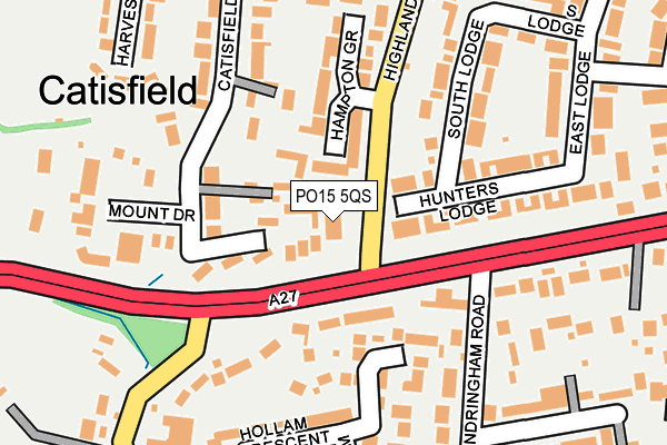
PO15 5QS is located in the Titchfield electoral ward, within the local authority district of Fareham and the English Parliamentary constituency of Fareham. The Sub Integrated Care Board (ICB) Location is NHS Hampshire and Isle of Wight ICB - D9Y0V and the police force is Hampshire. This postcode has been in use since January 1980.


GetTheData
Source: OS OpenMap – Local (Ordnance Survey)
Source: OS VectorMap District (Ordnance Survey)
Licence: Open Government Licence (requires attribution)
| Easting | 454829 |
| Northing | 105979 |
| Latitude | 50.850739 |
| Longitude | -1.222505 |
GetTheData
Source: Open Postcode Geo
Licence: Open Government Licence
| Country | England |
| Postcode District | PO15 |
| ➜ PO15 open data dashboard ➜ See where PO15 is on a map ➜ Where is Fareham? | |
GetTheData
Source: Land Registry Price Paid Data
Licence: Open Government Licence
Elevation or altitude of PO15 5QS as distance above sea level:
| Metres | Feet | |
|---|---|---|
| Elevation | 30m | 98ft |
Elevation is measured from the approximate centre of the postcode, to the nearest point on an OS contour line from OS Terrain 50, which has contour spacing of ten vertical metres.
➜ How high above sea level am I? Find the elevation of your current position using your device's GPS.
GetTheData
Source: Open Postcode Elevation
Licence: Open Government Licence
| Ward | Titchfield |
| Constituency | Fareham |
GetTheData
Source: ONS Postcode Database
Licence: Open Government Licence
| September 2023 | Violence and sexual offences | On or near County Gardens | 429m |
| January 2023 | Violence and sexual offences | On or near County Gardens | 429m |
| December 2022 | Criminal damage and arson | On or near Hollam Crescent | 201m |
| ➜ Get more crime data in our Crime section | |||
GetTheData
Source: data.police.uk
Licence: Open Government Licence
| Ranvilles Lane (The Avenue) | Catisfield | 85m |
| Hampton Grove (Highlands Road) | Catisfield | 146m |
| Ranvilles Lane (The Avenue) | Catisfield | 163m |
| Hampton Grove (Highlands Road) | Catisfield | 202m |
| Sandringham Road (The Avenue) | Catisfield | 253m |
| Fareham Station | 2.2km |
| Swanwick Station | 4.1km |
GetTheData
Source: NaPTAN
Licence: Open Government Licence
GetTheData
Source: ONS Postcode Database
Licence: Open Government Licence


➜ Get more ratings from the Food Standards Agency
GetTheData
Source: Food Standards Agency
Licence: FSA terms & conditions
| Last Collection | |||
|---|---|---|---|
| Location | Mon-Fri | Sat | Distance |
| Sandringham Road | 16:45 | 11:30 | 148m |
| Catisfield Post Office | 17:00 | 11:45 | 296m |
| Rowan Way | 16:45 | 11:30 | 327m |
GetTheData
Source: Dracos
Licence: Creative Commons Attribution-ShareAlike
| Facility | Distance |
|---|---|
| St Francis Special School Oldbury Way, Fareham Sports Hall | 601m |
| Titchfield Recreation Ground Mill Lane, Titchfield, Fareham Grass Pitches, Outdoor Tennis Courts | 716m |
| Titchfield Community Centre Mill Street, Titchfield, Fareham Sports Hall | 755m |
GetTheData
Source: Active Places
Licence: Open Government Licence
| School | Phase of Education | Distance |
|---|---|---|
| Heathfield Special School Oldbury Way, Fareham, PO14 3BN | Not applicable | 578m |
| St Francis Special School Patchway Drive, Oldbury Way, Fareham, PO14 3BN | Not applicable | 601m |
| Ranvilles Junior School Oldbury Way, Fareham, PO14 3BN | Primary | 622m |
GetTheData
Source: Edubase
Licence: Open Government Licence
The below table lists the International Territorial Level (ITL) codes (formerly Nomenclature of Territorial Units for Statistics (NUTS) codes) and Local Administrative Units (LAU) codes for PO15 5QS:
| ITL 1 Code | Name |
|---|---|
| TLJ | South East (England) |
| ITL 2 Code | Name |
| TLJ3 | Hampshire and Isle of Wight |
| ITL 3 Code | Name |
| TLJ35 | South Hampshire |
| LAU 1 Code | Name |
| E07000087 | Fareham |
GetTheData
Source: ONS Postcode Directory
Licence: Open Government Licence
The below table lists the Census Output Area (OA), Lower Layer Super Output Area (LSOA), and Middle Layer Super Output Area (MSOA) for PO15 5QS:
| Code | Name | |
|---|---|---|
| OA | E00115791 | |
| LSOA | E01022783 | Fareham 009D |
| MSOA | E02004735 | Fareham 009 |
GetTheData
Source: ONS Postcode Directory
Licence: Open Government Licence
| PO15 5NX | Catisfield Gate | 72m |
| PO15 5NF | Hunters Lodge | 74m |
| PO14 3DP | The Avenue | 87m |
| PO15 5NL | Hampton Grove | 103m |
| PO15 5NT | Catisfield Lane | 111m |
| PO14 3AA | The Avenue | 121m |
| PO14 3DR | Gatcombe Gardens | 138m |
| PO14 3DN | Sandringham Road | 171m |
| PO15 5NE | Hunters Lodge | 182m |
| PO14 3DT | Hollam Crescent | 186m |
GetTheData
Source: Open Postcode Geo; Land Registry Price Paid Data
Licence: Open Government Licence