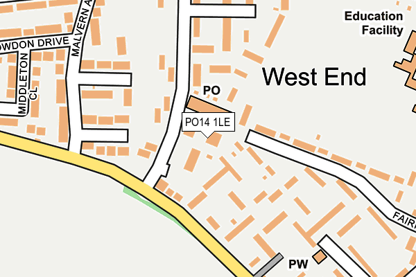
PO14 1LE is located in the Fareham South electoral ward, within the local authority district of Fareham and the English Parliamentary constituency of Fareham. The Sub Integrated Care Board (ICB) Location is NHS Hampshire and Isle of Wight ICB - D9Y0V and the police force is Hampshire. This postcode has been in use since January 1980.


GetTheData
Source: OS OpenMap – Local (Ordnance Survey)
Source: OS VectorMap District (Ordnance Survey)
Licence: Open Government Licence (requires attribution)
| Easting | 456337 |
| Northing | 105458 |
| Latitude | 50.845901 |
| Longitude | -1.201153 |
GetTheData
Source: Open Postcode Geo
Licence: Open Government Licence
| Country | England |
| Postcode District | PO14 |
| ➜ PO14 open data dashboard ➜ See where PO14 is on a map ➜ Where is Fareham? | |
GetTheData
Source: Land Registry Price Paid Data
Licence: Open Government Licence
Elevation or altitude of PO14 1LE as distance above sea level:
| Metres | Feet | |
|---|---|---|
| Elevation | 20m | 66ft |
Elevation is measured from the approximate centre of the postcode, to the nearest point on an OS contour line from OS Terrain 50, which has contour spacing of ten vertical metres.
➜ How high above sea level am I? Find the elevation of your current position using your device's GPS.
GetTheData
Source: Open Postcode Elevation
Licence: Open Government Licence
| Ward | Fareham South |
| Constituency | Fareham |
GetTheData
Source: ONS Postcode Database
Licence: Open Government Licence
| January 2024 | Violence and sexual offences | On or near Parking Area | 76m |
| January 2024 | Anti-social behaviour | On or near Parking Area | 76m |
| January 2024 | Other theft | On or near Parking Area | 76m |
| ➜ Get more crime data in our Crime section | |||
GetTheData
Source: data.police.uk
Licence: Open Government Licence
| Broadlaw Walk (Bishopsfield Road) | Fareham | 37m |
| Broadlaw Walk (Bishopsfield Road) | Fareham | 65m |
| Butser Walk (Bishopsfield Road) | Fareham | 230m |
| Butser Walk (Bishopsfield Road) | Fareham | 248m |
| Bardon Way (Longfield Avenue) | Fareham | 290m |
| Fareham Station | 1km |
| Swanwick Station | 5.6km |
GetTheData
Source: NaPTAN
Licence: Open Government Licence
GetTheData
Source: ONS Postcode Database
Licence: Open Government Licence


➜ Get more ratings from the Food Standards Agency
GetTheData
Source: Food Standards Agency
Licence: FSA terms & conditions
| Last Collection | |||
|---|---|---|---|
| Location | Mon-Fri | Sat | Distance |
| Bishopfield Road | 16:45 | 11:45 | 35m |
| Fairfield Avenue | 16:45 | 11:30 | 418m |
| Longmynd Drive | 16:45 | 11:30 | 478m |
GetTheData
Source: Dracos
Licence: Creative Commons Attribution-ShareAlike
| Facility | Distance |
|---|---|
| Fareham Academy St. Annes Grove, Fareham Sports Hall, Grass Pitches, Studio, Outdoor Tennis Courts | 347m |
| Fareham College Bishopsfield Road, Fareham Health and Fitness Gym, Grass Pitches, Sports Hall | 592m |
| St Judes Catholic Primary School Bishopsfield Road, Fareham Grass Pitches, Sports Hall | 615m |
GetTheData
Source: Active Places
Licence: Open Government Licence
| School | Phase of Education | Distance |
|---|---|---|
| Fareham Academy St Anne's Grove, Fareham, PO14 1JJ | Secondary | 347m |
| Wallisdean Junior School Wallisdean Avenue, Fareham, PO14 1HU | Primary | 352m |
| Wallisdean Infant School Wallisdean Avenue, Fareham, PO14 1HT | Primary | 404m |
GetTheData
Source: Edubase
Licence: Open Government Licence
The below table lists the International Territorial Level (ITL) codes (formerly Nomenclature of Territorial Units for Statistics (NUTS) codes) and Local Administrative Units (LAU) codes for PO14 1LE:
| ITL 1 Code | Name |
|---|---|
| TLJ | South East (England) |
| ITL 2 Code | Name |
| TLJ3 | Hampshire and Isle of Wight |
| ITL 3 Code | Name |
| TLJ35 | South Hampshire |
| LAU 1 Code | Name |
| E07000087 | Fareham |
GetTheData
Source: ONS Postcode Directory
Licence: Open Government Licence
The below table lists the Census Output Area (OA), Lower Layer Super Output Area (LSOA), and Middle Layer Super Output Area (MSOA) for PO14 1LE:
| Code | Name | |
|---|---|---|
| OA | E00115563 | |
| LSOA | E01022739 | Fareham 011E |
| MSOA | E02004737 | Fareham 011 |
GetTheData
Source: ONS Postcode Directory
Licence: Open Government Licence
| PO14 1LN | Bishopsfield Road | 37m |
| PO14 1LW | Bishopsfield Road | 43m |
| PO14 1LG | Crossfell Walk | 56m |
| PO14 1QT | Bishopsfield Road | 65m |
| PO14 1LP | Bredon Walk | 66m |
| PO14 1QU | Bishopsfield Road | 86m |
| PO14 1LD | Carran Walk | 103m |
| PO14 1QS | Bishopsfield Road | 105m |
| PO14 1LH | Crossfell Walk | 109m |
| PO14 1EW | Fairfield Avenue | 127m |
GetTheData
Source: Open Postcode Geo; Land Registry Price Paid Data
Licence: Open Government Licence