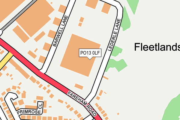
PO13 0LF is located in the Bridgemary electoral ward, within the local authority district of Gosport and the English Parliamentary constituency of Gosport. The Sub Integrated Care Board (ICB) Location is NHS Hampshire and Isle of Wight ICB - D9Y0V and the police force is Hampshire. This postcode has been in use since April 2015.


GetTheData
Source: OS OpenMap – Local (Ordnance Survey)
Source: OS VectorMap District (Ordnance Survey)
Licence: Open Government Licence (requires attribution)
| Easting | 458343 |
| Northing | 104216 |
| Latitude | 50.834534 |
| Longitude | -1.172860 |
GetTheData
Source: Open Postcode Geo
Licence: Open Government Licence
| Country | England |
| Postcode District | PO13 |
| ➜ PO13 open data dashboard ➜ See where PO13 is on a map ➜ Where is Gosport? | |
GetTheData
Source: Land Registry Price Paid Data
Licence: Open Government Licence
Elevation or altitude of PO13 0LF as distance above sea level:
| Metres | Feet | |
|---|---|---|
| Elevation | 10m | 33ft |
Elevation is measured from the approximate centre of the postcode, to the nearest point on an OS contour line from OS Terrain 50, which has contour spacing of ten vertical metres.
➜ How high above sea level am I? Find the elevation of your current position using your device's GPS.
GetTheData
Source: Open Postcode Elevation
Licence: Open Government Licence
| Ward | Bridgemary |
| Constituency | Gosport |
GetTheData
Source: ONS Postcode Database
Licence: Open Government Licence
| June 2022 | Bicycle theft | On or near Primrose Close | 267m |
| June 2022 | Vehicle crime | On or near Primrose Close | 267m |
| June 2022 | Violence and sexual offences | On or near Bridgemary Road | 387m |
| ➜ Get more crime data in our Crime section | |||
GetTheData
Source: data.police.uk
Licence: Open Government Licence
| Lederle Lane (Fareham Road) | Fleetlands | 125m |
| Lederle Lane (Fareham Road) | Fleetlands | 194m |
| Wych Lane (Fareham Road) | Fleetlands | 223m |
| Wych Lane Arch (Wych Lane) | Fleetlands | 304m |
| Wych Lane (Fareham Road) | Fleetlands | 309m |
| Fareham Station | 2.5km |
| Portchester Station | 3.8km |
| Portsmouth Harbour Station | 6.2km |
GetTheData
Source: NaPTAN
Licence: Open Government Licence
GetTheData
Source: ONS Postcode Database
Licence: Open Government Licence


➜ Get more ratings from the Food Standards Agency
GetTheData
Source: Food Standards Agency
Licence: FSA terms & conditions
| Last Collection | |||
|---|---|---|---|
| Location | Mon-Fri | Sat | Distance |
| Wych Lane | 17:15 | 11:45 | 510m |
| Hoeford | 17:00 | 12:00 | 567m |
| Gregson Avenue | 17:15 | 11:30 | 726m |
GetTheData
Source: Dracos
Licence: Creative Commons Attribution-ShareAlike
| Facility | Distance |
|---|---|
| Fleetlands Lederle Lane, Gosport Grass Pitches | 78m |
| Kendall Sports & Social Club (Closed) Gosport Studio, Health and Fitness Gym | 469m |
| Fleetlands Golf Course Fareham Road, Gosport Golf, Grass Pitches | 482m |
GetTheData
Source: Active Places
Licence: Open Government Licence
| School | Phase of Education | Distance |
|---|---|---|
| Woodcot Primary School Tukes Avenue, Bridgemary, Gosport, PO13 0SG | Primary | 742m |
| The Key Education Centre Tukes Avenue, Gosport, PO13 0SG | Not applicable | 742m |
| Haven Early Years Centre Harris Road, Gosport, PO13 0UY | Nursery | 902m |
GetTheData
Source: Edubase
Licence: Open Government Licence
The below table lists the International Territorial Level (ITL) codes (formerly Nomenclature of Territorial Units for Statistics (NUTS) codes) and Local Administrative Units (LAU) codes for PO13 0LF:
| ITL 1 Code | Name |
|---|---|
| TLJ | South East (England) |
| ITL 2 Code | Name |
| TLJ3 | Hampshire and Isle of Wight |
| ITL 3 Code | Name |
| TLJ35 | South Hampshire |
| LAU 1 Code | Name |
| E07000088 | Gosport |
GetTheData
Source: ONS Postcode Directory
Licence: Open Government Licence
The below table lists the Census Output Area (OA), Lower Layer Super Output Area (LSOA), and Middle Layer Super Output Area (MSOA) for PO13 0LF:
| Code | Name | |
|---|---|---|
| OA | E00115871 | |
| LSOA | E01022802 | Gosport 001C |
| MSOA | E02004741 | Gosport 001 |
GetTheData
Source: ONS Postcode Directory
Licence: Open Government Licence
| PO13 0AX | Lederle Lane | 131m |
| PO13 0EQ | Barwell Lane | 151m |
| PO13 0AB | Fareham Road | 179m |
| PO13 0WP | Primrose Close | 239m |
| PO13 0UG | Bridgemary Grove | 241m |
| PO13 0AQ | Fareham Road | 244m |
| PO13 0FZ | Lederle Lane | 273m |
| PO13 0SU | Wych Lane | 306m |
| PO13 0UN | Birch Drive | 314m |
| PO13 0UJ | Bridgemary Road | 326m |
GetTheData
Source: Open Postcode Geo; Land Registry Price Paid Data
Licence: Open Government Licence