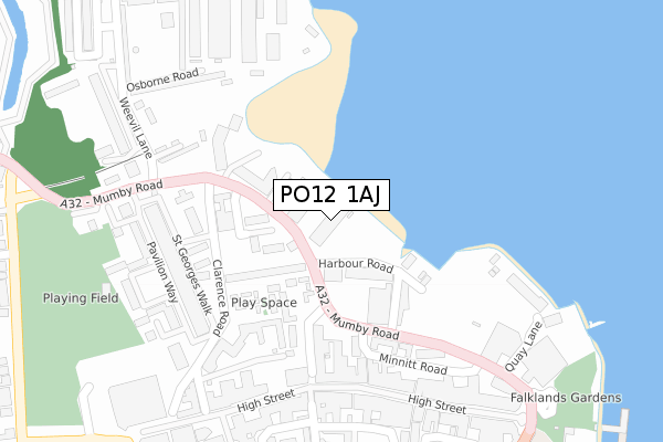
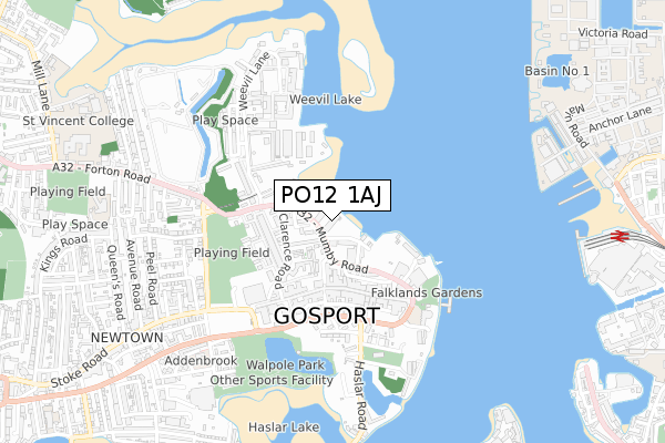
PO12 1AJ is located in the Harbourside & Town electoral ward, within the local authority district of Gosport and the English Parliamentary constituency of Gosport. The Sub Integrated Care Board (ICB) Location is NHS Hampshire and Isle of Wight ICB - D9Y0V and the police force is Hampshire. This postcode has been in use since March 1983.


GetTheData
Source: OS Open Zoomstack (Ordnance Survey)
Licence: Open Government Licence (requires attribution)
Attribution: Contains OS data © Crown copyright and database right 2025
Source: Open Postcode Geo
Licence: Open Government Licence (requires attribution)
Attribution: Contains OS data © Crown copyright and database right 2025; Contains Royal Mail data © Royal Mail copyright and database right 2025; Source: Office for National Statistics licensed under the Open Government Licence v.3.0
| Easting | 461950 |
| Northing | 100152 |
| Latitude | 50.797628 |
| Longitude | -1.122343 |
GetTheData
Source: Open Postcode Geo
Licence: Open Government Licence
| Country | England |
| Postcode District | PO12 |
➜ See where PO12 is on a map ➜ Where is Gosport? | |
GetTheData
Source: Land Registry Price Paid Data
Licence: Open Government Licence
Elevation or altitude of PO12 1AJ as distance above sea level:
| Metres | Feet | |
|---|---|---|
| Elevation | 10m | 33ft |
Elevation is measured from the approximate centre of the postcode, to the nearest point on an OS contour line from OS Terrain 50, which has contour spacing of ten vertical metres.
➜ How high above sea level am I? Find the elevation of your current position using your device's GPS.
GetTheData
Source: Open Postcode Elevation
Licence: Open Government Licence
| Ward | Harbourside & Town |
| Constituency | Gosport |
GetTheData
Source: ONS Postcode Database
Licence: Open Government Licence
| Waterside Medical Centre (Mumby Road) | Gosport | 70m |
| Waterside Medical Centre (Mumby Road) | Gosport | 77m |
| St George Barracks (Mumby Road) | Forton | 318m |
| St George Barracks | Forton | 325m |
| Police Station (South Street) | Gosport | 354m |
| Portsmouth Harbour Station | 1km |
| Southsea Hoverport | 2.1km |
| Portsmouth & Southsea Station | 2.2km |
GetTheData
Source: NaPTAN
Licence: Open Government Licence
Estimated total energy consumption in PO12 1AJ by fuel type, 2015.
| Consumption (kWh) | 56,456 |
|---|---|
| Meter count | 7 |
| Mean (kWh/meter) | 8,065 |
| Median (kWh/meter) | 7,177 |
GetTheData
Source: Postcode level gas estimates: 2015 (experimental)
Source: Postcode level electricity estimates: 2015 (experimental)
Licence: Open Government Licence
GetTheData
Source: ONS Postcode Database
Licence: Open Government Licence


➜ Get more ratings from the Food Standards Agency
GetTheData
Source: Food Standards Agency
Licence: FSA terms & conditions
| Last Collection | |||
|---|---|---|---|
| Location | Mon-Fri | Sat | Distance |
| Gosport Post Office | 18:30 | 12:00 | 290m |
| St Georges Barracks | 17:00 | 12:00 | 308m |
| Castle Tavern | 18:30 | 11:30 | 398m |
GetTheData
Source: Dracos
Licence: Creative Commons Attribution-ShareAlike
| Risk of PO12 1AJ flooding from rivers and sea | High |
| ➜ PO12 1AJ flood map | |
GetTheData
Source: Open Flood Risk by Postcode
Licence: Open Government Licence
The below table lists the International Territorial Level (ITL) codes (formerly Nomenclature of Territorial Units for Statistics (NUTS) codes) and Local Administrative Units (LAU) codes for PO12 1AJ:
| ITL 1 Code | Name |
|---|---|
| TLJ | South East (England) |
| ITL 2 Code | Name |
| TLJ3 | Hampshire and Isle of Wight |
| ITL 3 Code | Name |
| TLJ35 | South Hampshire |
| LAU 1 Code | Name |
| E07000088 | Gosport |
GetTheData
Source: ONS Postcode Directory
Licence: Open Government Licence
The below table lists the Census Output Area (OA), Lower Layer Super Output Area (LSOA), and Middle Layer Super Output Area (MSOA) for PO12 1AJ:
| Code | Name | |
|---|---|---|
| OA | E00168134 | |
| LSOA | E01032879 | Gosport 008G |
| MSOA | E02004748 | Gosport 008 |
GetTheData
Source: ONS Postcode Directory
Licence: Open Government Licence
| PO12 1AN | King Street | 99m |
| PO12 1AW | King Street | 108m |
| PO12 1BN | White Lion Walk | 129m |
| PO12 1BH | Seahorse Walk | 137m |
| PO12 1BB | Clarence Road | 165m |
| PO12 1BG | Harbour Road | 165m |
| PO12 1BW | Farriers Walk | 175m |
| PO12 1EN | Rope Quays | 183m |
| PO12 1HS | Burnhams Walk | 185m |
| PO12 1BE | North Cross Street | 198m |
GetTheData
Source: Open Postcode Geo; Land Registry Price Paid Data
Licence: Open Government Licence