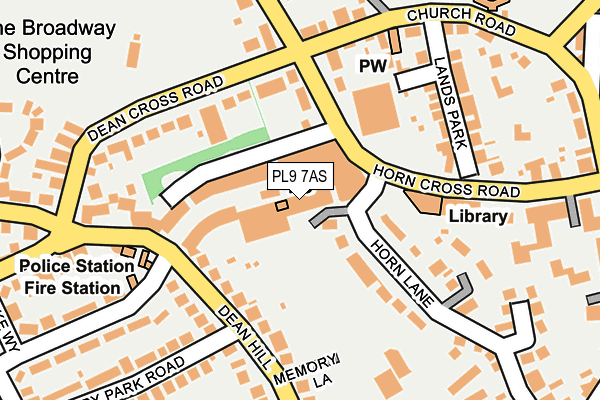
PL9 7AS is located in the Plymstock Radford electoral ward, within the unitary authority of Plymouth and the English Parliamentary constituency of South West Devon. The Sub Integrated Care Board (ICB) Location is NHS Devon ICB - 15N and the police force is Devon & Cornwall. This postcode has been in use since January 1980.


GetTheData
Source: OS OpenMap – Local (Ordnance Survey)
Source: OS VectorMap District (Ordnance Survey)
Licence: Open Government Licence (requires attribution)
| Easting | 251391 |
| Northing | 53217 |
| Latitude | 50.360035 |
| Longitude | -4.090652 |
GetTheData
Source: Open Postcode Geo
Licence: Open Government Licence
| Country | England |
| Postcode District | PL9 |
| ➜ PL9 open data dashboard ➜ See where PL9 is on a map ➜ Where is Plymouth? | |
GetTheData
Source: Land Registry Price Paid Data
Licence: Open Government Licence
Elevation or altitude of PL9 7AS as distance above sea level:
| Metres | Feet | |
|---|---|---|
| Elevation | 30m | 98ft |
Elevation is measured from the approximate centre of the postcode, to the nearest point on an OS contour line from OS Terrain 50, which has contour spacing of ten vertical metres.
➜ How high above sea level am I? Find the elevation of your current position using your device's GPS.
GetTheData
Source: Open Postcode Elevation
Licence: Open Government Licence
| Ward | Plymstock Radford |
| Constituency | South West Devon |
GetTheData
Source: ONS Postcode Database
Licence: Open Government Licence
| June 2022 | Public order | On or near The Broadway | 55m |
| June 2022 | Anti-social behaviour | On or near Horn Cross Road | 153m |
| June 2022 | Criminal damage and arson | On or near Lands Park | 189m |
| ➜ Get more crime data in our Crime section | |||
GetTheData
Source: data.police.uk
Licence: Open Government Licence
| Opposite Lidls (Horn Cross Road) | Plymstock | 73m |
| Broadway West (Dean Hill) | Plymstock | 135m |
| Dean Cross Road | Plymstock | 139m |
| Dean Cross Road | Plymstock | 143m |
| Berry Park Road (Dean Hill) | Plymstock | 158m |
| Plymouth Station | 4.2km |
GetTheData
Source: NaPTAN
Licence: Open Government Licence
GetTheData
Source: ONS Postcode Database
Licence: Open Government Licence


➜ Get more ratings from the Food Standards Agency
GetTheData
Source: Food Standards Agency
Licence: FSA terms & conditions
| Last Collection | |||
|---|---|---|---|
| Location | Mon-Fri | Sat | Distance |
| Plymstock Post Office | 17:30 | 12:00 | 14m |
| Greenacres | 17:00 | 13:00 | 638m |
| Higher Hooe | 17:00 | 12:00 | 817m |
GetTheData
Source: Dracos
Licence: Creative Commons Attribution-ShareAlike
| Facility | Distance |
|---|---|
| Dean Cross Park Dean Cross Road, Plymouth Grass Pitches, Outdoor Tennis Courts | 219m |
| Curves (Plymstock) Radford Park Road, Plymouth Health and Fitness Gym | 274m |
| Plymstock School Sports Centre Church Road, Plymstock, Plymouth Sports Hall, Health and Fitness Gym, Artificial Grass Pitch, Grass Pitches, Studio | 380m |
GetTheData
Source: Active Places
Licence: Open Government Licence
| School | Phase of Education | Distance |
|---|---|---|
| Plymstock School Church Road, Plymstock, Plymouth, PL9 9AZ | Secondary | 304m |
| Pomphlett Primary School Howard Road, Plymstock, Plymouth, PL9 7ES | Primary | 657m |
| Goosewell Primary Academy Goosewell Road, Plymstock, Plymouth, PL9 9HD | Primary | 723m |
GetTheData
Source: Edubase
Licence: Open Government Licence
The below table lists the International Territorial Level (ITL) codes (formerly Nomenclature of Territorial Units for Statistics (NUTS) codes) and Local Administrative Units (LAU) codes for PL9 7AS:
| ITL 1 Code | Name |
|---|---|
| TLK | South West (England) |
| ITL 2 Code | Name |
| TLK4 | Devon |
| ITL 3 Code | Name |
| TLK41 | Plymouth |
| LAU 1 Code | Name |
| E06000026 | Plymouth |
GetTheData
Source: ONS Postcode Directory
Licence: Open Government Licence
The below table lists the Census Output Area (OA), Lower Layer Super Output Area (LSOA), and Middle Layer Super Output Area (MSOA) for PL9 7AS:
| Code | Name | |
|---|---|---|
| OA | E00076473 | |
| LSOA | E01015136 | Plymouth 031B |
| MSOA | E02003152 | Plymouth 031 |
GetTheData
Source: ONS Postcode Directory
Licence: Open Government Licence
| PL9 7AY | Horn Cross Road | 100m |
| PL9 9BU | Horn Cross Road | 142m |
| PL9 9AA | Dean Hill | 150m |
| PL9 9AB | Dean Hill | 151m |
| PL9 7AZ | Dean Cross Road | 168m |
| PL9 9BY | Lands Park | 168m |
| PL9 9AH | Church Road | 179m |
| PL9 9AF | Dean Hill | 181m |
| PL9 9AJ | Church Road | 195m |
| PL9 9BR | Horn Lane | 200m |
GetTheData
Source: Open Postcode Geo; Land Registry Price Paid Data
Licence: Open Government Licence