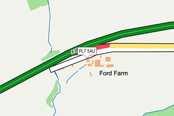
PL7 5AU lies on Ford Cottages in Plympton, Plymouth. PL7 5AU is located in the Newton & Yealmpton electoral ward, within the local authority district of South Hams and the English Parliamentary constituency of South West Devon. The Sub Integrated Care Board (ICB) Location is NHS Devon ICB - 15N and the police force is Devon & Cornwall. This postcode has been in use since January 1980.


GetTheData
Source: OS OpenMap – Local (Ordnance Survey)
Source: OS VectorMap District (Ordnance Survey)
Licence: Open Government Licence (requires attribution)
| Easting | 258123 |
| Northing | 55447 |
| Latitude | 50.381755 |
| Longitude | -3.996884 |
GetTheData
Source: Open Postcode Geo
Licence: Open Government Licence
| Street | Ford Cottages |
| Locality | Plympton |
| Town/City | Plymouth |
| Country | England |
| Postcode District | PL7 |
| ➜ PL7 open data dashboard ➜ See where PL7 is on a map | |
GetTheData
Source: Land Registry Price Paid Data
Licence: Open Government Licence
Elevation or altitude of PL7 5AU as distance above sea level:
| Metres | Feet | |
|---|---|---|
| Elevation | 60m | 197ft |
Elevation is measured from the approximate centre of the postcode, to the nearest point on an OS contour line from OS Terrain 50, which has contour spacing of ten vertical metres.
➜ How high above sea level am I? Find the elevation of your current position using your device's GPS.
GetTheData
Source: Open Postcode Elevation
Licence: Open Government Licence
| Ward | Newton & Yealmpton |
| Constituency | South West Devon |
GetTheData
Source: ONS Postcode Database
Licence: Open Government Licence
| May 2022 | Violence and sexual offences | On or near A38 | 197m |
| February 2022 | Drugs | On or near A38 | 197m |
| December 2021 | Violence and sexual offences | On or near A38 | 197m |
| ➜ Get more crime data in our Crime section | |||
GetTheData
Source: data.police.uk
Licence: Open Government Licence
| New Country Inn | Smithaleigh | 705m |
| Smithaleigh (A38) | Smithaleigh | 735m |
| Holmleigh (New Park Road) | Smithaleigh | 1,020m |
| Eastern Wood Road | Langage | 1,329m |
| Meadows Close (Eastern Wood Road) | Langage | 1,349m |
GetTheData
Source: NaPTAN
Licence: Open Government Licence
| Percentage of properties with Next Generation Access | 100.0% |
| Percentage of properties with Superfast Broadband | 0.0% |
| Percentage of properties with Ultrafast Broadband | 0.0% |
| Percentage of properties with Full Fibre Broadband | 0.0% |
Superfast Broadband is between 30Mbps and 300Mbps
Ultrafast Broadband is > 300Mbps
| Percentage of properties unable to receive 2Mbps | 0.0% |
| Percentage of properties unable to receive 5Mbps | 100.0% |
| Percentage of properties unable to receive 10Mbps | 100.0% |
| Percentage of properties unable to receive 30Mbps | 100.0% |
GetTheData
Source: Ofcom
Licence: Ofcom Terms of Use (requires attribution)
GetTheData
Source: ONS Postcode Database
Licence: Open Government Licence


➜ Get more ratings from the Food Standards Agency
GetTheData
Source: Food Standards Agency
Licence: FSA terms & conditions
| Last Collection | |||
|---|---|---|---|
| Location | Mon-Fri | Sat | Distance |
| Hemerdon | 16:30 | 07:10 | 3,107m |
| Westfield | 17:15 | 10:45 | 3,686m |
| Yealmpton Post Office | 16:45 | 10:40 | 3,692m |
GetTheData
Source: Dracos
Licence: Creative Commons Attribution-ShareAlike
| Facility | Distance |
|---|---|
| Sparkwell Playing Field Seaton Orchard, Sparkwell, Plymouth Grass Pitches | 2.3km |
| Welbeck Manor & Sparkwell Golf Course Sparkwell, Plymouth Golf | 2.7km |
| Glen Park Primary School Glen Road, Plympton, Plymouth Grass Pitches, Sports Hall | 2.7km |
GetTheData
Source: Active Places
Licence: Open Government Licence
| School | Phase of Education | Distance |
|---|---|---|
| Sparkwell All Saints Primary School Sparkwell, Plymouth, PL7 5DD | Primary | 2.3km |
| Yealmpstone Farm Primary School Meadowfield Place, Plympton, Plymouth, PL7 1XQ | Primary | 2.6km |
| Glen Park Primary School Glen Road, Plympton, Plymouth, PL7 2DE | Primary | 2.7km |
GetTheData
Source: Edubase
Licence: Open Government Licence
The below table lists the International Territorial Level (ITL) codes (formerly Nomenclature of Territorial Units for Statistics (NUTS) codes) and Local Administrative Units (LAU) codes for PL7 5AU:
| ITL 1 Code | Name |
|---|---|
| TLK | South West (England) |
| ITL 2 Code | Name |
| TLK4 | Devon |
| ITL 3 Code | Name |
| TLK43 | Devon CC |
| LAU 1 Code | Name |
| E07000044 | South Hams |
GetTheData
Source: ONS Postcode Directory
Licence: Open Government Licence
The below table lists the Census Output Area (OA), Lower Layer Super Output Area (LSOA), and Middle Layer Super Output Area (MSOA) for PL7 5AU:
| Code | Name | |
|---|---|---|
| OA | E00102037 | |
| LSOA | E01020149 | South Hams 001D |
| MSOA | E02004189 | South Hams 001 |
GetTheData
Source: ONS Postcode Directory
Licence: Open Government Licence
| PL7 5AZ | 694m | |
| PL7 5AX | 793m | |
| PL7 5BB | 1001m | |
| PL7 5AY | 1145m | |
| PL7 5HQ | Barn Close | 1214m |
| PL7 5DU | 1219m | |
| PL7 5ET | Eastern Wood Road | 1542m |
| PL21 9EG | 1555m | |
| PL7 5AP | 1566m | |
| PL21 9EL | Hazeldene Close | 1582m |
GetTheData
Source: Open Postcode Geo; Land Registry Price Paid Data
Licence: Open Government Licence