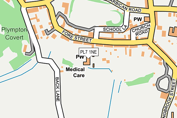
PL7 1NE is located in the Plympton Erle electoral ward, within the unitary authority of Plymouth and the English Parliamentary constituency of South West Devon. The Sub Integrated Care Board (ICB) Location is NHS Devon ICB - 15N and the police force is Devon & Cornwall. This postcode has been in use since June 1996.


GetTheData
Source: OS OpenMap – Local (Ordnance Survey)
Source: OS VectorMap District (Ordnance Survey)
Licence: Open Government Licence (requires attribution)
| Easting | 254383 |
| Northing | 55622 |
| Latitude | 50.382413 |
| Longitude | -4.049520 |
GetTheData
Source: Open Postcode Geo
Licence: Open Government Licence
| Country | England |
| Postcode District | PL7 |
| ➜ PL7 open data dashboard ➜ See where PL7 is on a map ➜ Where is Plymouth? | |
GetTheData
Source: Land Registry Price Paid Data
Licence: Open Government Licence
Elevation or altitude of PL7 1NE as distance above sea level:
| Metres | Feet | |
|---|---|---|
| Elevation | 20m | 66ft |
Elevation is measured from the approximate centre of the postcode, to the nearest point on an OS contour line from OS Terrain 50, which has contour spacing of ten vertical metres.
➜ How high above sea level am I? Find the elevation of your current position using your device's GPS.
GetTheData
Source: Open Postcode Elevation
Licence: Open Government Licence
| Ward | Plympton Erle |
| Constituency | South West Devon |
GetTheData
Source: ONS Postcode Database
Licence: Open Government Licence
| October 2022 | Public order | On or near St Maurice Road | 475m |
| June 2022 | Violence and sexual offences | On or near Church Road | 207m |
| June 2022 | Other crime | On or near Church Road | 207m |
| ➜ Get more crime data in our Crime section | |||
GetTheData
Source: data.police.uk
Licence: Open Government Licence
| Longbrook Street | Plympton | 216m |
| Longbrook Street | Plympton | 228m |
| Longcause | Plympton | 296m |
| Sydney Close (Dark Street Lane) | Plympton | 339m |
| Longcause | Plympton | 339m |
GetTheData
Source: NaPTAN
Licence: Open Government Licence
| Percentage of properties with Next Generation Access | 100.0% |
| Percentage of properties with Superfast Broadband | 100.0% |
| Percentage of properties with Ultrafast Broadband | 0.0% |
| Percentage of properties with Full Fibre Broadband | 0.0% |
Superfast Broadband is between 30Mbps and 300Mbps
Ultrafast Broadband is > 300Mbps
| Percentage of properties unable to receive 2Mbps | 0.0% |
| Percentage of properties unable to receive 5Mbps | 0.0% |
| Percentage of properties unable to receive 10Mbps | 0.0% |
| Percentage of properties unable to receive 30Mbps | 0.0% |
GetTheData
Source: Ofcom
Licence: Ofcom Terms of Use (requires attribution)
GetTheData
Source: ONS Postcode Database
Licence: Open Government Licence
➜ Get more ratings from the Food Standards Agency
GetTheData
Source: Food Standards Agency
Licence: FSA terms & conditions
| Last Collection | |||
|---|---|---|---|
| Location | Mon-Fri | Sat | Distance |
| Westfield | 17:15 | 10:45 | 1,626m |
| Hemerdon | 16:30 | 07:10 | 1,816m |
| Reservoir Road | 17:00 | 12:45 | 2,740m |
GetTheData
Source: Dracos
Licence: Creative Commons Attribution-ShareAlike
| Facility | Distance |
|---|---|
| Longcause Community Special School Longcause, Plymouth Sports Hall, Studio | 327m |
| Plympton Academy Moorland Road, Plymouth Sports Hall, Health and Fitness Gym, Grass Pitches, Artificial Grass Pitch | 700m |
| Plympton Lawn Tennis Club Ridgeway, Plymouth Outdoor Tennis Courts | 853m |
GetTheData
Source: Active Places
Licence: Open Government Licence
| School | Phase of Education | Distance |
|---|---|---|
| Longcause Community Special School Longcause, Plympton St Maurice, Plympton, Plymouth, PL7 1JB | Not applicable | 313m |
| Plympton St Maurice Primary School Plympton Hill, Plympton, Plymouth, PL7 1UB | Primary | 367m |
| Plympton Academy Moorland Road, Plympton, Plymouth, PL7 2RS | Secondary | 678m |
GetTheData
Source: Edubase
Licence: Open Government Licence
The below table lists the International Territorial Level (ITL) codes (formerly Nomenclature of Territorial Units for Statistics (NUTS) codes) and Local Administrative Units (LAU) codes for PL7 1NE:
| ITL 1 Code | Name |
|---|---|
| TLK | South West (England) |
| ITL 2 Code | Name |
| TLK4 | Devon |
| ITL 3 Code | Name |
| TLK41 | Plymouth |
| LAU 1 Code | Name |
| E06000026 | Plymouth |
GetTheData
Source: ONS Postcode Directory
Licence: Open Government Licence
The below table lists the Census Output Area (OA), Lower Layer Super Output Area (LSOA), and Middle Layer Super Output Area (MSOA) for PL7 1NE:
| Code | Name | |
|---|---|---|
| OA | E00076359 | |
| LSOA | E01015114 | Plymouth 019C |
| MSOA | E02003140 | Plymouth 019 |
GetTheData
Source: ONS Postcode Directory
Licence: Open Government Licence
| PL7 1NA | Fore Street | 81m |
| PL7 1NB | Fore Street | 88m |
| PL7 1NQ | School Lane | 146m |
| PL7 1LZ | Fore Street | 149m |
| PL7 1NH | Church Road | 179m |
| PL7 1FR | St Maurice Mews | 182m |
| PL7 1TH | Back Lane | 187m |
| PL7 1ND | Fore Street | 191m |
| PL7 1LX | Barbican Road | 207m |
| PL7 1TQ | Dorsmouth Terrace | 212m |
GetTheData
Source: Open Postcode Geo; Land Registry Price Paid Data
Licence: Open Government Licence