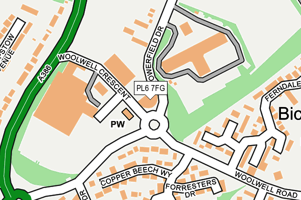
PL6 7FG lies on Towerfield Drive in Plymouth. PL6 7FG is located in the Bickleigh & Cornwood electoral ward, within the local authority district of South Hams and the English Parliamentary constituency of South West Devon. The Sub Integrated Care Board (ICB) Location is NHS Devon ICB - 15N and the police force is Devon & Cornwall. This postcode has been in use since December 2010.


GetTheData
Source: OS OpenMap – Local (Ordnance Survey)
Source: OS VectorMap District (Ordnance Survey)
Licence: Open Government Licence (requires attribution)
| Easting | 250467 |
| Northing | 61621 |
| Latitude | 50.435343 |
| Longitude | -4.106952 |
GetTheData
Source: Open Postcode Geo
Licence: Open Government Licence
| Street | Towerfield Drive |
| Town/City | Plymouth |
| Country | England |
| Postcode District | PL6 |
| ➜ PL6 open data dashboard ➜ See where PL6 is on a map ➜ Where is Plymouth? | |
GetTheData
Source: Land Registry Price Paid Data
Licence: Open Government Licence
Elevation or altitude of PL6 7FG as distance above sea level:
| Metres | Feet | |
|---|---|---|
| Elevation | 160m | 525ft |
Elevation is measured from the approximate centre of the postcode, to the nearest point on an OS contour line from OS Terrain 50, which has contour spacing of ten vertical metres.
➜ How high above sea level am I? Find the elevation of your current position using your device's GPS.
GetTheData
Source: Open Postcode Elevation
Licence: Open Government Licence
| Ward | Bickleigh & Cornwood |
| Constituency | South West Devon |
GetTheData
Source: ONS Postcode Database
Licence: Open Government Licence
| October 2022 | Violence and sexual offences | On or near Frensham Gardens | 438m |
| October 2022 | Violence and sexual offences | On or near Hessary Drive | 468m |
| October 2022 | Anti-social behaviour | On or near Hessary Drive | 468m |
| ➜ Get more crime data in our Crime section | |||
GetTheData
Source: data.police.uk
Licence: Open Government Licence
| Long Park Drive (Woolwell Road) | Woolwell | 143m |
| Tesco Superstore Roborough | Woolwell | 166m |
| Ferndale Close (Woolwell Road) | Woolwell | 175m |
| Roborough Footbridge | Belliver | 263m |
| Woolwell Road Roundabout | Widewell | 282m |
GetTheData
Source: NaPTAN
Licence: Open Government Licence
GetTheData
Source: ONS Postcode Database
Licence: Open Government Licence


➜ Get more ratings from the Food Standards Agency
GetTheData
Source: Food Standards Agency
Licence: FSA terms & conditions
| Last Collection | |||
|---|---|---|---|
| Location | Mon-Fri | Sat | Distance |
| Tesco (Roborough) | 17:30 | 12:30 | 90m |
| Beverston Way | 17:30 | 12:30 | 454m |
| Clittaford Road | 17:15 | 12:00 | 926m |
GetTheData
Source: Dracos
Licence: Creative Commons Attribution-ShareAlike
| Facility | Distance |
|---|---|
| Plymouth Argaum Rugby Football Club Bickleigh Down Road, Roborough, Plymouth Grass Pitches | 567m |
| Widewell Primary Academy Lulworth Drive, Plymouth Grass Pitches, Sports Hall, Artificial Grass Pitch | 737m |
| Roborough Sports Ground Tamerton Road, Roborugh, Plymouth Grass Pitches | 967m |
GetTheData
Source: Active Places
Licence: Open Government Licence
| School | Phase of Education | Distance |
|---|---|---|
| Bickleigh Down Church of England Primary School School Drive, Woolwell, Plymouth, PL6 7JW | Primary | 383m |
| Widewell Primary Academy Lulworth Drive, Roborough, Plymouth, PL6 7ER | Primary | 701m |
| Oakwood Primary Academy Pendeen Crescent, Southway, Plymouth, PL6 6QS | Primary | 1.2km |
GetTheData
Source: Edubase
Licence: Open Government Licence
The below table lists the International Territorial Level (ITL) codes (formerly Nomenclature of Territorial Units for Statistics (NUTS) codes) and Local Administrative Units (LAU) codes for PL6 7FG:
| ITL 1 Code | Name |
|---|---|
| TLK | South West (England) |
| ITL 2 Code | Name |
| TLK4 | Devon |
| ITL 3 Code | Name |
| TLK43 | Devon CC |
| LAU 1 Code | Name |
| E07000044 | South Hams |
GetTheData
Source: ONS Postcode Directory
Licence: Open Government Licence
The below table lists the Census Output Area (OA), Lower Layer Super Output Area (LSOA), and Middle Layer Super Output Area (MSOA) for PL6 7FG:
| Code | Name | |
|---|---|---|
| OA | E00102014 | |
| LSOA | E01020145 | South Hams 001B |
| MSOA | E02004189 | South Hams 001 |
GetTheData
Source: ONS Postcode Directory
Licence: Open Government Licence
| PL6 7QN | Coppice Wood Drive | 98m |
| PL6 7QJ | Croft Park | 139m |
| PL6 7HL | Hazelwood Drive | 153m |
| PL6 7QA | Forresters Drive | 181m |
| PL6 7QH | Copper Beech Way | 182m |
| PL6 7QL | Silver Birch Close | 189m |
| PL6 7QD | Kirkland Close | 222m |
| PL6 7QB | Hawthorn Close | 235m |
| PL6 7QF | Oaklands Close | 245m |
| PL6 7HW | Blackthorn Close | 253m |
GetTheData
Source: Open Postcode Geo; Land Registry Price Paid Data
Licence: Open Government Licence