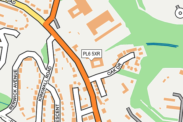
PL6 5XR is located in the Budshead electoral ward, within the unitary authority of Plymouth and the English Parliamentary constituency of Plymouth, Moor View. The Sub Integrated Care Board (ICB) Location is NHS Devon ICB - 15N and the police force is Devon & Cornwall. This postcode has been in use since January 1991.


GetTheData
Source: OS OpenMap – Local (Ordnance Survey)
Source: OS VectorMap District (Ordnance Survey)
Licence: Open Government Licence (requires attribution)
| Easting | 248455 |
| Northing | 59323 |
| Latitude | 50.414162 |
| Longitude | -4.134362 |
GetTheData
Source: Open Postcode Geo
Licence: Open Government Licence
| Country | England |
| Postcode District | PL6 |
| ➜ PL6 open data dashboard ➜ See where PL6 is on a map ➜ Where is Plymouth? | |
GetTheData
Source: Land Registry Price Paid Data
Licence: Open Government Licence
Elevation or altitude of PL6 5XR as distance above sea level:
| Metres | Feet | |
|---|---|---|
| Elevation | 110m | 361ft |
Elevation is measured from the approximate centre of the postcode, to the nearest point on an OS contour line from OS Terrain 50, which has contour spacing of ten vertical metres.
➜ How high above sea level am I? Find the elevation of your current position using your device's GPS.
GetTheData
Source: Open Postcode Elevation
Licence: Open Government Licence
| Ward | Budshead |
| Constituency | Plymouth, Moor View |
GetTheData
Source: ONS Postcode Database
Licence: Open Government Licence
| September 2022 | Violence and sexual offences | On or near Kirkwall Road | 200m |
| August 2022 | Violence and sexual offences | On or near Kirkwall Road | 200m |
| August 2022 | Anti-social behaviour | On or near Kirkwall Road | 200m |
| ➜ Get more crime data in our Crime section | |||
GetTheData
Source: data.police.uk
Licence: Open Government Licence
| Dayton Close (Budshead Road) | Crownhill | 103m |
| Kirkwall Road (Budshead Road) | Crownhill | 119m |
| Dayton Close (Budshead Road) | Crownhill | 123m |
| Whitleigh Cross (Budshead Road) | Crownhill | 161m |
| Kirkwall Road | Crownhill | 223m |
| St Budeaux Ferry Road Station | 4km |
| St Budeaux Victoria Road Station | 4km |
| Plymouth Station | 4.1km |
GetTheData
Source: NaPTAN
Licence: Open Government Licence
GetTheData
Source: ONS Postcode Database
Licence: Open Government Licence


➜ Get more ratings from the Food Standards Agency
GetTheData
Source: Food Standards Agency
Licence: FSA terms & conditions
| Last Collection | |||
|---|---|---|---|
| Location | Mon-Fri | Sat | Distance |
| Crownhill Post Office | 18:15 | 12:00 | 779m |
| Hartley Vale | 18:00 | 12:00 | 1,670m |
| Treveneague Gardens | 17:15 | 12:45 | 1,731m |
GetTheData
Source: Dracos
Licence: Creative Commons Attribution-ShareAlike
| Facility | Distance |
|---|---|
| Zone Fitness (Plymouth) Tamerton Foliot Road, Plymouth Health and Fitness Gym, Studio | 120m |
| Sir John Hunt Community Sports College Lancaster Gardens, Plymouth Sports Hall, Health and Fitness Gym, Grass Pitches, Studio, Artificial Grass Pitch | 755m |
| St Boniface's Catholic College Boniface Lane, Plymouth Health and Fitness Gym, Grass Pitches, Sports Hall, Outdoor Tennis Courts | 925m |
GetTheData
Source: Active Places
Licence: Open Government Licence
| School | Phase of Education | Distance |
|---|---|---|
| Whitleigh Community Primary School Lancaster Gardens, Whitleigh, Plymouth, PL5 4AA | Primary | 676m |
| Woodlands School Woodview Learning Community, Picklecombe Drive, Off Tamerton Foliot Road, Plymouth, PL6 5ES | Not applicable | 842m |
| Sir John Hunt Community Sports College Lancaster Gardens, Whitleigh, Plymouth, PL5 4AA | Secondary | 889m |
GetTheData
Source: Edubase
Licence: Open Government Licence
The below table lists the International Territorial Level (ITL) codes (formerly Nomenclature of Territorial Units for Statistics (NUTS) codes) and Local Administrative Units (LAU) codes for PL6 5XR:
| ITL 1 Code | Name |
|---|---|
| TLK | South West (England) |
| ITL 2 Code | Name |
| TLK4 | Devon |
| ITL 3 Code | Name |
| TLK41 | Plymouth |
| LAU 1 Code | Name |
| E06000026 | Plymouth |
GetTheData
Source: ONS Postcode Directory
Licence: Open Government Licence
The below table lists the Census Output Area (OA), Lower Layer Super Output Area (LSOA), and Middle Layer Super Output Area (MSOA) for PL6 5XR:
| Code | Name | |
|---|---|---|
| OA | E00075910 | |
| LSOA | E01015029 | Plymouth 008A |
| MSOA | E02003129 | Plymouth 008 |
GetTheData
Source: ONS Postcode Directory
Licence: Open Government Licence
| PL6 5TZ | Oak Drive | 63m |
| PL6 5DU | Budshead Road | 83m |
| PL6 5DP | Lodge Gardens | 112m |
| PL5 3TH | Kirkwall Road | 122m |
| PL5 3BX | Elgin Crescent | 190m |
| PL5 3TJ | Kirkwall Road | 213m |
| PL5 3TQ | Berwick Avenue | 248m |
| PL6 5DR | Tamerton Foliot Road | 252m |
| PL6 5DX | Dayton Close | 262m |
| PL6 5BU | Fort Terrace | 263m |
GetTheData
Source: Open Postcode Geo; Land Registry Price Paid Data
Licence: Open Government Licence