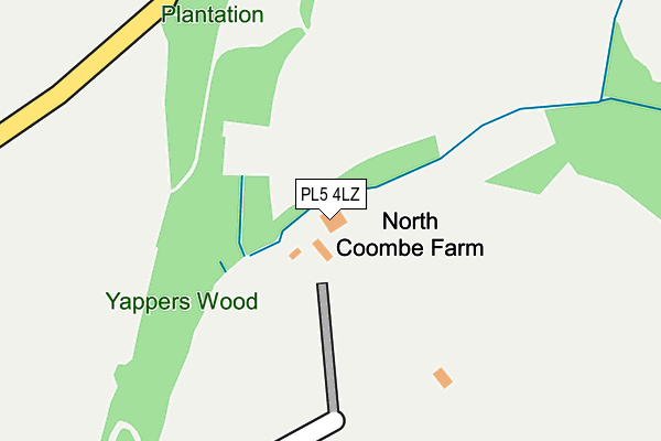
PL5 4LZ lies on Porsham Lane in Tamerton Foliot, Plymouth. PL5 4LZ is located in the Bickleigh & Cornwood electoral ward, within the local authority district of South Hams and the English Parliamentary constituency of South West Devon. The Sub Integrated Care Board (ICB) Location is NHS Devon ICB - 15N and the police force is Devon & Cornwall. This postcode has been in use since June 2005.


GetTheData
Source: OS OpenMap – Local (Ordnance Survey)
Source: OS VectorMap District (Ordnance Survey)
Licence: Open Government Licence (requires attribution)
| Easting | 248038 |
| Northing | 61728 |
| Latitude | 50.435668 |
| Longitude | -4.141202 |
GetTheData
Source: Open Postcode Geo
Licence: Open Government Licence
| Street | Porsham Lane |
| Locality | Tamerton Foliot |
| Town/City | Plymouth |
| Country | England |
| Postcode District | PL5 |
| ➜ PL5 open data dashboard ➜ See where PL5 is on a map | |
GetTheData
Source: Land Registry Price Paid Data
Licence: Open Government Licence
Elevation or altitude of PL5 4LZ as distance above sea level:
| Metres | Feet | |
|---|---|---|
| Elevation | 50m | 164ft |
Elevation is measured from the approximate centre of the postcode, to the nearest point on an OS contour line from OS Terrain 50, which has contour spacing of ten vertical metres.
➜ How high above sea level am I? Find the elevation of your current position using your device's GPS.
GetTheData
Source: Open Postcode Elevation
Licence: Open Government Licence
| Ward | Bickleigh & Cornwood |
| Constituency | South West Devon |
GetTheData
Source: ONS Postcode Database
Licence: Open Government Licence
| Latimer Walk | Tamerton Foliot | 629m |
| Waring Road (Dunnet Road) | Tamerton Foliot | 644m |
| Winnicott Close (Kinnaird Crescent) | Southway | 681m |
| Kinniard Crescent | Southway | 699m |
| Alger Walk (Dunnet Road) | Southway | 703m |
| Bere Ferrers Station | 3.3km |
| St Budeaux Victoria Road Station | 5km |
| St Budeaux Ferry Road Station | 5km |
GetTheData
Source: NaPTAN
Licence: Open Government Licence
| Percentage of properties with Next Generation Access | 100.0% |
| Percentage of properties with Superfast Broadband | 100.0% |
| Percentage of properties with Ultrafast Broadband | 0.0% |
| Percentage of properties with Full Fibre Broadband | 0.0% |
Superfast Broadband is between 30Mbps and 300Mbps
Ultrafast Broadband is > 300Mbps
| Percentage of properties unable to receive 2Mbps | 0.0% |
| Percentage of properties unable to receive 5Mbps | 0.0% |
| Percentage of properties unable to receive 10Mbps | 0.0% |
| Percentage of properties unable to receive 30Mbps | 0.0% |
GetTheData
Source: Ofcom
Licence: Ofcom Terms of Use (requires attribution)
GetTheData
Source: ONS Postcode Database
Licence: Open Government Licence


➜ Get more ratings from the Food Standards Agency
GetTheData
Source: Food Standards Agency
Licence: FSA terms & conditions
| Last Collection | |||
|---|---|---|---|
| Location | Mon-Fri | Sat | Distance |
| Beverston Way | 17:30 | 12:30 | 1,985m |
| Tesco (Roborough) | 17:30 | 12:30 | 2,343m |
| Clittaford Road | 17:15 | 12:00 | 2,423m |
GetTheData
Source: Dracos
Licence: Creative Commons Attribution-ShareAlike
| Facility | Distance |
|---|---|
| Bond Street Bond Street, Plymouth Grass Pitches | 830m |
| Mary Deans C Of E Primary School Mary Dean Avenue, Tamerton Foliot, Plymouth Grass Pitches | 950m |
| Beechwood Primary School (Closed) Bampfylde Way, Plymouth Grass Pitches | 965m |
GetTheData
Source: Active Places
Licence: Open Government Licence
| School | Phase of Education | Distance |
|---|---|---|
| Mary Dean's CofE Primary School and Nursery Mary Dean Avenue, Tamerton Foliot, Plymouth, PL5 4LS | Primary | 950m |
| Beechwood Primary Academy 31 Rockfield Avenue, Southway, Plymouth, PL6 6DX | Primary | 1.1km |
| Oakwood Primary Academy Pendeen Crescent, Southway, Plymouth, PL6 6QS | Primary | 1.6km |
GetTheData
Source: Edubase
Licence: Open Government Licence
The below table lists the International Territorial Level (ITL) codes (formerly Nomenclature of Territorial Units for Statistics (NUTS) codes) and Local Administrative Units (LAU) codes for PL5 4LZ:
| ITL 1 Code | Name |
|---|---|
| TLK | South West (England) |
| ITL 2 Code | Name |
| TLK4 | Devon |
| ITL 3 Code | Name |
| TLK43 | Devon CC |
| LAU 1 Code | Name |
| E07000044 | South Hams |
GetTheData
Source: ONS Postcode Directory
Licence: Open Government Licence
The below table lists the Census Output Area (OA), Lower Layer Super Output Area (LSOA), and Middle Layer Super Output Area (MSOA) for PL5 4LZ:
| Code | Name | |
|---|---|---|
| OA | E00102012 | |
| LSOA | E01020145 | South Hams 001B |
| MSOA | E02004189 | South Hams 001 |
GetTheData
Source: ONS Postcode Directory
Licence: Open Government Licence
| PL5 4LF | Coombe Lane | 404m |
| PL6 6NJ | Waring Road | 549m |
| PL6 6JW | Winnicott Close | 568m |
| PL6 6NQ | Waring Road | 571m |
| PL6 6JP | Moses Close | 589m |
| PL6 6TW | Clittaford View | 602m |
| PL6 6NL | Waring Road | 606m |
| PL6 6NH | Waring Road | 616m |
| PL6 6NN | Waring Road | 618m |
| PL6 6JN | Bulteel Gardens | 631m |
GetTheData
Source: Open Postcode Geo; Land Registry Price Paid Data
Licence: Open Government Licence