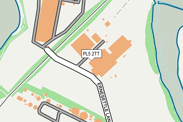
PL5 2TT is located in the Honicknowle electoral ward, within the unitary authority of Plymouth and the English Parliamentary constituency of Plymouth, Moor View. The Sub Integrated Care Board (ICB) Location is NHS Devon ICB - 15N and the police force is Devon & Cornwall. This postcode has been in use since January 1980.


GetTheData
Source: OS OpenMap – Local (Ordnance Survey)
Source: OS VectorMap District (Ordnance Survey)
Licence: Open Government Licence (requires attribution)
| Easting | 244609 |
| Northing | 60273 |
| Latitude | 50.421707 |
| Longitude | -4.188818 |
GetTheData
Source: Open Postcode Geo
Licence: Open Government Licence
| Country | England |
| Postcode District | PL5 |
| ➜ PL5 open data dashboard ➜ See where PL5 is on a map ➜ Where is Plymouth? | |
GetTheData
Source: Land Registry Price Paid Data
Licence: Open Government Licence
Elevation or altitude of PL5 2TT as distance above sea level:
| Metres | Feet | |
|---|---|---|
| Elevation | 20m | 66ft |
Elevation is measured from the approximate centre of the postcode, to the nearest point on an OS contour line from OS Terrain 50, which has contour spacing of ten vertical metres.
➜ How high above sea level am I? Find the elevation of your current position using your device's GPS.
GetTheData
Source: Open Postcode Elevation
Licence: Open Government Licence
| Ward | Honicknowle |
| Constituency | Plymouth, Moor View |
GetTheData
Source: ONS Postcode Database
Licence: Open Government Licence
| June 2022 | Anti-social behaviour | On or near North Weald Gardens | 498m |
| June 2022 | Violence and sexual offences | On or near North Weald Gardens | 498m |
| June 2022 | Criminal damage and arson | On or near North Weald Gardens | 498m |
| ➜ Get more crime data in our Crime section | |||
GetTheData
Source: data.police.uk
Licence: Open Government Licence
| Toshiba | Ernesettle | 309m |
| Tangmere Avenue (Lakeside Drive) | Ernesettle | 395m |
| Northolt Avenue | Ernesettle | 409m |
| Northolt Avenue | Ernesettle | 422m |
| Northolt Avenue (Uxbridge Drive) | Ernesettle | 454m |
| Saltash Station | 2.2km |
| St Budeaux Victoria Road Station | 2.2km |
| St Budeaux Ferry Road Station | 2.3km |
GetTheData
Source: NaPTAN
Licence: Open Government Licence
GetTheData
Source: ONS Postcode Database
Licence: Open Government Licence


➜ Get more ratings from the Food Standards Agency
GetTheData
Source: Food Standards Agency
Licence: FSA terms & conditions
| Last Collection | |||
|---|---|---|---|
| Location | Mon-Fri | Sat | Distance |
| Lakeside Drive | 17:00 | 12:00 | 1,651m |
| Victoria Road | 17:30 | 12:30 | 1,805m |
| Pemros Road | 17:15 | 12:15 | 1,850m |
GetTheData
Source: Dracos
Licence: Creative Commons Attribution-ShareAlike
| Facility | Distance |
|---|---|
| Ernesettle Green Ernesettle Green, Plymouth Grass Pitches | 811m |
| Parkway Sports Club Ernesettle Lane, Plymouth Grass Pitches | 957m |
| Lakeside Bottoms Lakeside Drive, Ernesettle, Plymouth Grass Pitches | 1.1km |
GetTheData
Source: Active Places
Licence: Open Government Licence
| School | Phase of Education | Distance |
|---|---|---|
| Ernesettle Community School Biggin Hill, Ernesettle, Plymouth, PL5 2RB | Primary | 1.3km |
| Mill Ford School Rochford Crescent, Ernesettle, Plymouth, PL5 2PY | Not applicable | 1.4km |
| St Budeaux CofE Primary Academy Priestley Avenue, Higher Saint Budeaux, Plymouth, PL5 2DW | Primary | 1.6km |
GetTheData
Source: Edubase
Licence: Open Government Licence
The below table lists the International Territorial Level (ITL) codes (formerly Nomenclature of Territorial Units for Statistics (NUTS) codes) and Local Administrative Units (LAU) codes for PL5 2TT:
| ITL 1 Code | Name |
|---|---|
| TLK | South West (England) |
| ITL 2 Code | Name |
| TLK4 | Devon |
| ITL 3 Code | Name |
| TLK41 | Plymouth |
| LAU 1 Code | Name |
| E06000026 | Plymouth |
GetTheData
Source: ONS Postcode Directory
Licence: Open Government Licence
The below table lists the Census Output Area (OA), Lower Layer Super Output Area (LSOA), and Middle Layer Super Output Area (MSOA) for PL5 2TT:
| Code | Name | |
|---|---|---|
| OA | E00076211 | |
| LSOA | E01015082 | Plymouth 004B |
| MSOA | E02003125 | Plymouth 004 |
GetTheData
Source: ONS Postcode Directory
Licence: Open Government Licence
| PL5 2SJ | Lakeside Drive | 406m |
| PL5 2TD | Hornchurch Road | 437m |
| PL5 2SH | Uxbridge Drive | 485m |
| PL5 2TE | Hornchurch Road | 503m |
| PL5 2TB | Tangmere Avenue | 505m |
| PL5 2DD | Exeter Close | 533m |
| PL5 2SL | Lakeside Drive | 534m |
| PL5 2DE | Gravesend Walk | 535m |
| PL5 2TA | North Weald Gardens | 542m |
| PL5 2SN | Manston Close | 553m |
GetTheData
Source: Open Postcode Geo; Land Registry Price Paid Data
Licence: Open Government Licence