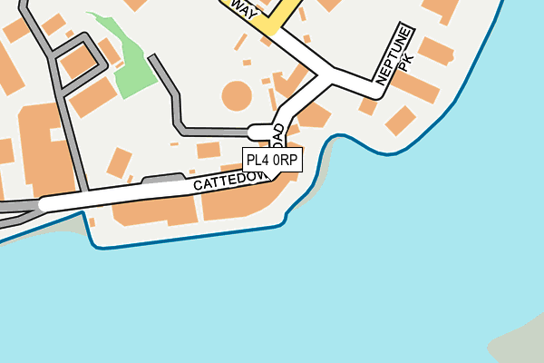
PL4 0RP is located in the Sutton and Mount Gould electoral ward, within the unitary authority of Plymouth and the English Parliamentary constituency of Plymouth, Sutton and Devonport. The Sub Integrated Care Board (ICB) Location is NHS Devon ICB - 15N and the police force is Devon & Cornwall. This postcode has been in use since January 1980.


GetTheData
Source: OS OpenMap – Local (Ordnance Survey)
Source: OS VectorMap District (Ordnance Survey)
Licence: Open Government Licence (requires attribution)
| Easting | 249598 |
| Northing | 53510 |
| Latitude | 50.362227 |
| Longitude | -4.115930 |
GetTheData
Source: Open Postcode Geo
Licence: Open Government Licence
| Country | England |
| Postcode District | PL4 |
| ➜ PL4 open data dashboard ➜ See where PL4 is on a map ➜ Where is Plymouth? | |
GetTheData
Source: Land Registry Price Paid Data
Licence: Open Government Licence
Elevation or altitude of PL4 0RP as distance above sea level:
| Metres | Feet | |
|---|---|---|
| Elevation | 10m | 33ft |
Elevation is measured from the approximate centre of the postcode, to the nearest point on an OS contour line from OS Terrain 50, which has contour spacing of ten vertical metres.
➜ How high above sea level am I? Find the elevation of your current position using your device's GPS.
GetTheData
Source: Open Postcode Elevation
Licence: Open Government Licence
| Ward | Sutton And Mount Gould |
| Constituency | Plymouth, Sutton And Devonport |
GetTheData
Source: ONS Postcode Database
Licence: Open Government Licence
| June 2022 | Public order | On or near Parking Area | 370m |
| June 2022 | Anti-social behaviour | On or near Parking Area | 370m |
| June 2022 | Violence and sexual offences | On or near Boringdon Road | 465m |
| ➜ Get more crime data in our Crime section | |||
GetTheData
Source: data.police.uk
Licence: Open Government Licence
| Maxwell Road | Cattedown | 214m |
| Prince Rock Depot (Macadam Road) | Cattedown | 387m |
| Oakfield Terrace Road | Cattedown | 511m |
| South Milton Street East (South Milton Street) | Cattedown | 588m |
| South Milton Street West (South Milton Street) | Cattedown | 600m |
| Plymouth Station | 2.6km |
| Devonport Station | 4.3km |
| Dockyard (Plymouth) Station | 4.8km |
GetTheData
Source: NaPTAN
Licence: Open Government Licence
Estimated total energy consumption in PL4 0RP by fuel type, 2015.
| Consumption (kWh) | 104,735 |
|---|---|
| Meter count | 13 |
| Mean (kWh/meter) | 8,057 |
| Median (kWh/meter) | 4,784 |
GetTheData
Source: Postcode level gas estimates: 2015 (experimental)
Source: Postcode level electricity estimates: 2015 (experimental)
Licence: Open Government Licence
GetTheData
Source: ONS Postcode Database
Licence: Open Government Licence


➜ Get more ratings from the Food Standards Agency
GetTheData
Source: Food Standards Agency
Licence: FSA terms & conditions
| Last Collection | |||
|---|---|---|---|
| Location | Mon-Fri | Sat | Distance |
| Oreston Post Office | 17:30 | 12:00 | 594m |
| Old Pomphlett P.o. | 17:15 | 13:00 | 833m |
| Plymouth Mail Centre | 19:30 | 17:30 | 856m |
GetTheData
Source: Dracos
Licence: Creative Commons Attribution-ShareAlike
| Facility | Distance |
|---|---|
| Plymouth Performance Gym Faraday Mill Business Park, Faraday Road, Plymouth Health and Fitness Gym, Studio | 710m |
| Extreme Fitness (Closed) Faraday Mill Business Park, Faraday Road, Plymouth Health and Fitness Gym | 716m |
| Crossfit Plymouth Faraday Mill Business Park, Faraday Road, Plymouth Studio | 747m |
GetTheData
Source: Active Places
Licence: Open Government Licence
| School | Phase of Education | Distance |
|---|---|---|
| Oreston Community Academy Oreston Road, Plymstock, Plymouth, PL9 7JY | Primary | 683m |
| Prince Rock Primary School Embankment Road, Plymouth, PL4 9JF | Primary | 1km |
| Hooe Primary Academy Hooe Road, Hooe, Plymstock, Plymouth, PL9 9RG | Primary | 1.1km |
GetTheData
Source: Edubase
Licence: Open Government Licence
The below table lists the International Territorial Level (ITL) codes (formerly Nomenclature of Territorial Units for Statistics (NUTS) codes) and Local Administrative Units (LAU) codes for PL4 0RP:
| ITL 1 Code | Name |
|---|---|
| TLK | South West (England) |
| ITL 2 Code | Name |
| TLK4 | Devon |
| ITL 3 Code | Name |
| TLK41 | Plymouth |
| LAU 1 Code | Name |
| E06000026 | Plymouth |
GetTheData
Source: ONS Postcode Directory
Licence: Open Government Licence
The below table lists the Census Output Area (OA), Lower Layer Super Output Area (LSOA), and Middle Layer Super Output Area (MSOA) for PL4 0RP:
| Code | Name | |
|---|---|---|
| OA | E00076688 | |
| LSOA | E01015182 | Plymouth 028E |
| MSOA | E02003149 | Plymouth 028 |
GetTheData
Source: ONS Postcode Directory
Licence: Open Government Licence
| PL4 0RW | Cattedown Road | 251m |
| PL4 0SN | Maxwell Road | 307m |
| PL9 9TF | Boringdon Road | 406m |
| PL9 9RH | Undercliff Road | 410m |
| PL9 9TN | 411m | |
| PL9 7NN | Turnquay | 424m |
| PL9 9TQ | Boringdon Terrace | 426m |
| PL9 9TG | Sunnyside | 429m |
| PL9 7NB | The Quay | 433m |
| PL9 9XB | Boringdon Road | 438m |
GetTheData
Source: Open Postcode Geo; Land Registry Price Paid Data
Licence: Open Government Licence