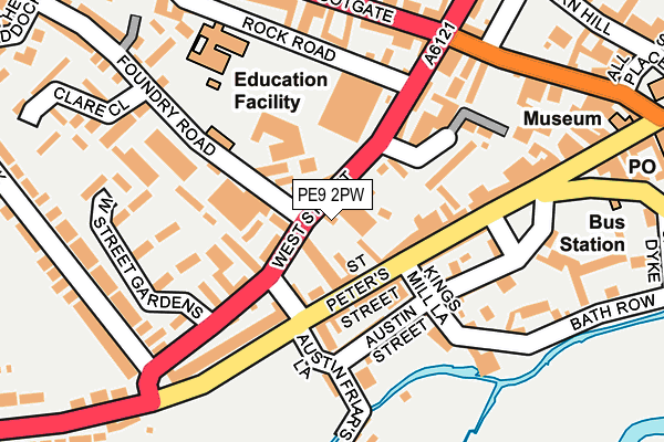
PE9 2PW is located in the Stamford St Mary's electoral ward, within the local authority district of South Kesteven and the English Parliamentary constituency of Grantham and Stamford. The Sub Integrated Care Board (ICB) Location is NHS Lincolnshire ICB - 71E and the police force is Lincolnshire. This postcode has been in use since July 2002.


GetTheData
Source: OS OpenMap – Local (Ordnance Survey)
Source: OS VectorMap District (Ordnance Survey)
Licence: Open Government Licence (requires attribution)
| Easting | 502556 |
| Northing | 307031 |
| Latitude | 52.651343 |
| Longitude | -0.485438 |
GetTheData
Source: Open Postcode Geo
Licence: Open Government Licence
| Country | England |
| Postcode District | PE9 |
| ➜ PE9 open data dashboard ➜ See where PE9 is on a map ➜ Where is Stamford? | |
GetTheData
Source: Land Registry Price Paid Data
Licence: Open Government Licence
Elevation or altitude of PE9 2PW as distance above sea level:
| Metres | Feet | |
|---|---|---|
| Elevation | 40m | 131ft |
Elevation is measured from the approximate centre of the postcode, to the nearest point on an OS contour line from OS Terrain 50, which has contour spacing of ten vertical metres.
➜ How high above sea level am I? Find the elevation of your current position using your device's GPS.
GetTheData
Source: Open Postcode Elevation
Licence: Open Government Licence
| Ward | Stamford St Mary's |
| Constituency | Grantham And Stamford |
GetTheData
Source: ONS Postcode Database
Licence: Open Government Licence
| November 2023 | Burglary | On or near Parking Area | 360m |
| October 2023 | Shoplifting | On or near Parking Area | 360m |
| August 2023 | Other theft | On or near Parking Area | 360m |
| ➜ Get more crime data in our Crime section | |||
GetTheData
Source: data.police.uk
Licence: Open Government Licence
| Torkington Gardens (West Street) | Stamford | 58m |
| Torkington Gardens (West Street) | Stamford | 73m |
| Austin Friar's Lane (Tinwell Road) | Stamford | 102m |
| Austin Friar's Lane (Tinwell Road) | Stamford | 112m |
| Bus Station (St Peter's Hill) | Stamford | 220m |
| Stamford Station | 0.5km |
GetTheData
Source: NaPTAN
Licence: Open Government Licence
GetTheData
Source: ONS Postcode Database
Licence: Open Government Licence


➜ Get more ratings from the Food Standards Agency
GetTheData
Source: Food Standards Agency
Licence: FSA terms & conditions
| Last Collection | |||
|---|---|---|---|
| Location | Mon-Fri | Sat | Distance |
| St Peters Street | 17:30 | 12:15 | 82m |
| Scotgate | 17:30 | 11:45 | 207m |
| Stamford Delivery Office | 18:00 | 12:30 | 301m |
GetTheData
Source: Dracos
Licence: Creative Commons Attribution-ShareAlike
| Facility | Distance |
|---|---|
| Westside Health And Fitness Club West Street, Stamford Health and Fitness Gym, Studio | 94m |
| Stamford Junior School Kettering Road, Stamford Swimming Pool, Sports Hall, Grass Pitches, Outdoor Tennis Courts | 454m |
| Stamford Recreational Grounds Recreation Ground Road, Stamford Outdoor Tennis Courts | 644m |
GetTheData
Source: Active Places
Licence: Open Government Licence
| School | Phase of Education | Distance |
|---|---|---|
| Stamford St Gilberts Church of England Primary School Foundry Road, Stamford, PE9 2PP | Primary | 45m |
| Stamford Junior School Kettering Road, Stamford, PE9 2LR | Not applicable | 609m |
| Stamford Endowed Schools Brazenose House, St Pauls Street, Stamford, Lincolnshire, PE9 2BE | Not applicable | 819m |
GetTheData
Source: Edubase
Licence: Open Government Licence
The below table lists the International Territorial Level (ITL) codes (formerly Nomenclature of Territorial Units for Statistics (NUTS) codes) and Local Administrative Units (LAU) codes for PE9 2PW:
| ITL 1 Code | Name |
|---|---|
| TLF | East Midlands (England) |
| ITL 2 Code | Name |
| TLF3 | Lincolnshire |
| ITL 3 Code | Name |
| TLF30 | Lincolnshire CC |
| LAU 1 Code | Name |
| E07000141 | South Kesteven |
GetTheData
Source: ONS Postcode Directory
Licence: Open Government Licence
The below table lists the Census Output Area (OA), Lower Layer Super Output Area (LSOA), and Middle Layer Super Output Area (MSOA) for PE9 2PW:
| Code | Name | |
|---|---|---|
| OA | E00133857 | |
| LSOA | E01026351 | South Kesteven 016C |
| MSOA | E02005491 | South Kesteven 016 |
GetTheData
Source: ONS Postcode Directory
Licence: Open Government Licence
| PE9 2PR | West Street | 36m |
| PE9 2GP | St Peters Court | 50m |
| PE9 2PP | Weston Mews | 59m |
| PE9 2PF | St Peters Street | 64m |
| PE9 2PL | West Street | 65m |
| PE9 2PJ | Petergate | 75m |
| PE9 2PQ | St Peters Street | 82m |
| PE9 2QP | Austin Street | 103m |
| PE9 2PS | West Street | 105m |
| PE9 2QR | Austin Street | 125m |
GetTheData
Source: Open Postcode Geo; Land Registry Price Paid Data
Licence: Open Government Licence