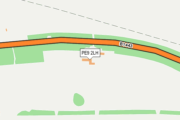
PE9 2LH is located in the Barnack electoral ward, within the unitary authority of Peterborough and the English Parliamentary constituency of North West Cambridgeshire. The Sub Integrated Care Board (ICB) Location is NHS Cambridgeshire and Peterborough ICB - 06H and the police force is Cambridgeshire. This postcode has been in use since January 1980.


GetTheData
Source: OS OpenMap – Local (Ordnance Survey)
Source: OS VectorMap District (Ordnance Survey)
Licence: Open Government Licence (requires attribution)
| Easting | 504377 |
| Northing | 306884 |
| Latitude | 52.649656 |
| Longitude | -0.458588 |
GetTheData
Source: Open Postcode Geo
Licence: Open Government Licence
| Country | England |
| Postcode District | PE9 |
| ➜ PE9 open data dashboard ➜ See where PE9 is on a map ➜ Where is Stamford? | |
GetTheData
Source: Land Registry Price Paid Data
Licence: Open Government Licence
Elevation or altitude of PE9 2LH as distance above sea level:
| Metres | Feet | |
|---|---|---|
| Elevation | 30m | 98ft |
Elevation is measured from the approximate centre of the postcode, to the nearest point on an OS contour line from OS Terrain 50, which has contour spacing of ten vertical metres.
➜ How high above sea level am I? Find the elevation of your current position using your device's GPS.
GetTheData
Source: Open Postcode Elevation
Licence: Open Government Licence
| Ward | Barnack |
| Constituency | North West Cambridgeshire |
GetTheData
Source: ONS Postcode Database
Licence: Open Government Licence
| Meadow View (Uffington Road) | Stamford | 691m |
| Meadow View (Uffington Road) | Stamford | 701m |
| Abbot's Close (Barnack Road) | Stamford | 757m |
| Abbot's Close (Barnack Road) | Stamford | 761m |
| Morrison Car Park (Uffington Road) | Stamford | 818m |
| Stamford Station | 1.5km |
GetTheData
Source: NaPTAN
Licence: Open Government Licence
GetTheData
Source: ONS Postcode Database
Licence: Open Government Licence


➜ Get more ratings from the Food Standards Agency
GetTheData
Source: Food Standards Agency
Licence: FSA terms & conditions
| Last Collection | |||
|---|---|---|---|
| Location | Mon-Fri | Sat | Distance |
| Abbotts Close | 17:30 | 11:30 | 770m |
| Priory Road | 17:30 | 11:15 | 929m |
| Newtown | 17:30 | 11:30 | 929m |
GetTheData
Source: Dracos
Licence: Creative Commons Attribution-ShareAlike
| Facility | Distance |
|---|---|
| Uffington Road Playing Field Uffington Road, Stamford Grass Pitches | 796m |
| Burghley Park Cricket Club Stamford Road, Pilsgate Grass Pitches | 977m |
| Stamford High School High Street, St. Martins, Stamford Health and Fitness Gym | 1.2km |
GetTheData
Source: Active Places
Licence: Open Government Licence
| School | Phase of Education | Distance |
|---|---|---|
| Stamford Endowed Schools Brazenose House, St Pauls Street, Stamford, Lincolnshire, PE9 2BE | Not applicable | 1.1km |
| Stamford Junior School Kettering Road, Stamford, PE9 2LR | Not applicable | 1.6km |
| St George's Church of England Aided Primary School Kesteven Road, Stamford, PE9 1SX | Primary | 1.7km |
GetTheData
Source: Edubase
Licence: Open Government Licence
The below table lists the International Territorial Level (ITL) codes (formerly Nomenclature of Territorial Units for Statistics (NUTS) codes) and Local Administrative Units (LAU) codes for PE9 2LH:
| ITL 1 Code | Name |
|---|---|
| TLH | East |
| ITL 2 Code | Name |
| TLH1 | East Anglia |
| ITL 3 Code | Name |
| TLH11 | Peterborough |
| LAU 1 Code | Name |
| E06000031 | Peterborough |
GetTheData
Source: ONS Postcode Directory
Licence: Open Government Licence
The below table lists the Census Output Area (OA), Lower Layer Super Output Area (LSOA), and Middle Layer Super Output Area (MSOA) for PE9 2LH:
| Code | Name | |
|---|---|---|
| OA | E00078840 | |
| LSOA | E01015590 | Peterborough 004B |
| MSOA | E02003240 | Peterborough 004 |
GetTheData
Source: ONS Postcode Directory
Licence: Open Government Licence
| PE9 2NG | Barnack Road | 459m |
| PE9 2EX | Uffington Road | 666m |
| PE9 2NU | Axiom Court | 710m |
| PE9 2ND | Abbotts Close | 712m |
| PE9 2EU | Priory Road | 780m |
| PE9 2NA | Barnack Road | 784m |
| PE9 2AS | Bowman Mews | 833m |
| PE9 2EG | Priory Gardens | 842m |
| PE9 3AA | Uffington Road | 874m |
| PE9 2EP | Cherry Holt Road | 879m |
GetTheData
Source: Open Postcode Geo; Land Registry Price Paid Data
Licence: Open Government Licence