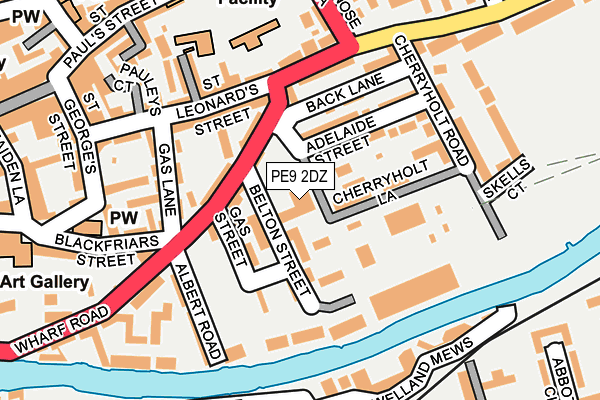
PE9 2DZ is located in the Stamford St Mary's electoral ward, within the local authority district of South Kesteven and the English Parliamentary constituency of Grantham and Stamford. The Sub Integrated Care Board (ICB) Location is NHS Lincolnshire ICB - 71E and the police force is Lincolnshire. This postcode has been in use since July 2009.


GetTheData
Source: OS OpenMap – Local (Ordnance Survey)
Source: OS VectorMap District (Ordnance Survey)
Licence: Open Government Licence (requires attribution)
| Easting | 503418 |
| Northing | 307110 |
| Latitude | 52.651870 |
| Longitude | -0.472687 |
GetTheData
Source: Open Postcode Geo
Licence: Open Government Licence
| Country | England |
| Postcode District | PE9 |
| ➜ PE9 open data dashboard ➜ See where PE9 is on a map ➜ Where is Stamford? | |
GetTheData
Source: Land Registry Price Paid Data
Licence: Open Government Licence
Elevation or altitude of PE9 2DZ as distance above sea level:
| Metres | Feet | |
|---|---|---|
| Elevation | 30m | 98ft |
Elevation is measured from the approximate centre of the postcode, to the nearest point on an OS contour line from OS Terrain 50, which has contour spacing of ten vertical metres.
➜ How high above sea level am I? Find the elevation of your current position using your device's GPS.
GetTheData
Source: Open Postcode Elevation
Licence: Open Government Licence
| Ward | Stamford St Mary's |
| Constituency | Grantham And Stamford |
GetTheData
Source: ONS Postcode Database
Licence: Open Government Licence
| January 2024 | Anti-social behaviour | On or near Shopping Area | 267m |
| January 2024 | Violence and sexual offences | On or near Shopping Area | 267m |
| January 2024 | Violence and sexual offences | On or near Shopping Area | 267m |
| ➜ Get more crime data in our Crime section | |||
GetTheData
Source: data.police.uk
Licence: Open Government Licence
| Site Of Brazenose College (Brazenose Lane) | Stamford | 212m |
| Phillips Court (Water Street) | Stamford | 224m |
| Phillips Court (Water Street) | Stamford | 224m |
| Stamford School (St Paul's Street) | Stamford | 311m |
| Abbot's Close (Barnack Road) | Stamford | 312m |
| Stamford Station | 0.7km |
GetTheData
Source: NaPTAN
Licence: Open Government Licence
GetTheData
Source: ONS Postcode Database
Licence: Open Government Licence


➜ Get more ratings from the Food Standards Agency
GetTheData
Source: Food Standards Agency
Licence: FSA terms & conditions
| Last Collection | |||
|---|---|---|---|
| Location | Mon-Fri | Sat | Distance |
| Wharf Road | 17:30 | 11:15 | 99m |
| Priory Road | 17:30 | 11:15 | 210m |
| Newtown | 17:30 | 11:30 | 215m |
GetTheData
Source: Dracos
Licence: Creative Commons Attribution-ShareAlike
| Facility | Distance |
|---|---|
| Stamford Endowed Schools Sports Centre Conduit Road, Stamford Swimming Pool, Sports Hall, Artificial Grass Pitch, Squash Courts, Outdoor Tennis Courts, Grass Pitches | 511m |
| Stamford High School High Street, St. Martins, Stamford Health and Fitness Gym | 527m |
| Stamford Recreational Grounds Recreation Ground Road, Stamford Outdoor Tennis Courts | 572m |
GetTheData
Source: Active Places
Licence: Open Government Licence
| School | Phase of Education | Distance |
|---|---|---|
| Stamford Endowed Schools Brazenose House, St Pauls Street, Stamford, Lincolnshire, PE9 2BE | Not applicable | 238m |
| Stamford Junior School Kettering Road, Stamford, PE9 2LR | Not applicable | 897m |
| Stamford St Gilberts Church of England Primary School Foundry Road, Stamford, PE9 2PP | Primary | 897m |
GetTheData
Source: Edubase
Licence: Open Government Licence
The below table lists the International Territorial Level (ITL) codes (formerly Nomenclature of Territorial Units for Statistics (NUTS) codes) and Local Administrative Units (LAU) codes for PE9 2DZ:
| ITL 1 Code | Name |
|---|---|
| TLF | East Midlands (England) |
| ITL 2 Code | Name |
| TLF3 | Lincolnshire |
| ITL 3 Code | Name |
| TLF30 | Lincolnshire CC |
| LAU 1 Code | Name |
| E07000141 | South Kesteven |
GetTheData
Source: ONS Postcode Directory
Licence: Open Government Licence
The below table lists the Census Output Area (OA), Lower Layer Super Output Area (LSOA), and Middle Layer Super Output Area (MSOA) for PE9 2DZ:
| Code | Name | |
|---|---|---|
| OA | E00133852 | |
| LSOA | E01026350 | South Kesteven 016B |
| MSOA | E02005491 | South Kesteven 016 |
GetTheData
Source: ONS Postcode Directory
Licence: Open Government Licence
| PE9 2WX | Belton Gardens | 59m |
| PE9 2AN | Gas Street | 68m |
| PE9 2EB | Wharf Road | 84m |
| PE9 2EF | Belton Street | 89m |
| PE9 2DQ | Wharf Road | 94m |
| PE9 2FH | Back Lane | 95m |
| PE9 2EH | Brownlow Terrace | 101m |
| PE9 2EN | Adelaide Street | 101m |
| PE9 2HN | St Leonards Street | 119m |
| PE9 2YG | Watergate | 121m |
GetTheData
Source: Open Postcode Geo; Land Registry Price Paid Data
Licence: Open Government Licence