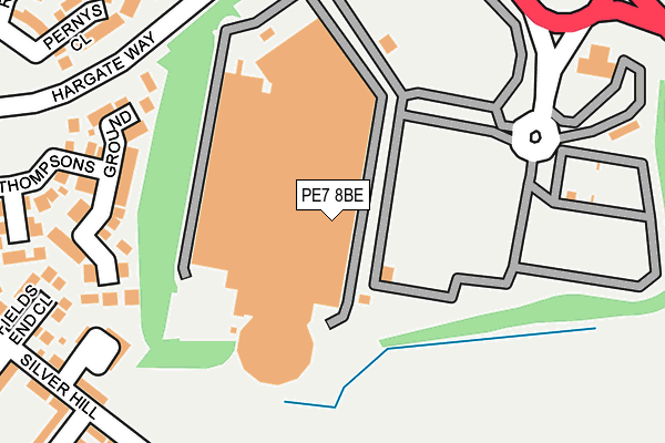
PE7 8BE lies on Serpentine Green Shopping Centre in Hampton, Peterborough. PE7 8BE is located in the Hargate and Hempsted electoral ward, within the unitary authority of Peterborough and the English Parliamentary constituency of North West Cambridgeshire. The Sub Integrated Care Board (ICB) Location is NHS Cambridgeshire and Peterborough ICB - 06H and the police force is Cambridgeshire. This postcode has been in use since June 1999.


GetTheData
Source: OS OpenMap – Local (Ordnance Survey)
Source: OS VectorMap District (Ordnance Survey)
Licence: Open Government Licence (requires attribution)
| Easting | 517936 |
| Northing | 295007 |
| Latitude | 52.540176 |
| Longitude | -0.262472 |
GetTheData
Source: Open Postcode Geo
Licence: Open Government Licence
| Street | Serpentine Green Shopping Centre |
| Locality | Hampton |
| Town/City | Peterborough |
| Country | England |
| Postcode District | PE7 |
| ➜ PE7 open data dashboard ➜ See where PE7 is on a map ➜ Where is Peterborough? | |
GetTheData
Source: Land Registry Price Paid Data
Licence: Open Government Licence
Elevation or altitude of PE7 8BE as distance above sea level:
| Metres | Feet | |
|---|---|---|
| Elevation | 20m | 66ft |
Elevation is measured from the approximate centre of the postcode, to the nearest point on an OS contour line from OS Terrain 50, which has contour spacing of ten vertical metres.
➜ How high above sea level am I? Find the elevation of your current position using your device's GPS.
GetTheData
Source: Open Postcode Elevation
Licence: Open Government Licence
| Ward | Hargate And Hempsted |
| Constituency | North West Cambridgeshire |
GetTheData
Source: ONS Postcode Database
Licence: Open Government Licence
| January 2024 | Violence and sexual offences | On or near Bank Avenue | 388m |
| December 2023 | Violence and sexual offences | On or near Bank Avenue | 388m |
| September 2023 | Violence and sexual offences | On or near Bank Avenue | 388m |
| ➜ Get more crime data in our Crime section | |||
GetTheData
Source: data.police.uk
Licence: Open Government Licence
| Hargate Way | Hampton | 249m |
| Hargate Way | Hampton | 256m |
| Tabor Court (Silver Hill) | Hampton | 286m |
| Tabor Court (Silver Hill) | Hampton | 303m |
| Archers Wood (Hargate Way) | Hampton Hargate | 492m |
| Peterborough Station | 4km |
GetTheData
Source: NaPTAN
Licence: Open Government Licence
| Median download speed | 25.4Mbps |
| Average download speed | 23.3Mbps |
| Maximum download speed | 63.86Mbps |
| Median upload speed | 6.8Mbps |
| Average upload speed | 5.4Mbps |
| Maximum upload speed | 12.60Mbps |
GetTheData
Source: Ofcom
Licence: Ofcom Terms of Use (requires attribution)
GetTheData
Source: ONS Postcode Database
Licence: Open Government Licence

➜ Get more ratings from the Food Standards Agency
GetTheData
Source: Food Standards Agency
Licence: FSA terms & conditions
| Last Collection | |||
|---|---|---|---|
| Location | Mon-Fri | Sat | Distance |
| Silver Hill | 18:00 | 12:30 | 360m |
| New Shopping Centre | 18:00 | 12:30 | 720m |
| Eldern Centre | 18:30 | 11:45 | 1,047m |
GetTheData
Source: Dracos
Licence: Creative Commons Attribution-ShareAlike
| Facility | Distance |
|---|---|
| Puregym (Peterborough Serpentine Green Shopping Centre) Serpentine Green Shopping Centre, The Serpentine, Hampton, Peterborough Health and Fitness Gym | 61m |
| Vivacity Premier Fitness Hadfield Road, Hampton, Peterborough Health and Fitness Gym, Swimming Pool, Studio | 414m |
| Hampton Leisure Centre Clayburn Road, Hampton Centre, Peterborough Health and Fitness Gym, Studio, Sports Hall, Grass Pitches | 564m |
GetTheData
Source: Active Places
Licence: Open Government Licence
| School | Phase of Education | Distance |
|---|---|---|
| Sense College 50 Forder Way, Cygnet Park, Hampton, Peterborough, PE7 8JB | Not applicable | 425m |
| Hampton College Eagle Way, Hampton Vale, Peterborough, PE7 8BF | All-through | 633m |
| Hampton Gardens Secondary School Hartland Avenue, Hampton Gardens, Peterborough, PE7 8HR | Secondary | 734m |
GetTheData
Source: Edubase
Licence: Open Government Licence
The below table lists the International Territorial Level (ITL) codes (formerly Nomenclature of Territorial Units for Statistics (NUTS) codes) and Local Administrative Units (LAU) codes for PE7 8BE:
| ITL 1 Code | Name |
|---|---|
| TLH | East |
| ITL 2 Code | Name |
| TLH1 | East Anglia |
| ITL 3 Code | Name |
| TLH11 | Peterborough |
| LAU 1 Code | Name |
| E06000031 | Peterborough |
GetTheData
Source: ONS Postcode Directory
Licence: Open Government Licence
The below table lists the Census Output Area (OA), Lower Layer Super Output Area (LSOA), and Middle Layer Super Output Area (MSOA) for PE7 8BE:
| Code | Name | |
|---|---|---|
| OA | E00171313 | |
| LSOA | E01033181 | Peterborough 022E |
| MSOA | E02006877 | Peterborough 022 |
GetTheData
Source: ONS Postcode Directory
Licence: Open Government Licence
| PE7 8AY | Lornas Field | 192m |
| PE7 8GF | Tabor Court | 249m |
| PE7 8AS | Fields End Close | 263m |
| PE7 8AL | Pernys Close | 278m |
| PE7 8AU | Thompsons Ground | 279m |
| PE7 8AX | Middlefield | 285m |
| PE7 8FF | Silver Hill | 287m |
| PE7 8EH | Ribes Close | 307m |
| PE7 8AJ | Holly Walk | 313m |
| PE7 8AT | Silver Hill | 316m |
GetTheData
Source: Open Postcode Geo; Land Registry Price Paid Data
Licence: Open Government Licence