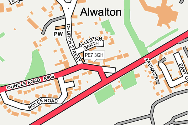
PE7 3GH is located in the Yaxley electoral ward, within the local authority district of Huntingdonshire and the English Parliamentary constituency of North West Cambridgeshire. The Sub Integrated Care Board (ICB) Location is NHS Cambridgeshire and Peterborough ICB - 06H and the police force is Cambridgeshire. This postcode has been in use since July 2016.


GetTheData
Source: OS OpenMap – Local (Ordnance Survey)
Source: OS VectorMap District (Ordnance Survey)
Licence: Open Government Licence (requires attribution)
| Easting | 522471 |
| Northing | 295362 |
| Latitude | 52.542367 |
| Longitude | -0.195508 |
GetTheData
Source: Open Postcode Geo
Licence: Open Government Licence
| Country | England |
| Postcode District | PE7 |
| ➜ PE7 open data dashboard ➜ See where PE7 is on a map | |
GetTheData
Source: Land Registry Price Paid Data
Licence: Open Government Licence
Elevation or altitude of PE7 3GH as distance above sea level:
| Metres | Feet | |
|---|---|---|
| Elevation | 20m | 66ft |
Elevation is measured from the approximate centre of the postcode, to the nearest point on an OS contour line from OS Terrain 50, which has contour spacing of ten vertical metres.
➜ How high above sea level am I? Find the elevation of your current position using your device's GPS.
GetTheData
Source: Open Postcode Elevation
Licence: Open Government Licence
| Ward | Yaxley |
| Constituency | North West Cambridgeshire |
GetTheData
Source: ONS Postcode Database
Licence: Open Government Licence
| Kings Delph | Kings Delph | 1,062m |
| Kings Delph | Kings Delph | 1,069m |
| Park Farm Crescent (Park Farm Way) | Stanground | 1,172m |
| Park Farm Crescent (Park Farm Way) | Stanground | 1,178m |
| Narrow Drove (Kings Delph) | Kings Delph | 1,222m |
| Peterborough Station | 5.2km |
GetTheData
Source: NaPTAN
Licence: Open Government Licence
GetTheData
Source: ONS Postcode Database
Licence: Open Government Licence


➜ Get more ratings from the Food Standards Agency
GetTheData
Source: Food Standards Agency
Licence: FSA terms & conditions
| Last Collection | |||
|---|---|---|---|
| Location | Mon-Fri | Sat | Distance |
| Parkfarm Way | 18:00 | 12:15 | 1,133m |
| Kings Delph | 17:00 | 07:00 | 1,228m |
| Grafham Close-oakdale Avenue | 18:00 | 12:15 | 1,298m |
GetTheData
Source: Dracos
Licence: Creative Commons Attribution-ShareAlike
| Facility | Distance |
|---|---|
| Cardea Playing Fields Bellona Drive, Peterborough Grass Pitches, Studio | 1.2km |
| Heritage Park Primary School Park Farm Way, Peterborough Grass Pitches | 1.3km |
| Stanground Sports Centre Peterborough Road, Peterborough Sports Hall, Swimming Pool, Health and Fitness Gym, Grass Pitches, Studio | 2.2km |
GetTheData
Source: Active Places
Licence: Open Government Licence
| School | Phase of Education | Distance |
|---|---|---|
| Heritage Park Primary School Park Farm Way, Park Farm, Peterborough, PE2 8XA | Primary | 1.3km |
| Saint Michael CofE Primary School (Voluntary Aided) Constantine Drive, Stanground South, Cardea, Peterborough, PE2 8SZ | Primary | 1.4km |
| Southfields Primary School Southfields Estate, Stanground, Peterborough, PE2 8PU | Primary | 2km |
GetTheData
Source: Edubase
Licence: Open Government Licence
The below table lists the International Territorial Level (ITL) codes (formerly Nomenclature of Territorial Units for Statistics (NUTS) codes) and Local Administrative Units (LAU) codes for PE7 3GH:
| ITL 1 Code | Name |
|---|---|
| TLH | East |
| ITL 2 Code | Name |
| TLH1 | East Anglia |
| ITL 3 Code | Name |
| TLH12 | Cambridgeshire CC |
| LAU 1 Code | Name |
| E07000011 | Huntingdonshire |
GetTheData
Source: ONS Postcode Directory
Licence: Open Government Licence
The below table lists the Census Output Area (OA), Lower Layer Super Output Area (LSOA), and Middle Layer Super Output Area (MSOA) for PE7 3GH:
| Code | Name | |
|---|---|---|
| OA | E00091872 | |
| LSOA | E01018213 | Huntingdonshire 001B |
| MSOA | E02003753 | Huntingdonshire 001 |
GetTheData
Source: ONS Postcode Directory
Licence: Open Government Licence
| PE7 3DZ | Ramsey Road | 463m |
| PE7 2PP | Whittlesey Road | 684m |
| PE7 3DQ | Kings Delph Drove | 785m |
| PE2 8UH | Beeston Drive | 946m |
| PE2 8UG | Framlingham Road | 980m |
| PE2 8UJ | Kenilworth Avenue | 981m |
| PE2 8UQ | Peckover Close | 1017m |
| PE2 8UY | Eynesford Close | 1033m |
| PE2 8UL | Oxburgh Close | 1065m |
| PE2 8UF | Framlingham Road | 1066m |
GetTheData
Source: Open Postcode Geo; Land Registry Price Paid Data
Licence: Open Government Licence