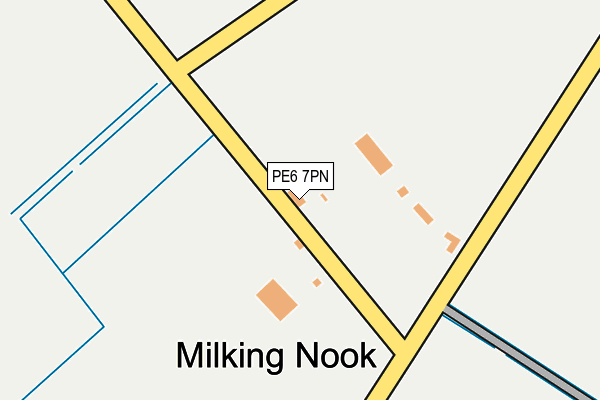
PE6 7PN lies on Glinton Road in Milking Nook, Peterborough. PE6 7PN is located in the Eye, Thorney and Newborough electoral ward, within the unitary authority of Peterborough and the English Parliamentary constituency of Peterborough. The Sub Integrated Care Board (ICB) Location is NHS Cambridgeshire and Peterborough ICB - 06H and the police force is Cambridgeshire. This postcode has been in use since January 1980.


GetTheData
Source: OS OpenMap – Local (Ordnance Survey)
Source: OS VectorMap District (Ordnance Survey)
Licence: Open Government Licence (requires attribution)
| Easting | 518339 |
| Northing | 305842 |
| Latitude | 52.637449 |
| Longitude | -0.252667 |
GetTheData
Source: Open Postcode Geo
Licence: Open Government Licence
| Street | Glinton Road |
| Locality | Milking Nook |
| Town/City | Peterborough |
| Country | England |
| Postcode District | PE6 |
➜ See where PE6 is on a map ➜ Where is Milking Nook? | |
GetTheData
Source: Land Registry Price Paid Data
Licence: Open Government Licence
Elevation or altitude of PE6 7PN as distance above sea level:
| Metres | Feet | |
|---|---|---|
| Elevation | 0m | 0ft |
Elevation is measured from the approximate centre of the postcode, to the nearest point on an OS contour line from OS Terrain 50, which has contour spacing of ten vertical metres.
➜ How high above sea level am I? Find the elevation of your current position using your device's GPS.
GetTheData
Source: Open Postcode Elevation
Licence: Open Government Licence
| Ward | Eye, Thorney And Newborough |
| Constituency | Peterborough |
GetTheData
Source: ONS Postcode Database
Licence: Open Government Licence
| Milking Nook Road (Thorney Road) | Milking Nook | 757m |
| Milking Nook Road (Thorney Road) | Milking Nook | 782m |
| Meadow Road (Werrington Bridge Road) | Milking Nook | 812m |
| The Decoy (Werrington Bridge Road) | Milking Nook | 832m |
| Meadow Road (Werrington Bridge Road) | Milking Nook | 853m |
GetTheData
Source: NaPTAN
Licence: Open Government Licence
| Percentage of properties with Next Generation Access | 100.0% |
| Percentage of properties with Superfast Broadband | 0.0% |
| Percentage of properties with Ultrafast Broadband | 0.0% |
| Percentage of properties with Full Fibre Broadband | 0.0% |
Superfast Broadband is between 30Mbps and 300Mbps
Ultrafast Broadband is > 300Mbps
| Percentage of properties unable to receive 2Mbps | 0.0% |
| Percentage of properties unable to receive 5Mbps | 0.0% |
| Percentage of properties unable to receive 10Mbps | 0.0% |
| Percentage of properties unable to receive 30Mbps | 100.0% |
GetTheData
Source: Ofcom
Licence: Ofcom Terms of Use (requires attribution)
GetTheData
Source: ONS Postcode Database
Licence: Open Government Licence


➜ Get more ratings from the Food Standards Agency
GetTheData
Source: Food Standards Agency
Licence: FSA terms & conditions
| Last Collection | |||
|---|---|---|---|
| Location | Mon-Fri | Sat | Distance |
| Village Hall | 16:45 | 07:00 | 1,596m |
| St Pegas Road | 16:30 | 07:00 | 1,726m |
| Hedgelands | 18:45 | 12:45 | 1,765m |
GetTheData
Source: Dracos
Licence: Creative Commons Attribution-ShareAlike
| Risk of PE6 7PN flooding from rivers and sea | Medium |
| ➜ PE6 7PN flood map | |
GetTheData
Source: Open Flood Risk by Postcode
Licence: Open Government Licence
The below table lists the International Territorial Level (ITL) codes (formerly Nomenclature of Territorial Units for Statistics (NUTS) codes) and Local Administrative Units (LAU) codes for PE6 7PN:
| ITL 1 Code | Name |
|---|---|
| TLH | East |
| ITL 2 Code | Name |
| TLH1 | East Anglia |
| ITL 3 Code | Name |
| TLH11 | Peterborough |
| LAU 1 Code | Name |
| E06000031 | Peterborough |
GetTheData
Source: ONS Postcode Directory
Licence: Open Government Licence
The below table lists the Census Output Area (OA), Lower Layer Super Output Area (LSOA), and Middle Layer Super Output Area (MSOA) for PE6 7PN:
| Code | Name | |
|---|---|---|
| OA | E00079048 | |
| LSOA | E01015630 | Peterborough 003A |
| MSOA | E02003239 | Peterborough 003 |
GetTheData
Source: ONS Postcode Directory
Licence: Open Government Licence
| PE6 7PL | Milking Nook | 469m |
| PE6 7PS | Laws Close | 499m |
| PE6 7PP | Werrington Bridge Road | 511m |
| PE6 7PR | Northborough Road | 624m |
| PE6 7PH | Thorney Road | 734m |
| PE6 7QG | Meadow Road | 749m |
| PE6 7PJ | Thorney Road | 767m |
| PE6 7QF | Werrington Bridge Road | 871m |
| PE6 7QE | Decoy Road | 972m |
| PE6 7PT | Thorney Road | 1096m |
GetTheData
Source: Open Postcode Geo; Land Registry Price Paid Data
Licence: Open Government Licence