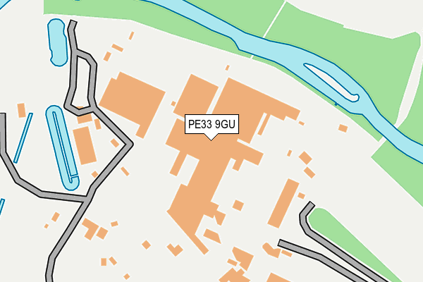
PE33 9GU is located in the Methwold electoral ward, within the local authority district of King's Lynn and West Norfolk and the English Parliamentary constituency of South West Norfolk. The Sub Integrated Care Board (ICB) Location is NHS Norfolk and Waveney ICB - 26A and the police force is Norfolk. This postcode has been in use since October 2008.


GetTheData
Source: OS OpenMap – Local (Ordnance Survey)
Source: OS VectorMap District (Ordnance Survey)
Licence: Open Government Licence (requires attribution)
| Easting | 566120 |
| Northing | 297662 |
| Latitude | 52.551453 |
| Longitude | 0.448700 |
GetTheData
Source: Open Postcode Geo
Licence: Open Government Licence
| Country | England |
| Postcode District | PE33 |
➜ See where PE33 is on a map | |
GetTheData
Source: Land Registry Price Paid Data
Licence: Open Government Licence
Elevation or altitude of PE33 9GU as distance above sea level:
| Metres | Feet | |
|---|---|---|
| Elevation | 10m | 33ft |
Elevation is measured from the approximate centre of the postcode, to the nearest point on an OS contour line from OS Terrain 50, which has contour spacing of ten vertical metres.
➜ How high above sea level am I? Find the elevation of your current position using your device's GPS.
GetTheData
Source: Open Postcode Elevation
Licence: Open Government Licence
| Ward | Methwold |
| Constituency | South West Norfolk |
GetTheData
Source: ONS Postcode Database
Licence: Open Government Licence
GetTheData
Source: ONS Postcode Database
Licence: Open Government Licence

➜ Get more ratings from the Food Standards Agency
GetTheData
Source: Food Standards Agency
Licence: FSA terms & conditions
| Last Collection | |||
|---|---|---|---|
| Location | Mon-Fri | Sat | Distance |
| Station Road | 16:00 | 09:00 | 3,153m |
| Red Lion | 16:00 | 08:30 | 3,359m |
| Wretton Post Office | 16:15 | 08:45 | 3,724m |
GetTheData
Source: Dracos
Licence: Creative Commons Attribution-ShareAlike
| Risk of PE33 9GU flooding from rivers and sea | Low |
| ➜ PE33 9GU flood map | |
GetTheData
Source: Open Flood Risk by Postcode
Licence: Open Government Licence
The below table lists the International Territorial Level (ITL) codes (formerly Nomenclature of Territorial Units for Statistics (NUTS) codes) and Local Administrative Units (LAU) codes for PE33 9GU:
| ITL 1 Code | Name |
|---|---|
| TLH | East |
| ITL 2 Code | Name |
| TLH1 | East Anglia |
| ITL 3 Code | Name |
| TLH16 | North and West Norfolk |
| LAU 1 Code | Name |
| E07000146 | King's Lynn and West Norfolk |
GetTheData
Source: ONS Postcode Directory
Licence: Open Government Licence
The below table lists the Census Output Area (OA), Lower Layer Super Output Area (LSOA), and Middle Layer Super Output Area (MSOA) for PE33 9GU:
| Code | Name | |
|---|---|---|
| OA | E00135434 | |
| LSOA | E01026650 | King's Lynn and West Norfolk 019C |
| MSOA | E02005569 | King's Lynn and West Norfolk 019 |
GetTheData
Source: ONS Postcode Directory
Licence: Open Government Licence
| PE33 9RY | 1168m | |
| PE33 9AZ | College Road | 2633m |
| PE33 9RR | Station Road | 2820m |
| PE33 9RP | Basil Road | 3034m |
| PE33 9QP | Fen Drove | 3062m |
| PE33 9TU | Brooks Lane | 3112m |
| PE33 9RE | Station Road | 3157m |
| PE33 9RB | West Dereham Road | 3161m |
| PE33 9RW | Hilgay Road | 3257m |
| PE38 0JY | 3259m |
GetTheData
Source: Open Postcode Geo; Land Registry Price Paid Data
Licence: Open Government Licence