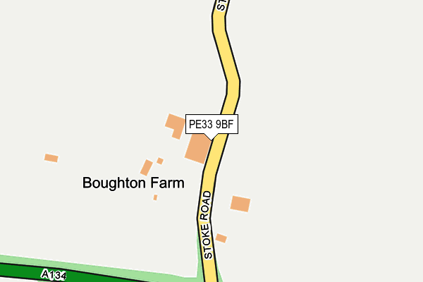
PE33 9BF is located in the Wissey electoral ward, within the local authority district of King's Lynn and West Norfolk and the English Parliamentary constituency of South West Norfolk. The Sub Integrated Care Board (ICB) Location is NHS Norfolk and Waveney ICB - 26A and the police force is Norfolk. This postcode has been in use since February 2007.


GetTheData
Source: OS OpenMap – Local (Ordnance Survey)
Source: OS VectorMap District (Ordnance Survey)
Licence: Open Government Licence (requires attribution)
| Easting | 569976 |
| Northing | 300947 |
| Latitude | 52.579787 |
| Longitude | 0.507218 |
GetTheData
Source: Open Postcode Geo
Licence: Open Government Licence
| Country | England |
| Postcode District | PE33 |
| ➜ PE33 open data dashboard ➜ See where PE33 is on a map | |
GetTheData
Source: Land Registry Price Paid Data
Licence: Open Government Licence
Elevation or altitude of PE33 9BF as distance above sea level:
| Metres | Feet | |
|---|---|---|
| Elevation | 10m | 33ft |
Elevation is measured from the approximate centre of the postcode, to the nearest point on an OS contour line from OS Terrain 50, which has contour spacing of ten vertical metres.
➜ How high above sea level am I? Find the elevation of your current position using your device's GPS.
GetTheData
Source: Open Postcode Elevation
Licence: Open Government Licence
| Ward | Wissey |
| Constituency | South West Norfolk |
GetTheData
Source: ONS Postcode Database
Licence: Open Government Licence
| June 2022 | Violence and sexual offences | On or near Boughton Road | 499m |
| June 2022 | Violence and sexual offences | On or near Boughton Road | 499m |
| November 2021 | Anti-social behaviour | On or near Little Lane | 427m |
| ➜ Get more crime data in our Crime section | |||
GetTheData
Source: data.police.uk
Licence: Open Government Licence
| Boughton Road (Lynn Road) | Stoke Ferry | 753m |
| Boughton Road (Lynn Road) | Stoke Ferry | 754m |
| Furlong Road (Lynn Road) | Stoke Ferry | 903m |
| Furlong Road (Lynn Road) | Stoke Ferry | 959m |
| Green (The Green) | Boughton | 1,033m |
GetTheData
Source: NaPTAN
Licence: Open Government Licence
GetTheData
Source: ONS Postcode Database
Licence: Open Government Licence


➜ Get more ratings from the Food Standards Agency
GetTheData
Source: Food Standards Agency
Licence: FSA terms & conditions
| Last Collection | |||
|---|---|---|---|
| Location | Mon-Fri | Sat | Distance |
| Cross Roads | 16:30 | 07:15 | 702m |
| Stoke Ferry Post Office | 17:00 | 09:00 | 917m |
| Wretton Road | 16:15 | 08:30 | 1,067m |
GetTheData
Source: Dracos
Licence: Creative Commons Attribution-ShareAlike
| Facility | Distance |
|---|---|
| Stoke Ferry Playing Field Buckenham Drive, Stoke Ferry, King's Lynn Grass Pitches | 945m |
| All Saints Academy (Stoke Ferry) Wretton Road, Stoke Ferry, King's Lynn Sports Hall, Grass Pitches | 1.2km |
| Peake Physique Therapy & Fitness Low Road, Wretton, King's Lynn Health and Fitness Gym | 1.3km |
GetTheData
Source: Active Places
Licence: Open Government Licence
| School | Phase of Education | Distance |
|---|---|---|
| All Saints Academy Wretton Road, Stoke Ferry, King's Lynn, PE33 9QJ | Primary | 1.2km |
| Sheridan House School Thetford Rd, Northwold, Thetford, IP26 5LQ | Not applicable | 5.5km |
GetTheData
Source: Edubase
Licence: Open Government Licence
The below table lists the International Territorial Level (ITL) codes (formerly Nomenclature of Territorial Units for Statistics (NUTS) codes) and Local Administrative Units (LAU) codes for PE33 9BF:
| ITL 1 Code | Name |
|---|---|
| TLH | East |
| ITL 2 Code | Name |
| TLH1 | East Anglia |
| ITL 3 Code | Name |
| TLH16 | North and West Norfolk |
| LAU 1 Code | Name |
| E07000146 | King's Lynn and West Norfolk |
GetTheData
Source: ONS Postcode Directory
Licence: Open Government Licence
The below table lists the Census Output Area (OA), Lower Layer Super Output Area (LSOA), and Middle Layer Super Output Area (MSOA) for PE33 9BF:
| Code | Name | |
|---|---|---|
| OA | E00135855 | |
| LSOA | E01026728 | King's Lynn and West Norfolk 018C |
| MSOA | E02005568 | King's Lynn and West Norfolk 018 |
GetTheData
Source: ONS Postcode Directory
Licence: Open Government Licence
| PE33 9ST | Boughton Road | 389m |
| PE33 9SS | Little Lane | 401m |
| PE33 9SX | Furlong Drove | 701m |
| PE33 9SU | Furlong Road | 710m |
| PE33 9SW | Lynn Road | 731m |
| PE33 9SP | Bradfield Place | 749m |
| PE33 9QZ | Field Lane | 846m |
| PE33 9SR | Fairfield Road | 877m |
| PE33 9AL | Stoke Road | 939m |
| PE33 9TW | Border Road | 993m |
GetTheData
Source: Open Postcode Geo; Land Registry Price Paid Data
Licence: Open Government Licence