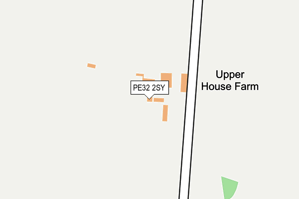
PE32 2SY is located in the Hermitage electoral ward, within the local authority district of Breckland and the English Parliamentary constituency of Mid Norfolk. The Sub Integrated Care Board (ICB) Location is NHS Norfolk and Waveney ICB - 26A and the police force is Norfolk. This postcode has been in use since January 1980.


GetTheData
Source: OS OpenMap – Local (Ordnance Survey)
Source: OS VectorMap District (Ordnance Survey)
Licence: Open Government Licence (requires attribution)
| Easting | 582600 |
| Northing | 323576 |
| Latitude | 52.778904 |
| Longitude | 0.705847 |
GetTheData
Source: Open Postcode Geo
Licence: Open Government Licence
| Country | England |
| Postcode District | PE32 |
| ➜ PE32 open data dashboard ➜ See where PE32 is on a map | |
GetTheData
Source: Land Registry Price Paid Data
Licence: Open Government Licence
Elevation or altitude of PE32 2SY as distance above sea level:
| Metres | Feet | |
|---|---|---|
| Elevation | 70m | 230ft |
Elevation is measured from the approximate centre of the postcode, to the nearest point on an OS contour line from OS Terrain 50, which has contour spacing of ten vertical metres.
➜ How high above sea level am I? Find the elevation of your current position using your device's GPS.
GetTheData
Source: Open Postcode Elevation
Licence: Open Government Licence
| Ward | Hermitage |
| Constituency | Mid Norfolk |
GetTheData
Source: ONS Postcode Database
Licence: Open Government Licence
| Percentage of properties with Next Generation Access | 100.0% |
| Percentage of properties with Superfast Broadband | 0.0% |
| Percentage of properties with Ultrafast Broadband | 0.0% |
| Percentage of properties with Full Fibre Broadband | 0.0% |
Superfast Broadband is between 30Mbps and 300Mbps
Ultrafast Broadband is > 300Mbps
| Percentage of properties unable to receive 2Mbps | 0.0% |
| Percentage of properties unable to receive 5Mbps | 100.0% |
| Percentage of properties unable to receive 10Mbps | 100.0% |
| Percentage of properties unable to receive 30Mbps | 100.0% |
GetTheData
Source: Ofcom
Licence: Ofcom Terms of Use (requires attribution)
GetTheData
Source: ONS Postcode Database
Licence: Open Government Licence
| Last Collection | |||
|---|---|---|---|
| Location | Mon-Fri | Sat | Distance |
| East Rudham Post Office | 17:00 | 11:00 | 4,721m |
GetTheData
Source: Dracos
Licence: Creative Commons Attribution-ShareAlike
| Facility | Distance |
|---|---|
| Great Massingham Village Hall & Playing Field Station Road, Great Massingham, King's Lynn Grass Pitches, Outdoor Tennis Courts | 2.8km |
| Massingham Playing Field Massingham Road, Massingham Road, Weasenham All Saints Grass Pitches | 2.9km |
| East Rudham Playing Field School Road, East Rudham Grass Pitches, Outdoor Tennis Courts | 4.1km |
GetTheData
Source: Active Places
Licence: Open Government Licence
| School | Phase of Education | Distance |
|---|---|---|
| Great Massingham CofE Primary School Weasenham Road, Great Massingham, King's Lynn, PE32 2EY | Primary | 2.7km |
| Rudham CofE Primary Academy School Road, East Rudham, King's Lynn, PE31 8RF | Primary | 4.4km |
| Harpley CofE VC Primary School School Lane, Harpley, King's Lynn, PE31 6DY | Primary | 4.5km |
GetTheData
Source: Edubase
Licence: Open Government Licence
The below table lists the International Territorial Level (ITL) codes (formerly Nomenclature of Territorial Units for Statistics (NUTS) codes) and Local Administrative Units (LAU) codes for PE32 2SY:
| ITL 1 Code | Name |
|---|---|
| TLH | East |
| ITL 2 Code | Name |
| TLH1 | East Anglia |
| ITL 3 Code | Name |
| TLH17 | Breckland and South Norfolk |
| LAU 1 Code | Name |
| E07000143 | Breckland |
GetTheData
Source: ONS Postcode Directory
Licence: Open Government Licence
The below table lists the Census Output Area (OA), Lower Layer Super Output Area (LSOA), and Middle Layer Super Output Area (MSOA) for PE32 2SY:
| Code | Name | |
|---|---|---|
| OA | E00134357 | |
| LSOA | E01026442 | Breckland 002A |
| MSOA | E02005504 | Breckland 002 |
GetTheData
Source: ONS Postcode Directory
Licence: Open Government Licence
| NR21 7DH | Stephenson Close | 1593m |
| NR21 7DQ | Earl Of Bandon Avenue | 1733m |
| PE32 2JZ | Weasenham Road | 1738m |
| NR21 7DG | Atcherley Square | 1771m |
| PE32 2SZ | 1911m | |
| NR21 7AJ | Massingham Road | 2211m |
| NR21 7JN | Felbrigg Walk | 2585m |
| NR21 7JL | Barsham Close | 2656m |
| PE32 2EY | Weasenham Road | 2661m |
| PE32 2EZ | Rectory Row | 2670m |
GetTheData
Source: Open Postcode Geo; Land Registry Price Paid Data
Licence: Open Government Licence