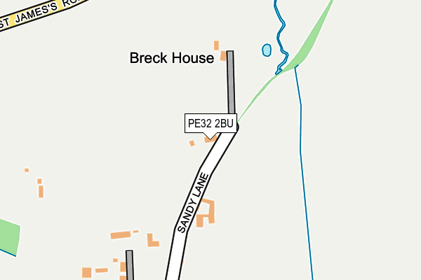
PE32 2BU lies on Broadmeadow Common in Castle Acre, King's Lynn. PE32 2BU is located in the Massingham with Castle Acre electoral ward, within the local authority district of King's Lynn and West Norfolk and the English Parliamentary constituency of North West Norfolk. The Sub Integrated Care Board (ICB) Location is NHS Norfolk and Waveney ICB - 26A and the police force is Norfolk. This postcode has been in use since January 1980.


GetTheData
Source: OS OpenMap – Local (Ordnance Survey)
Source: OS VectorMap District (Ordnance Survey)
Licence: Open Government Licence (requires attribution)
| Easting | 582372 |
| Northing | 315647 |
| Latitude | 52.707757 |
| Longitude | 0.698050 |
GetTheData
Source: Open Postcode Geo
Licence: Open Government Licence
| Street | Broadmeadow Common |
| Locality | Castle Acre |
| Town/City | King's Lynn |
| Country | England |
| Postcode District | PE32 |
| ➜ PE32 open data dashboard ➜ See where PE32 is on a map | |
GetTheData
Source: Land Registry Price Paid Data
Licence: Open Government Licence
Elevation or altitude of PE32 2BU as distance above sea level:
| Metres | Feet | |
|---|---|---|
| Elevation | 40m | 131ft |
Elevation is measured from the approximate centre of the postcode, to the nearest point on an OS contour line from OS Terrain 50, which has contour spacing of ten vertical metres.
➜ How high above sea level am I? Find the elevation of your current position using your device's GPS.
GetTheData
Source: Open Postcode Elevation
Licence: Open Government Licence
| Ward | Massingham With Castle Acre |
| Constituency | North West Norfolk |
GetTheData
Source: ONS Postcode Database
Licence: Open Government Licence
| February 2022 | Violence and sexual offences | On or near De Warrenne Place | 480m |
| June 2021 | Other theft | On or near Newton Road | 426m |
| ➜ Get more crime data in our Crime section | |||
GetTheData
Source: data.police.uk
Licence: Open Government Licence
| Pyes Lane (Town Lane) | Castle Acre | 482m |
| Pyes Lane (Town Lane) | Castle Acre | 540m |
| Newton Road | Newton By Castle Acre | 634m |
| Newton Road | Newton By Castle Acre | 635m |
| Costcutter (Massingham Road) | Castle Acre | 693m |
GetTheData
Source: NaPTAN
Licence: Open Government Licence
| Percentage of properties with Next Generation Access | 100.0% |
| Percentage of properties with Superfast Broadband | 100.0% |
| Percentage of properties with Ultrafast Broadband | 0.0% |
| Percentage of properties with Full Fibre Broadband | 0.0% |
Superfast Broadband is between 30Mbps and 300Mbps
Ultrafast Broadband is > 300Mbps
| Percentage of properties unable to receive 2Mbps | 0.0% |
| Percentage of properties unable to receive 5Mbps | 0.0% |
| Percentage of properties unable to receive 10Mbps | 0.0% |
| Percentage of properties unable to receive 30Mbps | 0.0% |
GetTheData
Source: Ofcom
Licence: Ofcom Terms of Use (requires attribution)
GetTheData
Source: ONS Postcode Database
Licence: Open Government Licence


➜ Get more ratings from the Food Standards Agency
GetTheData
Source: Food Standards Agency
Licence: FSA terms & conditions
| Last Collection | |||
|---|---|---|---|
| Location | Mon-Fri | Sat | Distance |
| Castleacre Post Office | 17:00 | 09:30 | 712m |
| Westacre Post Office | 17:15 | 09:15 | 4,399m |
GetTheData
Source: Dracos
Licence: Creative Commons Attribution-ShareAlike
| Facility | Distance |
|---|---|
| Castle Acre Playing Field St. James Green, Castle Acre, King's Lynn Grass Pitches | 599m |
| Dunham Golf Club (Closed) Little Dunham, King's Lynn Golf | 4.5km |
| Sporle Playing Field St. Marys View, Sporle, King's Lynn Grass Pitches | 5km |
GetTheData
Source: Active Places
Licence: Open Government Licence
| School | Phase of Education | Distance |
|---|---|---|
| Castle Acre Church of England Primary Academy Back Lane, Castle Acre, King's Lynn, PE32 2AR | Primary | 924m |
| Sporle Church of England Primary Academy 82 the Street, Sporle, King's Lynn, PE32 2DR | Primary | 4.8km |
| Great Dunham Primary School Litcham Road, Great Dunham, King's Lynn, PE32 2LQ | Primary | 5km |
GetTheData
Source: Edubase
Licence: Open Government Licence
The below table lists the International Territorial Level (ITL) codes (formerly Nomenclature of Territorial Units for Statistics (NUTS) codes) and Local Administrative Units (LAU) codes for PE32 2BU:
| ITL 1 Code | Name |
|---|---|
| TLH | East |
| ITL 2 Code | Name |
| TLH1 | East Anglia |
| ITL 3 Code | Name |
| TLH16 | North and West Norfolk |
| LAU 1 Code | Name |
| E07000146 | King's Lynn and West Norfolk |
GetTheData
Source: ONS Postcode Directory
Licence: Open Government Licence
The below table lists the Census Output Area (OA), Lower Layer Super Output Area (LSOA), and Middle Layer Super Output Area (MSOA) for PE32 2BU:
| Code | Name | |
|---|---|---|
| OA | E00135669 | |
| LSOA | E01026694 | King's Lynn and West Norfolk 012D |
| MSOA | E02005562 | King's Lynn and West Norfolk 012 |
GetTheData
Source: ONS Postcode Directory
Licence: Open Government Licence
| PE32 2BT | Newton Road | 169m |
| PE32 2AZ | Newton Road | 401m |
| PE32 2BA | North Street | 441m |
| PE32 2AX | Newton Road | 462m |
| PE32 2BE | Orchard Lane | 472m |
| PE32 2AY | De Warrenne Place | 489m |
| PE32 2BB | St James Green | 494m |
| PE32 2FG | Hannants Piece | 551m |
| PE32 2XB | Pyes Lane | 567m |
| PE32 2BD | St James Green | 569m |
GetTheData
Source: Open Postcode Geo; Land Registry Price Paid Data
Licence: Open Government Licence