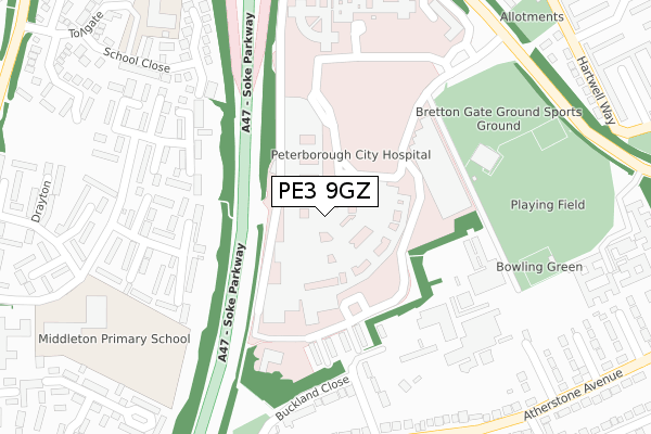
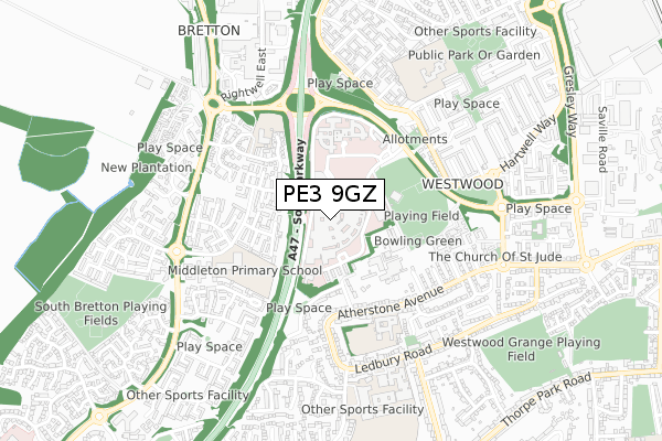
PE3 9GZ is located in the Ravensthorpe electoral ward, within the unitary authority of Peterborough and the English Parliamentary constituency of Peterborough. The Sub Integrated Care Board (ICB) Location is NHS Cambridgeshire and Peterborough ICB - 06H and the police force is Cambridgeshire. This postcode has been in use since January 1993.


GetTheData
Source: OS Open Zoomstack (Ordnance Survey)
Licence: Open Government Licence (requires attribution)
Attribution: Contains OS data © Crown copyright and database right 2024
Source: Open Postcode Geo
Licence: Open Government Licence (requires attribution)
Attribution: Contains OS data © Crown copyright and database right 2024; Contains Royal Mail data © Royal Mail copyright and database right 2024; Source: Office for National Statistics licensed under the Open Government Licence v.3.0
| Easting | 516674 |
| Northing | 299847 |
| Latitude | 52.583921 |
| Longitude | -0.279386 |
GetTheData
Source: Open Postcode Geo
Licence: Open Government Licence
| Country | England |
| Postcode District | PE3 |
| ➜ PE3 open data dashboard ➜ See where PE3 is on a map ➜ Where is Peterborough? | |
GetTheData
Source: Land Registry Price Paid Data
Licence: Open Government Licence
Elevation or altitude of PE3 9GZ as distance above sea level:
| Metres | Feet | |
|---|---|---|
| Elevation | 20m | 66ft |
Elevation is measured from the approximate centre of the postcode, to the nearest point on an OS contour line from OS Terrain 50, which has contour spacing of ten vertical metres.
➜ How high above sea level am I? Find the elevation of your current position using your device's GPS.
GetTheData
Source: Open Postcode Elevation
Licence: Open Government Licence
| Ward | Ravensthorpe |
| Constituency | Peterborough |
GetTheData
Source: ONS Postcode Database
Licence: Open Government Licence
| January 2024 | Violence and sexual offences | On or near Tollgate | 481m |
| December 2023 | Criminal damage and arson | On or near Tollgate | 481m |
| December 2023 | Anti-social behaviour | On or near Tollgate | 481m |
| ➜ Get more crime data in our Crime section | |||
GetTheData
Source: data.police.uk
Licence: Open Government Licence
| City Hospital Main Entrance (City Hospital) | North Bretton | 148m |
| City Hospital Bretton Gate (City Hospital) | North Bretton | 321m |
| City Hospital Bretton Gate (City Hospital) | North Bretton | 333m |
| City Hospital Mental Health Unit (City Hospital) | North Bretton | 342m |
| Meynell Walk (Atherstone Avenue) | Netherton | 434m |
| Peterborough Station | 2.2km |
GetTheData
Source: NaPTAN
Licence: Open Government Licence
GetTheData
Source: ONS Postcode Database
Licence: Open Government Licence


➜ Get more ratings from the Food Standards Agency
GetTheData
Source: Food Standards Agency
Licence: FSA terms & conditions
| Last Collection | |||
|---|---|---|---|
| Location | Mon-Fri | Sat | Distance |
| Tollgate-bretton Way | 18:00 | 12:45 | 524m |
| Atherstone Avenue | 18:30 | 13:00 | 595m |
| Netherton Post Office | 18:15 | 12:00 | 601m |
GetTheData
Source: Dracos
Licence: Creative Commons Attribution-ShareAlike
| Facility | Distance |
|---|---|
| City Of Peterborough Sports Club Bretton Gate, Bretton, Peterborough Artificial Grass Pitch, Grass Pitches, Squash Courts, Outdoor Tennis Courts, Indoor Tennis Centre | 283m |
| Sacred Heart Rc Primary School Tollgate, Bretton, Peterborough Grass Pitches | 397m |
| Thorpe Primary School Atherstone Avenue, Peterborough Sports Hall, Grass Pitches | 440m |
GetTheData
Source: Active Places
Licence: Open Government Licence
| School | Phase of Education | Distance |
|---|---|---|
| Nova Primary Academy South Bretton, Peterborough, PE3 9XJ | Primary | 380m |
| Sacred Heart Catholic Primary School Tollgate, Bretton, Peterborough, PE3 9XD | Primary | 430m |
| Thorpe Primary School Atherstone Avenue, Netherton, Peterborough, PE3 9UG | Primary | 445m |
GetTheData
Source: Edubase
Licence: Open Government Licence
The below table lists the International Territorial Level (ITL) codes (formerly Nomenclature of Territorial Units for Statistics (NUTS) codes) and Local Administrative Units (LAU) codes for PE3 9GZ:
| ITL 1 Code | Name |
|---|---|
| TLH | East |
| ITL 2 Code | Name |
| TLH1 | East Anglia |
| ITL 3 Code | Name |
| TLH11 | Peterborough |
| LAU 1 Code | Name |
| E06000031 | Peterborough |
GetTheData
Source: ONS Postcode Directory
Licence: Open Government Licence
The below table lists the Census Output Area (OA), Lower Layer Super Output Area (LSOA), and Middle Layer Super Output Area (MSOA) for PE3 9GZ:
| Code | Name | |
|---|---|---|
| OA | E00079355 | |
| LSOA | E01015691 | Peterborough 015E |
| MSOA | E02003251 | Peterborough 015 |
GetTheData
Source: ONS Postcode Directory
Licence: Open Government Licence
| PE3 9XQ | Middleton | 233m |
| PE3 9XG | Cleatham | 266m |
| PE3 9UQ | Buckland Close | 277m |
| PE3 9XH | Middleton | 279m |
| PE3 9FS | School Close | 340m |
| PE3 9XF | Cleatham | 342m |
| PE3 9UH | Buckland Close | 346m |
| PE3 9UG | Atherstone Avenue | 369m |
| PE3 9XW | Drayton | 383m |
| PE3 9UJ | Atherstone Avenue | 384m |
GetTheData
Source: Open Postcode Geo; Land Registry Price Paid Data
Licence: Open Government Licence