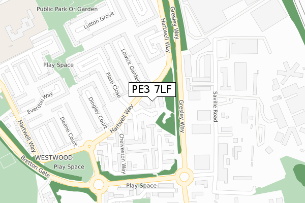
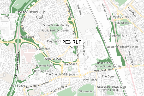
PE3 7LF is located in the Ravensthorpe electoral ward, within the unitary authority of Peterborough and the English Parliamentary constituency of Peterborough. The Sub Integrated Care Board (ICB) Location is NHS Cambridgeshire and Peterborough ICB - 06H and the police force is Cambridgeshire. This postcode has been in use since March 1983.


GetTheData
Source: OS Open Zoomstack (Ordnance Survey)
Licence: Open Government Licence (requires attribution)
Attribution: Contains OS data © Crown copyright and database right 2024
Source: Open Postcode Geo
Licence: Open Government Licence (requires attribution)
Attribution: Contains OS data © Crown copyright and database right 2024; Contains Royal Mail data © Royal Mail copyright and database right 2024; Source: Office for National Statistics licensed under the Open Government Licence v.3.0
| Easting | 517496 |
| Northing | 300170 |
| Latitude | 52.586647 |
| Longitude | -0.267145 |
GetTheData
Source: Open Postcode Geo
Licence: Open Government Licence
| Country | England |
| Postcode District | PE3 |
| ➜ PE3 open data dashboard ➜ See where PE3 is on a map ➜ Where is Peterborough? | |
GetTheData
Source: Land Registry Price Paid Data
Licence: Open Government Licence
Elevation or altitude of PE3 7LF as distance above sea level:
| Metres | Feet | |
|---|---|---|
| Elevation | 20m | 66ft |
Elevation is measured from the approximate centre of the postcode, to the nearest point on an OS contour line from OS Terrain 50, which has contour spacing of ten vertical metres.
➜ How high above sea level am I? Find the elevation of your current position using your device's GPS.
GetTheData
Source: Open Postcode Elevation
Licence: Open Government Licence
| Ward | Ravensthorpe |
| Constituency | Peterborough |
GetTheData
Source: ONS Postcode Database
Licence: Open Government Licence
| June 2022 | Burglary | On or near Lowick Gardens | 133m |
| June 2022 | Criminal damage and arson | On or near Lowick Gardens | 133m |
| June 2022 | Violence and sexual offences | On or near Lowick Gardens | 133m |
| ➜ Get more crime data in our Crime section | |||
GetTheData
Source: data.police.uk
Licence: Open Government Licence
| Hartwell Court (Hartwell Way) | Westwood | 49m |
| Hartwell Court (Hartwell Way) | Westwood | 71m |
| Dingley Court (Hartwell Way) | Westwood | 194m |
| Winwick Place (Hartwell Way) | Westwood | 238m |
| Winwick Place (Hartwell Way) | Westwood | 272m |
| Peterborough Station | 1.8km |
GetTheData
Source: NaPTAN
Licence: Open Government Licence
➜ Broadband speed and availability dashboard for PE3 7LF
| Percentage of properties with Next Generation Access | 100.0% |
| Percentage of properties with Superfast Broadband | 100.0% |
| Percentage of properties with Ultrafast Broadband | 100.0% |
| Percentage of properties with Full Fibre Broadband | 0.0% |
Superfast Broadband is between 30Mbps and 300Mbps
Ultrafast Broadband is > 300Mbps
| Median download speed | 50.0Mbps |
| Average download speed | 56.9Mbps |
| Maximum download speed | 200.00Mbps |
| Median upload speed | 1.3Mbps |
| Average upload speed | 6.7Mbps |
| Maximum upload speed | 20.00Mbps |
| Percentage of properties unable to receive 2Mbps | 0.0% |
| Percentage of properties unable to receive 5Mbps | 0.0% |
| Percentage of properties unable to receive 10Mbps | 0.0% |
| Percentage of properties unable to receive 30Mbps | 0.0% |
➜ Broadband speed and availability dashboard for PE3 7LF
GetTheData
Source: Ofcom
Licence: Ofcom Terms of Use (requires attribution)
GetTheData
Source: ONS Postcode Database
Licence: Open Government Licence


➜ Get more ratings from the Food Standards Agency
GetTheData
Source: Food Standards Agency
Licence: FSA terms & conditions
| Last Collection | |||
|---|---|---|---|
| Location | Mon-Fri | Sat | Distance |
| Hartwell Way-hartwell Court | 18:30 | 13:00 | 37m |
| Cranford Drive Roundabout | 18:45 | 13:15 | 280m |
| Westwood Post Office | 18:30 | 12:15 | 449m |
GetTheData
Source: Dracos
Licence: Creative Commons Attribution-ShareAlike
| Facility | Distance |
|---|---|
| Highlees Primary School Ashton Road, Peterborough Grass Pitches, Sports Hall | 484m |
| Hmp Peterborough Saville Road, Peterborough Artificial Grass Pitch | 487m |
| City Of Peterborough Sports Club Bretton Gate, Bretton, Peterborough Artificial Grass Pitch, Grass Pitches, Squash Courts, Outdoor Tennis Courts, Indoor Tennis Centre | 602m |
GetTheData
Source: Active Places
Licence: Open Government Licence
| School | Phase of Education | Distance |
|---|---|---|
| Highlees Primary School Ashton Road, Westwood, Peterborough, PE3 7ER | Primary | 486m |
| Ravensthorpe Primary School Brigstock Court, Peterborough, PE3 7NB | Primary | 852m |
| Thorpe Primary School Atherstone Avenue, Netherton, Peterborough, PE3 9UG | Primary | 932m |
GetTheData
Source: Edubase
Licence: Open Government Licence
The below table lists the International Territorial Level (ITL) codes (formerly Nomenclature of Territorial Units for Statistics (NUTS) codes) and Local Administrative Units (LAU) codes for PE3 7LF:
| ITL 1 Code | Name |
|---|---|
| TLH | East |
| ITL 2 Code | Name |
| TLH1 | East Anglia |
| ITL 3 Code | Name |
| TLH11 | Peterborough |
| LAU 1 Code | Name |
| E06000031 | Peterborough |
GetTheData
Source: ONS Postcode Directory
Licence: Open Government Licence
The below table lists the Census Output Area (OA), Lower Layer Super Output Area (LSOA), and Middle Layer Super Output Area (MSOA) for PE3 7LF:
| Code | Name | |
|---|---|---|
| OA | E00079217 | |
| LSOA | E01015663 | Peterborough 009D |
| MSOA | E02003245 | Peterborough 009 |
GetTheData
Source: ONS Postcode Directory
Licence: Open Government Licence
| PE3 7EN | Horton Walk | 98m |
| PE3 7EL | Quinton Garth | 122m |
| PE3 7ED | Clipston Walk | 140m |
| PE3 7HJ | Winwick Place | 142m |
| PE3 7HG | Lowick Gardens | 152m |
| PE3 7HD | Lowick Gardens | 153m |
| PE3 7EE | Clipston Walk | 159m |
| PE3 7AB | Flore Close | 164m |
| PE3 7AN | Dingley Court | 171m |
| PE3 7EF | Irchester Place | 175m |
GetTheData
Source: Open Postcode Geo; Land Registry Price Paid Data
Licence: Open Government Licence