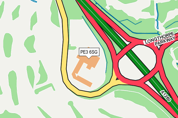
PE3 6SG is located in the West electoral ward, within the unitary authority of Peterborough and the English Parliamentary constituency of Peterborough. The Sub Integrated Care Board (ICB) Location is NHS Cambridgeshire and Peterborough ICB - 06H and the police force is Cambridgeshire. This postcode has been in use since January 1980.


GetTheData
Source: OS OpenMap – Local (Ordnance Survey)
Source: OS VectorMap District (Ordnance Survey)
Licence: Open Government Licence (requires attribution)
| Easting | 516207 |
| Northing | 297667 |
| Latitude | 52.564432 |
| Longitude | -0.287039 |
GetTheData
Source: Open Postcode Geo
Licence: Open Government Licence
| Country | England |
| Postcode District | PE3 |
| ➜ PE3 open data dashboard ➜ See where PE3 is on a map ➜ Where is Peterborough? | |
GetTheData
Source: Land Registry Price Paid Data
Licence: Open Government Licence
Elevation or altitude of PE3 6SG as distance above sea level:
| Metres | Feet | |
|---|---|---|
| Elevation | 10m | 33ft |
Elevation is measured from the approximate centre of the postcode, to the nearest point on an OS contour line from OS Terrain 50, which has contour spacing of ten vertical metres.
➜ How high above sea level am I? Find the elevation of your current position using your device's GPS.
GetTheData
Source: Open Postcode Elevation
Licence: Open Government Licence
| Ward | West |
| Constituency | Peterborough |
GetTheData
Source: ONS Postcode Database
Licence: Open Government Licence
| December 2023 | Public order | On or near Lingwood Park | 362m |
| November 2023 | Violence and sexual offences | On or near Lingwood Park | 362m |
| November 2023 | Other theft | On or near Lingwood Park | 362m |
| ➜ Get more crime data in our Crime section | |||
GetTheData
Source: data.police.uk
Licence: Open Government Licence
| Nene Valley Railway Car Park (Orton Mere) | Orton Longueville | 702m |
| Woburn Close (Thorpe Road) | Longthorpe | 742m |
| Woburn Close (Thorpe Road) | Longthorpe | 749m |
| Police Headquarters (Thorpe Wood Road) | Thorpe Wood | 967m |
| Fox And Hounds (Thorpe Road) | Longthorpe | 971m |
| Orton Mere (Nene Valley Railway) | Orton Longueville | 668m |
| Ferry Meadows (Nene Valley Railway) | Ferry Meadows | 1,194m |
| Peterborough Station | 2.8km |
GetTheData
Source: NaPTAN
Licence: Open Government Licence
GetTheData
Source: ONS Postcode Database
Licence: Open Government Licence


➜ Get more ratings from the Food Standards Agency
GetTheData
Source: Food Standards Agency
Licence: FSA terms & conditions
| Last Collection | |||
|---|---|---|---|
| Location | Mon-Fri | Sat | Distance |
| Holywell Way | 18:00 | 13:00 | 566m |
| Longthorpe Post Office | 18:15 | 12:00 | 741m |
| Grove Lane | 18:15 | 13:00 | 917m |
GetTheData
Source: Dracos
Licence: Creative Commons Attribution-ShareAlike
| Facility | Distance |
|---|---|
| Club Moativation (Peterborough West) Thorpe Wood, Peterborough Health and Fitness Gym, Swimming Pool, Studio | 0m |
| Thorpe Wood Golf Course Thorpe Wood, Peterborough Golf | 285m |
| Holywell Way Holywell Way, Longthorpe, Peterborough Grass Pitches | 528m |
GetTheData
Source: Active Places
Licence: Open Government Licence
| School | Phase of Education | Distance |
|---|---|---|
| St Botolph's Church of England Primary School Oundle Road, Orton Longueville, Peterborough, PE2 7EA | Primary | 1.1km |
| Longthorpe Primary School Bradwell Road, Longthorpe, Peterborough, PE3 9QW | Primary | 1.3km |
| Nene Park Academy Oundle Road, Orton Longueville, Peterborough, PE2 7EA | Secondary | 1.3km |
GetTheData
Source: Edubase
Licence: Open Government Licence
The below table lists the International Territorial Level (ITL) codes (formerly Nomenclature of Territorial Units for Statistics (NUTS) codes) and Local Administrative Units (LAU) codes for PE3 6SG:
| ITL 1 Code | Name |
|---|---|
| TLH | East |
| ITL 2 Code | Name |
| TLH1 | East Anglia |
| ITL 3 Code | Name |
| TLH11 | Peterborough |
| LAU 1 Code | Name |
| E06000031 | Peterborough |
GetTheData
Source: ONS Postcode Directory
Licence: Open Government Licence
The below table lists the Census Output Area (OA), Lower Layer Super Output Area (LSOA), and Middle Layer Super Output Area (MSOA) for PE3 6SG:
| Code | Name | |
|---|---|---|
| OA | E00079354 | |
| LSOA | E01015689 | Peterborough 015C |
| MSOA | E02003251 | Peterborough 015 |
GetTheData
Source: ONS Postcode Directory
Licence: Open Government Licence
| PE3 6RX | Lingwood Park | 321m |
| PE3 6FB | Haywardsfield | 417m |
| PE3 6SJ | Carisbrook Court | 422m |
| PE3 6SY | Kirkton Gate | 484m |
| PE3 6RY | Penyale | 502m |
| PE3 6SP | Tintagel Court | 508m |
| PE3 6SS | Holywell Way | 560m |
| PE3 6SZ | Down Gate | 570m |
| PE3 6SL | Stokesay Court | 570m |
| PE3 6SN | Tantallon Court | 578m |
GetTheData
Source: Open Postcode Geo; Land Registry Price Paid Data
Licence: Open Government Licence