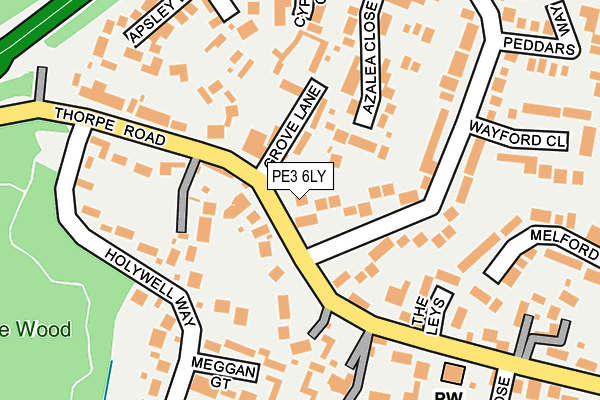
PE3 6LY is located in the West electoral ward, within the unitary authority of Peterborough and the English Parliamentary constituency of Peterborough. The Sub Integrated Care Board (ICB) Location is NHS Cambridgeshire and Peterborough ICB - 06H and the police force is Cambridgeshire. This postcode has been in use since January 1980.


GetTheData
Source: OS OpenMap – Local (Ordnance Survey)
Source: OS VectorMap District (Ordnance Survey)
Licence: Open Government Licence (requires attribution)
| Easting | 516148 |
| Northing | 298573 |
| Latitude | 52.572604 |
| Longitude | -0.287577 |
GetTheData
Source: Open Postcode Geo
Licence: Open Government Licence
| Country | England |
| Postcode District | PE3 |
| ➜ PE3 open data dashboard ➜ See where PE3 is on a map ➜ Where is Peterborough? | |
GetTheData
Source: Land Registry Price Paid Data
Licence: Open Government Licence
Elevation or altitude of PE3 6LY as distance above sea level:
| Metres | Feet | |
|---|---|---|
| Elevation | 20m | 66ft |
Elevation is measured from the approximate centre of the postcode, to the nearest point on an OS contour line from OS Terrain 50, which has contour spacing of ten vertical metres.
➜ How high above sea level am I? Find the elevation of your current position using your device's GPS.
GetTheData
Source: Open Postcode Elevation
Licence: Open Government Licence
| Ward | West |
| Constituency | Peterborough |
GetTheData
Source: ONS Postcode Database
Licence: Open Government Licence
| October 2023 | Vehicle crime | On or near Wayford Close | 229m |
| October 2023 | Vehicle crime | On or near Wayford Close | 229m |
| June 2022 | Vehicle crime | On or near Longthorpe Close | 113m |
| ➜ Get more crime data in our Crime section | |||
GetTheData
Source: data.police.uk
Licence: Open Government Licence
| Fox And Hounds (Thorpe Road) | Longthorpe | 137m |
| Fox And Hounds (Thorpe Road) | Longthorpe | 147m |
| Woburn Close (Thorpe Road) | Longthorpe | 306m |
| Woburn Close (Thorpe Road) | Longthorpe | 313m |
| Harewood Gardens | Netherton | 401m |
| Orton Mere (Nene Valley Railway) | Orton Longueville | 1,498m |
| Peterborough Station | 2.6km |
GetTheData
Source: NaPTAN
Licence: Open Government Licence
| Percentage of properties with Next Generation Access | 100.0% |
| Percentage of properties with Superfast Broadband | 100.0% |
| Percentage of properties with Ultrafast Broadband | 50.0% |
| Percentage of properties with Full Fibre Broadband | 0.0% |
Superfast Broadband is between 30Mbps and 300Mbps
Ultrafast Broadband is > 300Mbps
| Percentage of properties unable to receive 2Mbps | 0.0% |
| Percentage of properties unable to receive 5Mbps | 0.0% |
| Percentage of properties unable to receive 10Mbps | 0.0% |
| Percentage of properties unable to receive 30Mbps | 0.0% |
GetTheData
Source: Ofcom
Licence: Ofcom Terms of Use (requires attribution)
GetTheData
Source: ONS Postcode Database
Licence: Open Government Licence


➜ Get more ratings from the Food Standards Agency
GetTheData
Source: Food Standards Agency
Licence: FSA terms & conditions
| Last Collection | |||
|---|---|---|---|
| Location | Mon-Fri | Sat | Distance |
| Grove Lane | 18:15 | 13:00 | 30m |
| Holywell Way | 18:00 | 13:00 | 345m |
| Longthorpe Post Office | 18:15 | 12:00 | 397m |
GetTheData
Source: Dracos
Licence: Creative Commons Attribution-ShareAlike
| Facility | Distance |
|---|---|
| Longthorpe Lawn Tennis Club Thorpe Road, Peterborough Outdoor Tennis Courts | 375m |
| Holywell Way Holywell Way, Longthorpe, Peterborough Grass Pitches | 505m |
| Thomas Cook (Closed) Thorpe Wood Road, Peterborough Grass Pitches | 724m |
GetTheData
Source: Active Places
Licence: Open Government Licence
| School | Phase of Education | Distance |
|---|---|---|
| Longthorpe Primary School Bradwell Road, Longthorpe, Peterborough, PE3 9QW | Primary | 469m |
| Jack Hunt School Bradwell Road, Peterborough, PE3 9PY | Secondary | 1km |
| Nova Primary Academy South Bretton, Peterborough, PE3 9XJ | Primary | 1.1km |
GetTheData
Source: Edubase
Licence: Open Government Licence
The below table lists the International Territorial Level (ITL) codes (formerly Nomenclature of Territorial Units for Statistics (NUTS) codes) and Local Administrative Units (LAU) codes for PE3 6LY:
| ITL 1 Code | Name |
|---|---|
| TLH | East |
| ITL 2 Code | Name |
| TLH1 | East Anglia |
| ITL 3 Code | Name |
| TLH11 | Peterborough |
| LAU 1 Code | Name |
| E06000031 | Peterborough |
GetTheData
Source: ONS Postcode Directory
Licence: Open Government Licence
The below table lists the Census Output Area (OA), Lower Layer Super Output Area (LSOA), and Middle Layer Super Output Area (MSOA) for PE3 6LY:
| Code | Name | |
|---|---|---|
| OA | E00079342 | |
| LSOA | E01015689 | Peterborough 015C |
| MSOA | E02003251 | Peterborough 015 |
GetTheData
Source: ONS Postcode Directory
Licence: Open Government Licence
| PE3 6NA | Thorpe Road | 90m |
| PE3 6NJ | Millwood Gardens | 98m |
| PE3 6HW | Longthorpe Close | 99m |
| PE3 6LZ | Grove Lane | 101m |
| PE3 9NE | Apsley Way | 112m |
| PE3 9QU | Azalea Close | 139m |
| PE3 6NB | Thorpe Road | 146m |
| PE3 6LE | The Leys | 170m |
| PE3 9QX | Cypress Close | 183m |
| PE3 9QZ | Virginia Close | 195m |
GetTheData
Source: Open Postcode Geo; Land Registry Price Paid Data
Licence: Open Government Licence