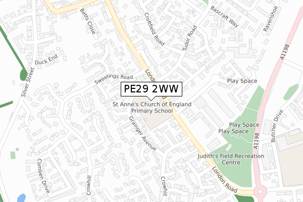
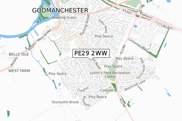
PE29 2WW is located in the Godmanchester & Hemingford Abbots electoral ward, within the local authority district of Huntingdonshire and the English Parliamentary constituency of Huntingdon. The Sub Integrated Care Board (ICB) Location is NHS Cambridgeshire and Peterborough ICB - 06H and the police force is Cambridgeshire. This postcode has been in use since June 2000.


GetTheData
Source: OS Open Zoomstack (Ordnance Survey)
Licence: Open Government Licence (requires attribution)
Attribution: Contains OS data © Crown copyright and database right 2024
Source: Open Postcode Geo
Licence: Open Government Licence (requires attribution)
Attribution: Contains OS data © Crown copyright and database right 2024; Contains Royal Mail data © Royal Mail copyright and database right 2024; Source: Office for National Statistics licensed under the Open Government Licence v.3.0
| Easting | 524912 |
| Northing | 269900 |
| Latitude | 52.313008 |
| Longitude | -0.169057 |
GetTheData
Source: Open Postcode Geo
Licence: Open Government Licence
| Country | England |
| Postcode District | PE29 |
| ➜ PE29 open data dashboard ➜ See where PE29 is on a map ➜ Where is Godmanchester? | |
GetTheData
Source: Land Registry Price Paid Data
Licence: Open Government Licence
Elevation or altitude of PE29 2WW as distance above sea level:
| Metres | Feet | |
|---|---|---|
| Elevation | 20m | 66ft |
Elevation is measured from the approximate centre of the postcode, to the nearest point on an OS contour line from OS Terrain 50, which has contour spacing of ten vertical metres.
➜ How high above sea level am I? Find the elevation of your current position using your device's GPS.
GetTheData
Source: Open Postcode Elevation
Licence: Open Government Licence
| Ward | Godmanchester & Hemingford Abbots |
| Constituency | Huntingdon |
GetTheData
Source: ONS Postcode Database
Licence: Open Government Licence
| January 2024 | Criminal damage and arson | On or near Cob Place | 495m |
| January 2024 | Violence and sexual offences | On or near Cob Place | 495m |
| November 2023 | Violence and sexual offences | On or near Brick Kilns | 171m |
| ➜ Get more crime data in our Crime section | |||
GetTheData
Source: data.police.uk
Licence: Open Government Licence
| Lions Cross (Tudor Road) | Godmanchester | 99m |
| Crowhill (London Road) | Godmanchester | 105m |
| Buttermel Close (Grainger Avenue) | Godmanchester | 111m |
| Lions Cross (Tudor Road) | Godmanchester | 147m |
| Sweetings Road (London Road) | Godmanchester | 160m |
| Huntingdon Station | 2.3km |
GetTheData
Source: NaPTAN
Licence: Open Government Licence
GetTheData
Source: ONS Postcode Database
Licence: Open Government Licence


➜ Get more ratings from the Food Standards Agency
GetTheData
Source: Food Standards Agency
Licence: FSA terms & conditions
| Last Collection | |||
|---|---|---|---|
| Location | Mon-Fri | Sat | Distance |
| Earning Street | 17:30 | 11:45 | 378m |
| Godmanchester Post Office | 17:30 | 11:45 | 684m |
| Market Square | 18:00 | 12:00 | 2,188m |
GetTheData
Source: Dracos
Licence: Creative Commons Attribution-ShareAlike
| Facility | Distance |
|---|---|
| St Anne's Cofe Primary School London Road, Godmanchester, Huntingdon Grass Pitches | 0m |
| Judith's Field Recreation Centre Chord Business Park, London Road, Godmanchester, Huntingdon Grass Pitches | 298m |
| Bridge Academy Butcher Drive, Godmanchester, Huntingdon Grass Pitches | 453m |
GetTheData
Source: Active Places
Licence: Open Government Licence
| School | Phase of Education | Distance |
|---|---|---|
| St Anne's CofE Primary School London Road, Godmanchester, Huntingdon, PE29 2WW | Primary | 1m |
| Godmanchester Bridge Academy 2 Butcher Drive, Godmanchester, PE29 2NL | Primary | 452m |
| Godmanchester Community Academy Park Lane, Godmanchester, Huntingdon, PE29 2AG | Primary | 1km |
GetTheData
Source: Edubase
Licence: Open Government Licence
The below table lists the International Territorial Level (ITL) codes (formerly Nomenclature of Territorial Units for Statistics (NUTS) codes) and Local Administrative Units (LAU) codes for PE29 2WW:
| ITL 1 Code | Name |
|---|---|
| TLH | East |
| ITL 2 Code | Name |
| TLH1 | East Anglia |
| ITL 3 Code | Name |
| TLH12 | Cambridgeshire CC |
| LAU 1 Code | Name |
| E07000011 | Huntingdonshire |
GetTheData
Source: ONS Postcode Directory
Licence: Open Government Licence
The below table lists the Census Output Area (OA), Lower Layer Super Output Area (LSOA), and Middle Layer Super Output Area (MSOA) for PE29 2WW:
| Code | Name | |
|---|---|---|
| OA | E00091478 | |
| LSOA | E01018133 | Huntingdonshire 014C |
| MSOA | E02003766 | Huntingdonshire 014 |
GetTheData
Source: ONS Postcode Directory
Licence: Open Government Licence
| PE29 2JT | Grainger Avenue | 74m |
| PE29 2WR | London Road | 110m |
| PE29 2JY | Littlefield Close | 119m |
| PE29 2LR | Thickwillow | 131m |
| PE29 2JZ | Sears Close | 149m |
| PE29 2JU | Buttermel Close | 151m |
| PE29 2DZ | Lions Cross | 172m |
| PE29 2HZ | London Road | 185m |
| PE29 2LS | Brick Kilns | 187m |
| PE29 2JS | Sweetings Road | 209m |
GetTheData
Source: Open Postcode Geo; Land Registry Price Paid Data
Licence: Open Government Licence