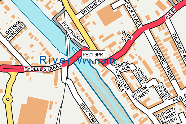
PE21 9PR is located in the Witham electoral ward, within the local authority district of Boston and the English Parliamentary constituency of Boston and Skegness. The Sub Integrated Care Board (ICB) Location is NHS Lincolnshire ICB - 71E and the police force is Lincolnshire. This postcode has been in use since June 1998.


GetTheData
Source: OS OpenMap – Local (Ordnance Survey)
Source: OS VectorMap District (Ordnance Survey)
Licence: Open Government Licence (requires attribution)
| Easting | 532431 |
| Northing | 344486 |
| Latitude | 52.981362 |
| Longitude | -0.028918 |
GetTheData
Source: Open Postcode Geo
Licence: Open Government Licence
| Country | England |
| Postcode District | PE21 |
➜ See where PE21 is on a map ➜ Where is Boston? | |
GetTheData
Source: Land Registry Price Paid Data
Licence: Open Government Licence
Elevation or altitude of PE21 9PR as distance above sea level:
| Metres | Feet | |
|---|---|---|
| Elevation | 0m | 0ft |
Elevation is measured from the approximate centre of the postcode, to the nearest point on an OS contour line from OS Terrain 50, which has contour spacing of ten vertical metres.
➜ How high above sea level am I? Find the elevation of your current position using your device's GPS.
GetTheData
Source: Open Postcode Elevation
Licence: Open Government Licence
| Ward | Witham |
| Constituency | Boston And Skegness |
GetTheData
Source: ONS Postcode Database
Licence: Open Government Licence
| Witham Green (Tattershall Road) | Boston | 88m |
| Witham Green (Tattershall Road) | Boston | 169m |
| Asda Store (Lister Way) | Boston | 345m |
| Asda Store (Lister Way) | Boston | 371m |
| Fydell Court (Fydell Street) | Boston | 381m |
| Boston Station | 0.4km |
GetTheData
Source: NaPTAN
Licence: Open Government Licence
GetTheData
Source: ONS Postcode Database
Licence: Open Government Licence


➜ Get more ratings from the Food Standards Agency
GetTheData
Source: Food Standards Agency
Licence: FSA terms & conditions
| Last Collection | |||
|---|---|---|---|
| Location | Mon-Fri | Sat | Distance |
| Witham Place | 17:30 | 11:50 | 98m |
| Fydell Street | 17:30 | 11:50 | 229m |
| Tower Street | 17:45 | 12:30 | 337m |
GetTheData
Source: Dracos
Licence: Creative Commons Attribution-ShareAlike
| Risk of PE21 9PR flooding from rivers and sea | Low |
| ➜ PE21 9PR flood map | |
GetTheData
Source: Open Flood Risk by Postcode
Licence: Open Government Licence
The below table lists the International Territorial Level (ITL) codes (formerly Nomenclature of Territorial Units for Statistics (NUTS) codes) and Local Administrative Units (LAU) codes for PE21 9PR:
| ITL 1 Code | Name |
|---|---|
| TLF | East Midlands (England) |
| ITL 2 Code | Name |
| TLF3 | Lincolnshire |
| ITL 3 Code | Name |
| TLF30 | Lincolnshire CC |
| LAU 1 Code | Name |
| E07000136 | Boston |
GetTheData
Source: ONS Postcode Directory
Licence: Open Government Licence
The below table lists the Census Output Area (OA), Lower Layer Super Output Area (LSOA), and Middle Layer Super Output Area (MSOA) for PE21 9PR:
| Code | Name | |
|---|---|---|
| OA | E00132130 | |
| LSOA | E01026037 | Boston 002E |
| MSOA | E02005418 | Boston 002 |
GetTheData
Source: ONS Postcode Directory
Licence: Open Government Licence
| PE21 9JG | Tattershall Road | 47m |
| PE21 6LQ | Cottage Gardens | 53m |
| PE21 9JH | Witham Riverside Mews | 94m |
| PE21 9JT | Tattershall Court | 111m |
| PE21 8SB | Haven Bank | 116m |
| PE21 6PW | Norfolk Street | 117m |
| PE21 6PS | Union Place | 124m |
| PE21 6LG | Witham Place | 138m |
| PE21 8LE | Fydell Street | 158m |
| PE21 6PT | Union Street | 160m |
GetTheData
Source: Open Postcode Geo; Land Registry Price Paid Data
Licence: Open Government Licence