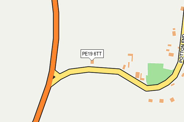
PE19 6TT is located in the Caxton & Papworth electoral ward, within the local authority district of South Cambridgeshire and the English Parliamentary constituency of South Cambridgeshire. The Sub Integrated Care Board (ICB) Location is NHS Cambridgeshire and Peterborough ICB - 06H and the police force is Cambridgeshire. This postcode has been in use since June 2000.


GetTheData
Source: OS OpenMap – Local (Ordnance Survey)
Source: OS VectorMap District (Ordnance Survey)
Licence: Open Government Licence (requires attribution)
| Easting | 526795 |
| Northing | 259275 |
| Latitude | 52.217105 |
| Longitude | -0.145438 |
GetTheData
Source: Open Postcode Geo
Licence: Open Government Licence
| Country | England |
| Postcode District | PE19 |
| ➜ PE19 open data dashboard ➜ See where PE19 is on a map ➜ Where is Eltisley? | |
GetTheData
Source: Land Registry Price Paid Data
Licence: Open Government Licence
Elevation or altitude of PE19 6TT as distance above sea level:
| Metres | Feet | |
|---|---|---|
| Elevation | 60m | 197ft |
Elevation is measured from the approximate centre of the postcode, to the nearest point on an OS contour line from OS Terrain 50, which has contour spacing of ten vertical metres.
➜ How high above sea level am I? Find the elevation of your current position using your device's GPS.
GetTheData
Source: Open Postcode Elevation
Licence: Open Government Licence
| Ward | Caxton & Papworth |
| Constituency | South Cambridgeshire |
GetTheData
Source: ONS Postcode Database
Licence: Open Government Licence
| June 2022 | Vehicle crime | On or near St Neots Road | 477m |
| May 2022 | Vehicle crime | On or near Meadow View | 440m |
| May 2021 | Burglary | On or near Potton End | 92m |
| ➜ Get more crime data in our Crime section | |||
GetTheData
Source: data.police.uk
Licence: Open Government Licence
| St. John The Baptist's Church (St Neots Road) | Church End | 470m |
| St. John The Baptist's Church (St Neots Road) | Church End | 474m |
| The Green Cricket Ground (St Neots Road) | Eltisley | 623m |
| The Green Cricket Ground (St Neots Road) | Eltisley | 630m |
GetTheData
Source: NaPTAN
Licence: Open Government Licence
| Percentage of properties with Next Generation Access | 100.0% |
| Percentage of properties with Superfast Broadband | 0.0% |
| Percentage of properties with Ultrafast Broadband | 0.0% |
| Percentage of properties with Full Fibre Broadband | 0.0% |
Superfast Broadband is between 30Mbps and 300Mbps
Ultrafast Broadband is > 300Mbps
| Percentage of properties unable to receive 2Mbps | 0.0% |
| Percentage of properties unable to receive 5Mbps | 0.0% |
| Percentage of properties unable to receive 10Mbps | 0.0% |
| Percentage of properties unable to receive 30Mbps | 100.0% |
GetTheData
Source: Ofcom
Licence: Ofcom Terms of Use (requires attribution)
GetTheData
Source: ONS Postcode Database
Licence: Open Government Licence


➜ Get more ratings from the Food Standards Agency
GetTheData
Source: Food Standards Agency
Licence: FSA terms & conditions
| Last Collection | |||
|---|---|---|---|
| Location | Mon-Fri | Sat | Distance |
| Eltisley | 16:15 | 08:45 | 621m |
| Croxton Village | 16:15 | 07:45 | 2,036m |
| Croxton Village | 16:15 | 07:30 | 2,445m |
GetTheData
Source: Dracos
Licence: Creative Commons Attribution-ShareAlike
| Facility | Distance |
|---|---|
| Great Grandsden Sports And Recreation Ground Caxton Road, Great Gransden, Sandy Grass Pitches | 3km |
| King George V Field (Papworth Everard) Ermine Street South, Papworth Everard, Cambridge Grass Pitches, Outdoor Tennis Courts | 4km |
| Cambourne Village College Sheepfold Lane, Cambourne, Cambridge Grass Pitches, Artificial Grass Pitch, Sports Hall, Studio | 4.2km |
GetTheData
Source: Active Places
Licence: Open Government Licence
| School | Phase of Education | Distance |
|---|---|---|
| The Newton Community Primary School Caxton End, Eltisley, St Neots, PE19 6TL | Primary | 535m |
| Barnabas Oley CofE Primary School Little Lane, Great Gransden, Sandy, SG19 3AE | Primary | 3.4km |
| Cambourne Village College Sheepfold Lane, Cambourne, Cambridge, CB23 6FR | Secondary | 4.3km |
GetTheData
Source: Edubase
Licence: Open Government Licence
The below table lists the International Territorial Level (ITL) codes (formerly Nomenclature of Territorial Units for Statistics (NUTS) codes) and Local Administrative Units (LAU) codes for PE19 6TT:
| ITL 1 Code | Name |
|---|---|
| TLH | East |
| ITL 2 Code | Name |
| TLH1 | East Anglia |
| ITL 3 Code | Name |
| TLH12 | Cambridgeshire CC |
| LAU 1 Code | Name |
| E07000012 | South Cambridgeshire |
GetTheData
Source: ONS Postcode Directory
Licence: Open Government Licence
The below table lists the Census Output Area (OA), Lower Layer Super Output Area (LSOA), and Middle Layer Super Output Area (MSOA) for PE19 6TT:
| Code | Name | |
|---|---|---|
| OA | E00091963 | |
| LSOA | E01033118 | South Cambridgeshire 021E |
| MSOA | E02006874 | South Cambridgeshire 021 |
GetTheData
Source: ONS Postcode Directory
Licence: Open Government Licence
| PE19 6TH | Potton End | 257m |
| PE19 6TP | Meadow View | 415m |
| PE19 6TQ | The Green | 467m |
| PE19 6TE | St Neots Road | 505m |
| PE19 6TL | Caxton End | 538m |
| PE19 6TG | The Green | 588m |
| PE19 6TN | Greenfields | 619m |
| PE19 6TJ | Caxton End | 648m |
| PE19 6TF | St Thomas | 754m |
| PE19 6TR | Cambridge Road | 817m |
GetTheData
Source: Open Postcode Geo; Land Registry Price Paid Data
Licence: Open Government Licence