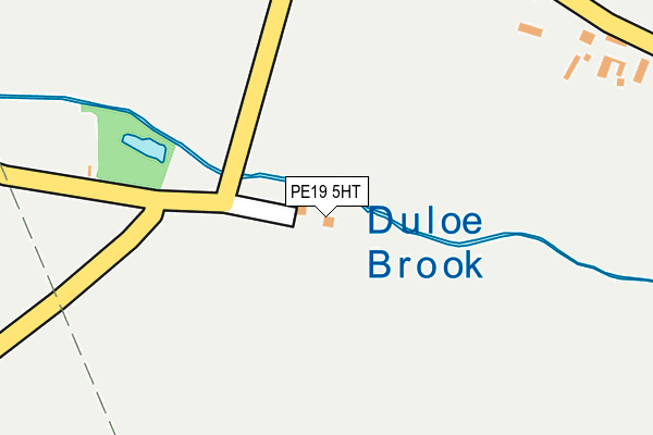
PE19 5HT is located in the Wyboston electoral ward, within the unitary authority of Bedford and the English Parliamentary constituency of North East Bedfordshire. The Sub Integrated Care Board (ICB) Location is NHS Bedfordshire, Luton and Milton Keynes ICB - M1J4Y and the police force is Bedfordshire. This postcode has been in use since June 2000.


GetTheData
Source: OS OpenMap – Local (Ordnance Survey)
Source: OS VectorMap District (Ordnance Survey)
Licence: Open Government Licence (requires attribution)
| Easting | 515775 |
| Northing | 260449 |
| Latitude | 52.230091 |
| Longitude | -0.306243 |
GetTheData
Source: Open Postcode Geo
Licence: Open Government Licence
| Country | England |
| Postcode District | PE19 |
| ➜ PE19 open data dashboard ➜ See where PE19 is on a map ➜ Where is Duloe? | |
GetTheData
Source: Land Registry Price Paid Data
Licence: Open Government Licence
Elevation or altitude of PE19 5HT as distance above sea level:
| Metres | Feet | |
|---|---|---|
| Elevation | 30m | 98ft |
Elevation is measured from the approximate centre of the postcode, to the nearest point on an OS contour line from OS Terrain 50, which has contour spacing of ten vertical metres.
➜ How high above sea level am I? Find the elevation of your current position using your device's GPS.
GetTheData
Source: Open Postcode Elevation
Licence: Open Government Licence
| Ward | Wyboston |
| Constituency | North East Bedfordshire |
GetTheData
Source: ONS Postcode Database
Licence: Open Government Licence
| Woodhouse Lane (Village Street) | Duloe | 283m |
| Woodhouse Lane (Village Street) | Duloe | 291m |
| Village East (Village Street) | Duloe | 415m |
| Village East (Village Street) | Duloe | 420m |
| Marchioness Way (Monarch Road) | Eaton Socon | 989m |
| St Neots Station | 4km |
GetTheData
Source: NaPTAN
Licence: Open Government Licence
| Percentage of properties with Next Generation Access | 100.0% |
| Percentage of properties with Superfast Broadband | 50.0% |
| Percentage of properties with Ultrafast Broadband | 0.0% |
| Percentage of properties with Full Fibre Broadband | 0.0% |
Superfast Broadband is between 30Mbps and 300Mbps
Ultrafast Broadband is > 300Mbps
| Percentage of properties unable to receive 2Mbps | 0.0% |
| Percentage of properties unable to receive 5Mbps | 0.0% |
| Percentage of properties unable to receive 10Mbps | 0.0% |
| Percentage of properties unable to receive 30Mbps | 50.0% |
GetTheData
Source: Ofcom
Licence: Ofcom Terms of Use (requires attribution)
GetTheData
Source: ONS Postcode Database
Licence: Open Government Licence


➜ Get more ratings from the Food Standards Agency
GetTheData
Source: Food Standards Agency
Licence: FSA terms & conditions
| Last Collection | |||
|---|---|---|---|
| Location | Mon-Fri | Sat | Distance |
| Duloe | 16:00 | 07:30 | 317m |
| Staploe | 16:00 | 07:30 | 942m |
| Monarch Road-medland Grove | 17:30 | 11:45 | 1,053m |
GetTheData
Source: Dracos
Licence: Creative Commons Attribution-ShareAlike
| Facility | Distance |
|---|---|
| Duloe Playing Fields Woodhouse Lane, Duloe Grass Pitches | 410m |
| Bushmead Primary School Bushmead Road, Eaton Socon, St. Neots Grass Pitches | 1.4km |
| Crosshall Junior School Great North Road, Eaton Ford, St. Neots Grass Pitches | 1.6km |
GetTheData
Source: Active Places
Licence: Open Government Licence
| School | Phase of Education | Distance |
|---|---|---|
| Bushmead Primary School Bushmead Road, Eaton Socon, St Neots, PE19 8BT | Primary | 1.3km |
| Crosshall Infant School Academy Trust 446 Great North Road, Eaton Ford, St Neots, PE19 7GG | Primary | 1.6km |
| Crosshall Junior School Great North Road, Eaton Ford, St Neots, PE19 7GG | Primary | 1.6km |
GetTheData
Source: Edubase
Licence: Open Government Licence
The below table lists the International Territorial Level (ITL) codes (formerly Nomenclature of Territorial Units for Statistics (NUTS) codes) and Local Administrative Units (LAU) codes for PE19 5HT:
| ITL 1 Code | Name |
|---|---|
| TLH | East |
| ITL 2 Code | Name |
| TLH2 | Bedfordshire and Hertfordshire |
| ITL 3 Code | Name |
| TLH24 | Bedford |
| LAU 1 Code | Name |
| E06000055 | Bedford |
GetTheData
Source: ONS Postcode Directory
Licence: Open Government Licence
The below table lists the Census Output Area (OA), Lower Layer Super Output Area (LSOA), and Middle Layer Super Output Area (MSOA) for PE19 5HT:
| Code | Name | |
|---|---|---|
| OA | E00088559 | |
| LSOA | E01017543 | Bedford 004E |
| MSOA | E02003619 | Bedford 004 |
GetTheData
Source: ONS Postcode Directory
Licence: Open Government Licence
| PE19 5HP | 272m | |
| PE19 5HR | Woodhouse Lane | 365m |
| PE19 5JA | 938m | |
| PE19 8JW | Earl Close | 969m |
| PE19 8JF | Prince Close | 984m |
| PE19 8QJ | Muntjac Close | 991m |
| PE19 8GU | Monarch Road | 1012m |
| PE19 8DF | Monarch Road | 1021m |
| PE19 8LA | Beaver Close | 1033m |
| PE19 8QL | Fallow Drive | 1038m |
GetTheData
Source: Open Postcode Geo; Land Registry Price Paid Data
Licence: Open Government Licence