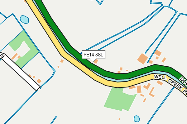
PE14 8SL lies on Downham Road in Outwell, Wisbech. PE14 8SL is located in the Emneth & Outwell electoral ward, within the local authority district of King's Lynn and West Norfolk and the English Parliamentary constituency of South West Norfolk. The Sub Integrated Care Board (ICB) Location is NHS Norfolk and Waveney ICB - 26A and the police force is Norfolk. This postcode has been in use since January 1980.


GetTheData
Source: OS OpenMap – Local (Ordnance Survey)
Source: OS VectorMap District (Ordnance Survey)
Licence: Open Government Licence (requires attribution)
| Easting | 552526 |
| Northing | 303227 |
| Latitude | 52.605437 |
| Longitude | 0.250953 |
GetTheData
Source: Open Postcode Geo
Licence: Open Government Licence
| Street | Downham Road |
| Locality | Outwell |
| Town/City | Wisbech |
| Country | England |
| Postcode District | PE14 |
➜ See where PE14 is on a map | |
GetTheData
Source: Land Registry Price Paid Data
Licence: Open Government Licence
Elevation or altitude of PE14 8SL as distance above sea level:
| Metres | Feet | |
|---|---|---|
| Elevation | 0m | 0ft |
Elevation is measured from the approximate centre of the postcode, to the nearest point on an OS contour line from OS Terrain 50, which has contour spacing of ten vertical metres.
➜ How high above sea level am I? Find the elevation of your current position using your device's GPS.
GetTheData
Source: Open Postcode Elevation
Licence: Open Government Licence
| Ward | Emneth & Outwell |
| Constituency | South West Norfolk |
GetTheData
Source: ONS Postcode Database
Licence: Open Government Licence
| Isle Bridge Road (Rectory Road) | Outwell | 1,331m |
| Isle Bridge Road (Rectory Road) | Outwell | 1,344m |
| Isle Road | Outwell | 1,379m |
| Scotts Bridge Garage (Wisbech Road) | Outwell | 2,057m |
GetTheData
Source: NaPTAN
Licence: Open Government Licence
| Percentage of properties with Next Generation Access | 100.0% |
| Percentage of properties with Superfast Broadband | 66.7% |
| Percentage of properties with Ultrafast Broadband | 0.0% |
| Percentage of properties with Full Fibre Broadband | 0.0% |
Superfast Broadband is between 30Mbps and 300Mbps
Ultrafast Broadband is > 300Mbps
| Median download speed | 18.8Mbps |
| Average download speed | 23.1Mbps |
| Maximum download speed | 54.96Mbps |
| Median upload speed | 4.4Mbps |
| Average upload speed | 4.5Mbps |
| Maximum upload speed | 10.00Mbps |
| Percentage of properties unable to receive 2Mbps | 0.0% |
| Percentage of properties unable to receive 5Mbps | 0.0% |
| Percentage of properties unable to receive 10Mbps | 0.0% |
| Percentage of properties unable to receive 30Mbps | 33.3% |
GetTheData
Source: Ofcom
Licence: Ofcom Terms of Use (requires attribution)
GetTheData
Source: ONS Postcode Database
Licence: Open Government Licence


➜ Get more ratings from the Food Standards Agency
GetTheData
Source: Food Standards Agency
Licence: FSA terms & conditions
| Last Collection | |||
|---|---|---|---|
| Location | Mon-Fri | Sat | Distance |
| Small Lode Upwell | 09:00 | 07:15 | 1,244m |
| Outwell Post Office | 16:15 | 09:30 | 1,272m |
| Lister Road Upwell | 16:00 | 08:00 | 1,633m |
GetTheData
Source: Dracos
Licence: Creative Commons Attribution-ShareAlike
| Risk of PE14 8SL flooding from rivers and sea | Medium |
| ➜ PE14 8SL flood map | |
GetTheData
Source: Open Flood Risk by Postcode
Licence: Open Government Licence
The below table lists the International Territorial Level (ITL) codes (formerly Nomenclature of Territorial Units for Statistics (NUTS) codes) and Local Administrative Units (LAU) codes for PE14 8SL:
| ITL 1 Code | Name |
|---|---|
| TLH | East |
| ITL 2 Code | Name |
| TLH1 | East Anglia |
| ITL 3 Code | Name |
| TLH16 | North and West Norfolk |
| LAU 1 Code | Name |
| E07000146 | King's Lynn and West Norfolk |
GetTheData
Source: ONS Postcode Directory
Licence: Open Government Licence
The below table lists the Census Output Area (OA), Lower Layer Super Output Area (LSOA), and Middle Layer Super Output Area (MSOA) for PE14 8SL:
| Code | Name | |
|---|---|---|
| OA | E00135496 | |
| LSOA | E01026659 | King's Lynn and West Norfolk 016A |
| MSOA | E02005566 | King's Lynn and West Norfolk 016 |
GetTheData
Source: ONS Postcode Directory
Licence: Open Government Licence
| PE14 8SA | Well Creek Road | 109m |
| PE14 8RY | Chalk Road | 412m |
| PE14 8SB | Baldwins Drove | 480m |
| PE14 8SG | Langhorns Lane | 721m |
| PE14 8RP | Church Drove | 754m |
| PE14 8RU | Glenfield Close | 775m |
| PE14 8PX | Mullicourt Road | 857m |
| PE14 8SE | Downham Road | 872m |
| PE14 8SD | Well Creek Road | 956m |
| PE14 8SH | Langhorns Lane | 1053m |
GetTheData
Source: Open Postcode Geo; Land Registry Price Paid Data
Licence: Open Government Licence