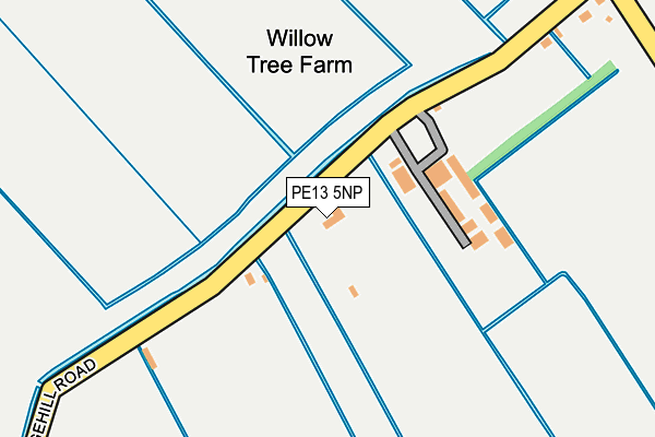
PE13 5NP lies on Grangehill Road in Tydd St Giles, Wisbech. PE13 5NP is located in the Leverington & Wisbech Rural electoral ward, within the local authority district of Fenland and the English Parliamentary constituency of North East Cambridgeshire. The Sub Integrated Care Board (ICB) Location is NHS Cambridgeshire and Peterborough ICB - 06H and the police force is Cambridgeshire. This postcode has been in use since January 1980.


GetTheData
Source: OS OpenMap – Local (Ordnance Survey)
Source: OS VectorMap District (Ordnance Survey)
Licence: Open Government Licence (requires attribution)
| Easting | 538696 |
| Northing | 315573 |
| Latitude | 52.720057 |
| Longitude | 0.052060 |
GetTheData
Source: Open Postcode Geo
Licence: Open Government Licence
| Street | Grangehill Road |
| Locality | Tydd St Giles |
| Town/City | Wisbech |
| Country | England |
| Postcode District | PE13 |
➜ See where PE13 is on a map | |
GetTheData
Source: Land Registry Price Paid Data
Licence: Open Government Licence
Elevation or altitude of PE13 5NP as distance above sea level:
| Metres | Feet | |
|---|---|---|
| Elevation | 0m | 0ft |
Elevation is measured from the approximate centre of the postcode, to the nearest point on an OS contour line from OS Terrain 50, which has contour spacing of ten vertical metres.
➜ How high above sea level am I? Find the elevation of your current position using your device's GPS.
GetTheData
Source: Open Postcode Elevation
Licence: Open Government Licence
| Ward | Leverington & Wisbech Rural |
| Constituency | North East Cambridgeshire |
GetTheData
Source: ONS Postcode Database
Licence: Open Government Licence
| Grangehill Road (Cross Drove) | Tydd St Giles Fen | 337m |
| Grangehill Road (Cross Drove) | Tydd St Giles Fen | 345m |
GetTheData
Source: NaPTAN
Licence: Open Government Licence
| Percentage of properties with Next Generation Access | 100.0% |
| Percentage of properties with Superfast Broadband | 0.0% |
| Percentage of properties with Ultrafast Broadband | 0.0% |
| Percentage of properties with Full Fibre Broadband | 0.0% |
Superfast Broadband is between 30Mbps and 300Mbps
Ultrafast Broadband is > 300Mbps
| Median download speed | 4.0Mbps |
| Average download speed | 3.9Mbps |
| Maximum download speed | 5.52Mbps |
| Median upload speed | 0.9Mbps |
| Average upload speed | 0.8Mbps |
| Maximum upload speed | 1.04Mbps |
| Percentage of properties unable to receive 2Mbps | 14.3% |
| Percentage of properties unable to receive 5Mbps | 14.3% |
| Percentage of properties unable to receive 10Mbps | 14.3% |
| Percentage of properties unable to receive 30Mbps | 100.0% |
GetTheData
Source: Ofcom
Licence: Ofcom Terms of Use (requires attribution)
GetTheData
Source: ONS Postcode Database
Licence: Open Government Licence
| Last Collection | |||
|---|---|---|---|
| Location | Mon-Fri | Sat | Distance |
| Mission House | 15:45 | 08:15 | 810m |
| Manor Hill Corner | 15:30 | 08:00 | 2,554m |
| St Ives Cross | 15:45 | 07:30 | 2,577m |
GetTheData
Source: Dracos
Licence: Creative Commons Attribution-ShareAlike
| Risk of PE13 5NP flooding from rivers and sea | Low |
| ➜ PE13 5NP flood map | |
GetTheData
Source: Open Flood Risk by Postcode
Licence: Open Government Licence
The below table lists the International Territorial Level (ITL) codes (formerly Nomenclature of Territorial Units for Statistics (NUTS) codes) and Local Administrative Units (LAU) codes for PE13 5NP:
| ITL 1 Code | Name |
|---|---|
| TLH | East |
| ITL 2 Code | Name |
| TLH1 | East Anglia |
| ITL 3 Code | Name |
| TLH12 | Cambridgeshire CC |
| LAU 1 Code | Name |
| E07000010 | Fenland |
GetTheData
Source: ONS Postcode Directory
Licence: Open Government Licence
The below table lists the Census Output Area (OA), Lower Layer Super Output Area (LSOA), and Middle Layer Super Output Area (MSOA) for PE13 5NP:
| Code | Name | |
|---|---|---|
| OA | E00091309 | |
| LSOA | E01018097 | Fenland 001D |
| MSOA | E02003742 | Fenland 001 |
GetTheData
Source: ONS Postcode Directory
Licence: Open Government Licence
| PE12 0JR | 626m | |
| PE13 5NR | Cross Drove | 732m |
| PE13 5NJ | Black Lane | 988m |
| PE12 0LA | Birds Drove | 1023m |
| PE13 5NN | Bythorne Bank | 1239m |
| PE12 0HF | Goochgate | 1422m |
| PE12 0JT | Broadgate | 1572m |
| PE13 5PA | Middle Broad Drove | 1596m |
| PE12 0LW | Guanockgate | 1612m |
| PE13 5NU | Broad Drove West | 1654m |
GetTheData
Source: Open Postcode Geo; Land Registry Price Paid Data
Licence: Open Government Licence