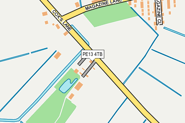
PE13 4TB lies on Coxs Lane in Wisbech. PE13 4TB is located in the Leverington & Wisbech Rural electoral ward, within the local authority district of Fenland and the English Parliamentary constituency of North East Cambridgeshire. The Sub Integrated Care Board (ICB) Location is NHS Cambridgeshire and Peterborough ICB - 06H and the police force is Cambridgeshire. This postcode has been in use since January 1980.


GetTheData
Source: OS OpenMap – Local (Ordnance Survey)
Source: OS VectorMap District (Ordnance Survey)
Licence: Open Government Licence (requires attribution)
| Easting | 544831 |
| Northing | 308876 |
| Latitude | 52.658269 |
| Longitude | 0.139866 |
GetTheData
Source: Open Postcode Geo
Licence: Open Government Licence
| Street | Coxs Lane |
| Town/City | Wisbech |
| Country | England |
| Postcode District | PE13 |
➜ See where PE13 is on a map ➜ Where is Wisbech? | |
GetTheData
Source: Land Registry Price Paid Data
Licence: Open Government Licence
Elevation or altitude of PE13 4TB as distance above sea level:
| Metres | Feet | |
|---|---|---|
| Elevation | 0m | 0ft |
Elevation is measured from the approximate centre of the postcode, to the nearest point on an OS contour line from OS Terrain 50, which has contour spacing of ten vertical metres.
➜ How high above sea level am I? Find the elevation of your current position using your device's GPS.
GetTheData
Source: Open Postcode Elevation
Licence: Open Government Licence
| Ward | Leverington & Wisbech Rural |
| Constituency | North East Cambridgeshire |
GetTheData
Source: ONS Postcode Database
Licence: Open Government Licence
2010 23 JUL £146,000 |
2003 4 APR £90,000 |
GetTheData
Source: HM Land Registry Price Paid Data
Licence: Contains HM Land Registry data © Crown copyright and database right 2025. This data is licensed under the Open Government Licence v3.0.
| Barton Road | Wisbech | 617m |
| Cromwell Retail Park (Cromwell Road) | Wisbech | 677m |
| Cromwell Retail Park (Cromwell Road) | Wisbech | 690m |
| Oldfield Lane (Cromwell Road) | Wisbech | 724m |
| Oldfield Lane (Cromwell Road) | Wisbech | 770m |
GetTheData
Source: NaPTAN
Licence: Open Government Licence
| Percentage of properties with Next Generation Access | 100.0% |
| Percentage of properties with Superfast Broadband | 0.0% |
| Percentage of properties with Ultrafast Broadband | 0.0% |
| Percentage of properties with Full Fibre Broadband | 0.0% |
Superfast Broadband is between 30Mbps and 300Mbps
Ultrafast Broadband is > 300Mbps
| Percentage of properties unable to receive 2Mbps | 0.0% |
| Percentage of properties unable to receive 5Mbps | 0.0% |
| Percentage of properties unable to receive 10Mbps | 0.0% |
| Percentage of properties unable to receive 30Mbps | 100.0% |
GetTheData
Source: Ofcom
Licence: Ofcom Terms of Use (requires attribution)
GetTheData
Source: ONS Postcode Database
Licence: Open Government Licence


➜ Get more ratings from the Food Standards Agency
GetTheData
Source: Food Standards Agency
Licence: FSA terms & conditions
| Last Collection | |||
|---|---|---|---|
| Location | Mon-Fri | Sat | Distance |
| Barton Road | 16:45 | 11:30 | 530m |
| Magazine Lane North Brink | 18:30 | 11:45 | 626m |
| North Brink | 16:45 | 08:00 | 1,047m |
GetTheData
Source: Dracos
Licence: Creative Commons Attribution-ShareAlike
| Risk of PE13 4TB flooding from rivers and sea | Low |
| ➜ PE13 4TB flood map | |
GetTheData
Source: Open Flood Risk by Postcode
Licence: Open Government Licence
The below table lists the International Territorial Level (ITL) codes (formerly Nomenclature of Territorial Units for Statistics (NUTS) codes) and Local Administrative Units (LAU) codes for PE13 4TB:
| ITL 1 Code | Name |
|---|---|
| TLH | East |
| ITL 2 Code | Name |
| TLH1 | East Anglia |
| ITL 3 Code | Name |
| TLH12 | Cambridgeshire CC |
| LAU 1 Code | Name |
| E07000010 | Fenland |
GetTheData
Source: ONS Postcode Directory
Licence: Open Government Licence
The below table lists the Census Output Area (OA), Lower Layer Super Output Area (LSOA), and Middle Layer Super Output Area (MSOA) for PE13 4TB:
| Code | Name | |
|---|---|---|
| OA | E00091294 | |
| LSOA | E01018093 | Fenland 003E |
| MSOA | E02003744 | Fenland 003 |
GetTheData
Source: ONS Postcode Directory
Licence: Open Government Licence
| PE13 1LQ | Wares Cottages | 199m |
| PE13 1LG | Magazine Lane | 273m |
| PE13 4TD | Coxs Lane | 275m |
| PE13 1LH | Magazine Close | 275m |
| PE13 4UP | Barton Green | 462m |
| PE13 4TA | North Brink | 464m |
| PE13 4TF | Barton Road | 467m |
| PE13 1LJ | Magazine Lane | 488m |
| PE14 0RH | South Brink | 510m |
| PE13 1LS | Purbeck Close | 521m |
GetTheData
Source: Open Postcode Geo; Land Registry Price Paid Data
Licence: Open Government Licence