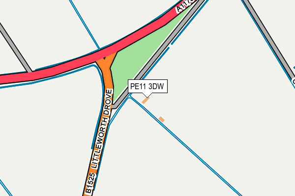
PE11 3DW lies on Spalding Road in Deeping St Nicholas, Spalding. PE11 3DW is located in the Market & West Deeping electoral ward, within the local authority district of South Kesteven and the English Parliamentary constituency of South Holland and The Deepings. The Sub Integrated Care Board (ICB) Location is NHS Lincolnshire ICB - 71E and the police force is Lincolnshire. This postcode has been in use since January 1980.


GetTheData
Source: OS OpenMap – Local (Ordnance Survey)
Source: OS VectorMap District (Ordnance Survey)
Licence: Open Government Licence (requires attribution)
| Easting | 517261 |
| Northing | 312628 |
| Latitude | 52.698640 |
| Longitude | -0.266190 |
GetTheData
Source: Open Postcode Geo
Licence: Open Government Licence
| Street | Spalding Road |
| Locality | Deeping St Nicholas |
| Town/City | Spalding |
| Country | England |
| Postcode District | PE11 |
➜ See where PE11 is on a map | |
GetTheData
Source: Land Registry Price Paid Data
Licence: Open Government Licence
Elevation or altitude of PE11 3DW as distance above sea level:
| Metres | Feet | |
|---|---|---|
| Elevation | 0m | 0ft |
Elevation is measured from the approximate centre of the postcode, to the nearest point on an OS contour line from OS Terrain 50, which has contour spacing of ten vertical metres.
➜ How high above sea level am I? Find the elevation of your current position using your device's GPS.
GetTheData
Source: Open Postcode Elevation
Licence: Open Government Licence
| Ward | Market & West Deeping |
| Constituency | South Holland And The Deepings |
GetTheData
Source: ONS Postcode Database
Licence: Open Government Licence
| Percentage of properties with Next Generation Access | 100.0% |
| Percentage of properties with Superfast Broadband | 0.0% |
| Percentage of properties with Ultrafast Broadband | 0.0% |
| Percentage of properties with Full Fibre Broadband | 0.0% |
Superfast Broadband is between 30Mbps and 300Mbps
Ultrafast Broadband is > 300Mbps
| Percentage of properties unable to receive 2Mbps | 0.0% |
| Percentage of properties unable to receive 5Mbps | 33.3% |
| Percentage of properties unable to receive 10Mbps | 33.3% |
| Percentage of properties unable to receive 30Mbps | 100.0% |
GetTheData
Source: Ofcom
Licence: Ofcom Terms of Use (requires attribution)
GetTheData
Source: ONS Postcode Database
Licence: Open Government Licence
| Last Collection | |||
|---|---|---|---|
| Location | Mon-Fri | Sat | Distance |
| Frognall | 16:45 | 07:30 | 2,624m |
| Rycroft Avenue | 16:45 | 11:15 | 3,093m |
| Crowson Way | 16:30 | 11:15 | 3,300m |
GetTheData
Source: Dracos
Licence: Creative Commons Attribution-ShareAlike
| Risk of PE11 3DW flooding from rivers and sea | Low |
| ➜ PE11 3DW flood map | |
GetTheData
Source: Open Flood Risk by Postcode
Licence: Open Government Licence
The below table lists the International Territorial Level (ITL) codes (formerly Nomenclature of Territorial Units for Statistics (NUTS) codes) and Local Administrative Units (LAU) codes for PE11 3DW:
| ITL 1 Code | Name |
|---|---|
| TLF | East Midlands (England) |
| ITL 2 Code | Name |
| TLF3 | Lincolnshire |
| ITL 3 Code | Name |
| TLF30 | Lincolnshire CC |
| LAU 1 Code | Name |
| E07000141 | South Kesteven |
GetTheData
Source: ONS Postcode Directory
Licence: Open Government Licence
The below table lists the Census Output Area (OA), Lower Layer Super Output Area (LSOA), and Middle Layer Super Output Area (MSOA) for PE11 3DW:
| Code | Name | |
|---|---|---|
| OA | E00133771 | |
| LSOA | E01026336 | South Kesteven 013C |
| MSOA | E02005488 | South Kesteven 013 |
GetTheData
Source: ONS Postcode Directory
Licence: Open Government Licence
| PE11 3DP | Spalding Road | 996m |
| PE11 3DJ | Main Road | 1065m |
| PE6 8SB | Spalding Road | 1329m |
| PE11 3HW | Main Road | 1665m |
| PE11 3HH | Main Road | 1773m |
| PE6 9QF | Six Score Road | 1904m |
| PE11 3HP | Carrington Drive | 1987m |
| PE11 3HR | Carrington Drive | 1997m |
| PE11 3HL | Main Road | 2122m |
| PE6 8RP | Frognall | 2143m |
GetTheData
Source: Open Postcode Geo; Land Registry Price Paid Data
Licence: Open Government Licence