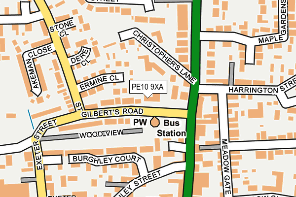
PE10 9XA is located in the Bourne West electoral ward, within the local authority district of South Kesteven and the English Parliamentary constituency of Grantham and Stamford. The Sub Integrated Care Board (ICB) Location is NHS Lincolnshire ICB - 71E and the police force is Lincolnshire. This postcode has been in use since January 1980.


GetTheData
Source: OS OpenMap – Local (Ordnance Survey)
Source: OS VectorMap District (Ordnance Survey)
Licence: Open Government Licence (requires attribution)
| Easting | 509514 |
| Northing | 320552 |
| Latitude | 52.771465 |
| Longitude | -0.378139 |
GetTheData
Source: Open Postcode Geo
Licence: Open Government Licence
| Country | England |
| Postcode District | PE10 |
| ➜ PE10 open data dashboard ➜ See where PE10 is on a map ➜ Where is Bourne? | |
GetTheData
Source: Land Registry Price Paid Data
Licence: Open Government Licence
Elevation or altitude of PE10 9XA as distance above sea level:
| Metres | Feet | |
|---|---|---|
| Elevation | 10m | 33ft |
Elevation is measured from the approximate centre of the postcode, to the nearest point on an OS contour line from OS Terrain 50, which has contour spacing of ten vertical metres.
➜ How high above sea level am I? Find the elevation of your current position using your device's GPS.
GetTheData
Source: Open Postcode Elevation
Licence: Open Government Licence
| Ward | Bourne West |
| Constituency | Grantham And Stamford |
GetTheData
Source: ONS Postcode Database
Licence: Open Government Licence
| January 2024 | Burglary | On or near Police Station | 472m |
| November 2023 | Violence and sexual offences | On or near Police Station | 472m |
| October 2023 | Violence and sexual offences | On or near Police Station | 472m |
| ➜ Get more crime data in our Crime section | |||
GetTheData
Source: data.police.uk
Licence: Open Government Licence
| Bus Station (St Gilberts Road) | Bourne | 45m |
| Bus Station (North Street) | Bourne | 73m |
| Baldwin Grove (Harrington Street) | Bourne | 233m |
| Baldwin Grove (Harrington Street) | Bourne | 236m |
| Sainsburys (Exeter Street) | Bourne | 290m |
GetTheData
Source: NaPTAN
Licence: Open Government Licence
GetTheData
Source: ONS Postcode Database
Licence: Open Government Licence


➜ Get more ratings from the Food Standards Agency
GetTheData
Source: Food Standards Agency
Licence: FSA terms & conditions
| Last Collection | |||
|---|---|---|---|
| Location | Mon-Fri | Sat | Distance |
| St Gilberts Road | 17:30 | 12:15 | 43m |
| Meadow Close | 17:30 | 12:00 | 265m |
| North Road | 17:30 | 12:15 | 331m |
GetTheData
Source: Dracos
Licence: Creative Commons Attribution-ShareAlike
| Facility | Distance |
|---|---|
| Recreation Road Playing Fields Recreation Road, Bourne Grass Pitches | 507m |
| Bourne Leisure Centre Queens Road, Bourne Sports Hall, Swimming Pool, Health and Fitness Gym, Studio | 562m |
| Bourne Academy Edinburgh Crescent, Bourne Grass Pitches, Sports Hall | 614m |
GetTheData
Source: Active Places
Licence: Open Government Licence
| School | Phase of Education | Distance |
|---|---|---|
| Bourne Academy Edinburgh Crescent, Bourne, PE10 9DT | Secondary | 614m |
| Bourne Abbey Church of England Primary Academy Abbey Road, Bourne, PE10 9EP | Primary | 696m |
| Bourne Westfield Primary Academy Westbourne Park, Bourne, PE10 9QS | Primary | 872m |
GetTheData
Source: Edubase
Licence: Open Government Licence
The below table lists the International Territorial Level (ITL) codes (formerly Nomenclature of Territorial Units for Statistics (NUTS) codes) and Local Administrative Units (LAU) codes for PE10 9XA:
| ITL 1 Code | Name |
|---|---|
| TLF | East Midlands (England) |
| ITL 2 Code | Name |
| TLF3 | Lincolnshire |
| ITL 3 Code | Name |
| TLF30 | Lincolnshire CC |
| LAU 1 Code | Name |
| E07000141 | South Kesteven |
GetTheData
Source: ONS Postcode Directory
Licence: Open Government Licence
The below table lists the Census Output Area (OA), Lower Layer Super Output Area (LSOA), and Middle Layer Super Output Area (MSOA) for PE10 9XA:
| Code | Name | |
|---|---|---|
| OA | E00133597 | |
| LSOA | E01026299 | South Kesteven 010A |
| MSOA | E02005485 | South Kesteven 010 |
GetTheData
Source: ONS Postcode Directory
Licence: Open Government Licence
| PE10 9XH | Ermine Close | 76m |
| PE10 9XB | St Gilberts Road | 89m |
| PE10 9AJ | North Street | 112m |
| PE10 9AQ | North Street | 113m |
| PE10 9AL | Marquess Court | 120m |
| PE10 9AZ | Christophers Lane | 121m |
| PE10 9AP | North Road | 134m |
| PE10 9NL | Wood View | 137m |
| PE10 9EZ | Meadowgate | 142m |
| PE10 9XQ | Dere Close | 147m |
GetTheData
Source: Open Postcode Geo; Land Registry Price Paid Data
Licence: Open Government Licence