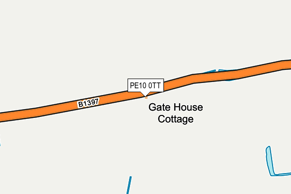
PE10 0TT lies on Fen Road in Dowsby, Bourne. PE10 0TT is located in the Aveland electoral ward, within the local authority district of South Kesteven and the English Parliamentary constituency of Grantham and Stamford. The Sub Integrated Care Board (ICB) Location is NHS Lincolnshire ICB - 71E and the police force is Lincolnshire. This postcode has been in use since January 1980.


GetTheData
Source: OS OpenMap – Local (Ordnance Survey)
Source: OS VectorMap District (Ordnance Survey)
Licence: Open Government Licence (requires attribution)
| Easting | 511789 |
| Northing | 329629 |
| Latitude | 52.852563 |
| Longitude | -0.341331 |
GetTheData
Source: Open Postcode Geo
Licence: Open Government Licence
| Street | Fen Road |
| Locality | Dowsby |
| Town/City | Bourne |
| Country | England |
| Postcode District | PE10 |
| ➜ PE10 open data dashboard ➜ See where PE10 is on a map | |
GetTheData
Source: Land Registry Price Paid Data
Licence: Open Government Licence
Elevation or altitude of PE10 0TT as distance above sea level:
| Metres | Feet | |
|---|---|---|
| Elevation | 10m | 33ft |
Elevation is measured from the approximate centre of the postcode, to the nearest point on an OS contour line from OS Terrain 50, which has contour spacing of ten vertical metres.
➜ How high above sea level am I? Find the elevation of your current position using your device's GPS.
GetTheData
Source: Open Postcode Elevation
Licence: Open Government Licence
| Ward | Aveland |
| Constituency | Grantham And Stamford |
GetTheData
Source: ONS Postcode Database
Licence: Open Government Licence
| June 2022 | Violence and sexual offences | On or near Main Road | 475m |
| June 2022 | Violence and sexual offences | On or near Main Road | 475m |
| June 2022 | Anti-social behaviour | On or near Main Road | 475m |
| ➜ Get more crime data in our Crime section | |||
GetTheData
Source: data.police.uk
Licence: Open Government Licence
| Fen Road (Main Road) | Dowsby | 484m |
| Fen Road (Main Road) | Dowsby | 497m |
| St Andrew's Church (Main Road) | Dowsby | 519m |
| Demand Responsive Area | Dowsby | 527m |
| St Andrew's Church (Main Road) | Dowsby | 535m |
GetTheData
Source: NaPTAN
Licence: Open Government Licence
GetTheData
Source: ONS Postcode Database
Licence: Open Government Licence


➜ Get more ratings from the Food Standards Agency
GetTheData
Source: Food Standards Agency
Licence: FSA terms & conditions
| Last Collection | |||
|---|---|---|---|
| Location | Mon-Fri | Sat | Distance |
| Dowsby Village | 16:30 | 07:30 | 512m |
| Rippingale Village | 16:30 | 08:00 | 2,282m |
| Rippingale Post Office | 16:30 | 11:30 | 2,633m |
GetTheData
Source: Dracos
Licence: Creative Commons Attribution-ShareAlike
| Facility | Distance |
|---|---|
| Pointon Sports And Social Club Fen Road, Pointon, Sleaford Grass Pitches | 2.2km |
| Rippingale Jubilee Playing Field Pinfold Close, Rippingale Grass Pitches, Outdoor Tennis Courts | 2.4km |
| St Georges Academy (Billingborough Site) (Closed) Birthorpe Road, Billingborough, Sleaford Grass Pitches, Sports Hall | 4.3km |
GetTheData
Source: Active Places
Licence: Open Government Licence
| School | Phase of Education | Distance |
|---|---|---|
| The St Gilbert of Sempringham Church of England Primary School, Pointon West Road, Pointon, Sleaford, NG34 0NA | Primary | 2.3km |
| Billingborough Primary School Victoria Street, Billingborough, Sleaford, NG34 0NX | Primary | 4.9km |
GetTheData
Source: Edubase
Licence: Open Government Licence
The below table lists the International Territorial Level (ITL) codes (formerly Nomenclature of Territorial Units for Statistics (NUTS) codes) and Local Administrative Units (LAU) codes for PE10 0TT:
| ITL 1 Code | Name |
|---|---|
| TLF | East Midlands (England) |
| ITL 2 Code | Name |
| TLF3 | Lincolnshire |
| ITL 3 Code | Name |
| TLF30 | Lincolnshire CC |
| LAU 1 Code | Name |
| E07000141 | South Kesteven |
GetTheData
Source: ONS Postcode Directory
Licence: Open Government Licence
The below table lists the Census Output Area (OA), Lower Layer Super Output Area (LSOA), and Middle Layer Super Output Area (MSOA) for PE10 0TT:
| Code | Name | |
|---|---|---|
| OA | E00133531 | |
| LSOA | E01026290 | South Kesteven 008A |
| MSOA | E02005483 | South Kesteven 008 |
GetTheData
Source: ONS Postcode Directory
Licence: Open Government Licence
| PE10 0TS | Fen Road | 367m |
| PE10 0TR | Fen Road | 429m |
| PE10 0TL | Main Road | 515m |
| NG34 0LD | 1297m | |
| PE10 0TF | Dowsby Road | 1307m |
| PE10 0TD | Station Street | 1576m |
| PE10 0TE | Cross Roads | 1582m |
| PE10 0TG | Fen Road | 1849m |
| NG34 0HS | 1966m | |
| PE10 0TH | Millers Close | 2035m |
GetTheData
Source: Open Postcode Geo; Land Registry Price Paid Data
Licence: Open Government Licence