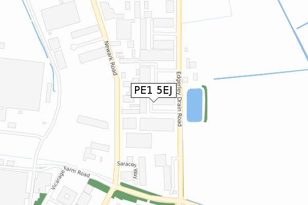
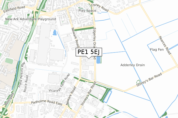
PE1 5EJ is located in the East electoral ward, within the unitary authority of Peterborough and the English Parliamentary constituency of Peterborough. The Sub Integrated Care Board (ICB) Location is NHS Cambridgeshire and Peterborough ICB - 06H and the police force is Cambridgeshire. This postcode has been in use since May 2005.


GetTheData
Source: OS Open Zoomstack (Ordnance Survey)
Licence: Open Government Licence (requires attribution)
Attribution: Contains OS data © Crown copyright and database right 2024
Source: Open Postcode Geo
Licence: Open Government Licence (requires attribution)
Attribution: Contains OS data © Crown copyright and database right 2024; Contains Royal Mail data © Royal Mail copyright and database right 2024; Source: Office for National Statistics licensed under the Open Government Licence v.3.0
| Easting | 521714 |
| Northing | 299814 |
| Latitude | 52.582521 |
| Longitude | -0.205049 |
GetTheData
Source: Open Postcode Geo
Licence: Open Government Licence
| Country | England |
| Postcode District | PE1 |
| ➜ PE1 open data dashboard ➜ See where PE1 is on a map ➜ Where is Peterborough? | |
GetTheData
Source: Land Registry Price Paid Data
Licence: Open Government Licence
Elevation or altitude of PE1 5EJ as distance above sea level:
| Metres | Feet | |
|---|---|---|
| Elevation | 0m | 0ft |
Elevation is measured from the approximate centre of the postcode, to the nearest point on an OS contour line from OS Terrain 50, which has contour spacing of ten vertical metres.
➜ How high above sea level am I? Find the elevation of your current position using your device's GPS.
GetTheData
Source: Open Postcode Elevation
Licence: Open Government Licence
| Ward | East |
| Constituency | Peterborough |
GetTheData
Source: ONS Postcode Database
Licence: Open Government Licence
| June 2022 | Criminal damage and arson | On or near Park/Open Space | 131m |
| June 2022 | Other theft | On or near Edgerley Drain Road | 230m |
| June 2022 | Vehicle crime | On or near Sports/Recreation Area | 245m |
| ➜ Get more crime data in our Crime section | |||
GetTheData
Source: data.police.uk
Licence: Open Government Licence
| Saracen Way (Newark Road) | Eastern Industry | 175m |
| Saracen Way (Newark Road) | Eastern Industry | 212m |
| Vicarage Farm Road | Eastern Industry | 401m |
| Vicarage Farm Road | Eastern Industry | 403m |
| Leofric Square (Vicarage Farm Road) | Eastern Industry | 534m |
| Peterborough Station | 3.1km |
GetTheData
Source: NaPTAN
Licence: Open Government Licence
GetTheData
Source: ONS Postcode Database
Licence: Open Government Licence


➜ Get more ratings from the Food Standards Agency
GetTheData
Source: Food Standards Agency
Licence: FSA terms & conditions
| Last Collection | |||
|---|---|---|---|
| Location | Mon-Fri | Sat | Distance |
| Oxney Road-franklin Crescent | 18:30 | 12:45 | 861m |
| Vicarage Farm Road | 18:15 | 12:15 | 926m |
| Vicarage Farm Road | 929m | ||
GetTheData
Source: Dracos
Licence: Creative Commons Attribution-ShareAlike
| Facility | Distance |
|---|---|
| City Of Peterborough Academy Reeves Way, Peterborough Sports Hall, Grass Pitches, Artificial Grass Pitch, Outdoor Tennis Courts | 1.1km |
| Fengate Gym Fengate, Peterborough Health and Fitness Gym | 1.1km |
| St John Fisher Catholic High School (Peterborough) Park Lane, Peterborough Artificial Grass Pitch, Grass Pitches, Sports Hall, Studio | 1.2km |
GetTheData
Source: Active Places
Licence: Open Government Licence
| School | Phase of Education | Distance |
|---|---|---|
| St Thomas More Catholic Primary School St Thomas More Catholic Primary School, Park Lane, Eastfield, Peterborough, PE1 5JW | Primary | 1.1km |
| Medeshamstede Academy Reeves Way, Peterborough, PE1 5LQ | Not applicable | 1.1km |
| City of Peterborough Academy Reeves Way, Peterborough, PE1 5LQ | Secondary | 1.1km |
GetTheData
Source: Edubase
Licence: Open Government Licence
The below table lists the International Territorial Level (ITL) codes (formerly Nomenclature of Territorial Units for Statistics (NUTS) codes) and Local Administrative Units (LAU) codes for PE1 5EJ:
| ITL 1 Code | Name |
|---|---|
| TLH | East |
| ITL 2 Code | Name |
| TLH1 | East Anglia |
| ITL 3 Code | Name |
| TLH11 | Peterborough |
| LAU 1 Code | Name |
| E06000031 | Peterborough |
GetTheData
Source: ONS Postcode Directory
Licence: Open Government Licence
The below table lists the Census Output Area (OA), Lower Layer Super Output Area (LSOA), and Middle Layer Super Output Area (MSOA) for PE1 5EJ:
| Code | Name | |
|---|---|---|
| OA | E00078957 | |
| LSOA | E01015616 | Peterborough 013F |
| MSOA | E02003249 | Peterborough 013 |
GetTheData
Source: ONS Postcode Directory
Licence: Open Government Licence
| PE1 5YD | Newark Road | 104m |
| PE1 5EL | Stevern Way | 111m |
| PE1 5NL | Edgerley Drain Road | 226m |
| PE1 5UP | Empson Road | 379m |
| PE1 5WG | Newark Road | 414m |
| PE1 5FL | Newark Road | 471m |
| PE1 5YF | Palmers Road | 476m |
| PE1 5YS | Bramhall Place | 478m |
| PE1 5PP | Newark Road | 492m |
| PE1 5YQ | Myrtle House Caravan Park | 510m |
GetTheData
Source: Open Postcode Geo; Land Registry Price Paid Data
Licence: Open Government Licence