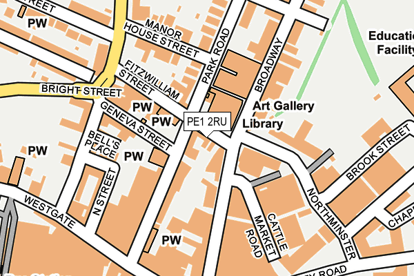
PE1 2RU lies on Fitzwilliam Street in Peterborough. PE1 2RU is located in the Central electoral ward, within the unitary authority of Peterborough and the English Parliamentary constituency of Peterborough. The Sub Integrated Care Board (ICB) Location is NHS Cambridgeshire and Peterborough ICB - 06H and the police force is Cambridgeshire. This postcode has been in use since January 1980.


GetTheData
Source: OS OpenMap – Local (Ordnance Survey)
Source: OS VectorMap District (Ordnance Survey)
Licence: Open Government Licence (requires attribution)
| Easting | 519242 |
| Northing | 299045 |
| Latitude | 52.576158 |
| Longitude | -0.241791 |
GetTheData
Source: Open Postcode Geo
Licence: Open Government Licence
| Street | Fitzwilliam Street |
| Town/City | Peterborough |
| Country | England |
| Postcode District | PE1 |
| ➜ PE1 open data dashboard ➜ See where PE1 is on a map ➜ Where is Peterborough? | |
GetTheData
Source: Land Registry Price Paid Data
Licence: Open Government Licence
Elevation or altitude of PE1 2RU as distance above sea level:
| Metres | Feet | |
|---|---|---|
| Elevation | 10m | 33ft |
Elevation is measured from the approximate centre of the postcode, to the nearest point on an OS contour line from OS Terrain 50, which has contour spacing of ten vertical metres.
➜ How high above sea level am I? Find the elevation of your current position using your device's GPS.
GetTheData
Source: Open Postcode Elevation
Licence: Open Government Licence
| Ward | Central |
| Constituency | Peterborough |
GetTheData
Source: ONS Postcode Database
Licence: Open Government Licence
| January 2024 | Anti-social behaviour | On or near Parking Area | 210m |
| January 2024 | Violence and sexual offences | On or near Parking Area | 210m |
| January 2024 | Violence and sexual offences | On or near Parking Area | 210m |
| ➜ Fitzwilliam Street crime map and outcomes | |||
GetTheData
Source: data.police.uk
Licence: Open Government Licence
| Broadway Cinema (Broadway) | Peterborough | 119m |
| Northminster | Peterborough | 126m |
| Tesco (Broadway) | Peterborough | 126m |
| Tesco (Broadway) | Peterborough | 153m |
| Broadway Cinema (Broadway) | Peterborough | 156m |
| Peterborough (Nene Valley Railway) | Woodston | 1,035m |
| Peterborough Station | 0.6km |
GetTheData
Source: NaPTAN
Licence: Open Government Licence
| Percentage of properties with Next Generation Access | 25.0% |
| Percentage of properties with Superfast Broadband | 25.0% |
| Percentage of properties with Ultrafast Broadband | 0.0% |
| Percentage of properties with Full Fibre Broadband | 0.0% |
Superfast Broadband is between 30Mbps and 300Mbps
Ultrafast Broadband is > 300Mbps
| Percentage of properties unable to receive 2Mbps | 0.0% |
| Percentage of properties unable to receive 5Mbps | 0.0% |
| Percentage of properties unable to receive 10Mbps | 0.0% |
| Percentage of properties unable to receive 30Mbps | 0.0% |
GetTheData
Source: Ofcom
Licence: Ofcom Terms of Use (requires attribution)
GetTheData
Source: ONS Postcode Database
Licence: Open Government Licence


➜ Get more ratings from the Food Standards Agency
GetTheData
Source: Food Standards Agency
Licence: FSA terms & conditions
| Last Collection | |||
|---|---|---|---|
| Location | Mon-Fri | Sat | Distance |
| Broadway | 18:45 | 12:00 | 81m |
| Boroughby-russell Street | 18:15 | 11:45 | 179m |
| Westgate | 18:30 | 11:45 | 238m |
GetTheData
Source: Dracos
Licence: Creative Commons Attribution-ShareAlike
| Facility | Distance |
|---|---|
| Ultra Bodies Gym & Fitness (Closed) Broadway, Peterborough Health and Fitness Gym | 124m |
| Trugym (Peterborough) (Closed) New Road, Peterborough Health and Fitness Gym, Studio | 223m |
| Energie Fitness (Peterborough) Westgate, Peterborough Health and Fitness Gym | 404m |
GetTheData
Source: Active Places
Licence: Open Government Licence
| School | Phase of Education | Distance |
|---|---|---|
| The Beeches Primary School Beech Avenue, Peterborough, PE1 2EH | Primary | 458m |
| Clare Lodge Care of: Peterborough City Council, Town Hall, Bridge Street, Peterborough, PE1 1HF | Not applicable | 523m |
| Bishop Creighton Academy Vineyard Road, Peterborough, PE1 5DB | Primary | 573m |
GetTheData
Source: Edubase
Licence: Open Government Licence
The below table lists the International Territorial Level (ITL) codes (formerly Nomenclature of Territorial Units for Statistics (NUTS) codes) and Local Administrative Units (LAU) codes for PE1 2RU:
| ITL 1 Code | Name |
|---|---|
| TLH | East |
| ITL 2 Code | Name |
| TLH1 | East Anglia |
| ITL 3 Code | Name |
| TLH11 | Peterborough |
| LAU 1 Code | Name |
| E06000031 | Peterborough |
GetTheData
Source: ONS Postcode Directory
Licence: Open Government Licence
The below table lists the Census Output Area (OA), Lower Layer Super Output Area (LSOA), and Middle Layer Super Output Area (MSOA) for PE1 2RU:
| Code | Name | |
|---|---|---|
| OA | E00171261 | |
| LSOA | E01015602 | Peterborough 014C |
| MSOA | E02003250 | Peterborough 014 |
GetTheData
Source: ONS Postcode Directory
Licence: Open Government Licence
| PE1 2TJ | Park Road | 87m |
| PE1 2TH | Park Road | 94m |
| PE1 2UX | Park Road | 99m |
| PE1 1RS | Broadway | 110m |
| PE1 1SQ | Broadway | 110m |
| PE1 2RT | Geneva Street | 115m |
| PE1 2RX | Fitzwilliam Street | 117m |
| PE1 2TD | Park Road | 119m |
| PE1 2RS | Geneva Street | 127m |
| PE1 2RR | Lincoln Road | 156m |
GetTheData
Source: Open Postcode Geo; Land Registry Price Paid Data
Licence: Open Government Licence