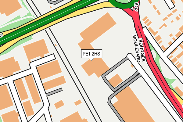
PE1 2HS is located in the North electoral ward, within the unitary authority of Peterborough and the English Parliamentary constituency of Peterborough. The Sub Integrated Care Board (ICB) Location is NHS Cambridgeshire and Peterborough ICB - 06H and the police force is Cambridgeshire. This postcode has been in use since December 1995.


GetTheData
Source: OS OpenMap – Local (Ordnance Survey)
Source: OS VectorMap District (Ordnance Survey)
Licence: Open Government Licence (requires attribution)
| Easting | 517709 |
| Northing | 301228 |
| Latitude | 52.596107 |
| Longitude | -0.263627 |
GetTheData
Source: Open Postcode Geo
Licence: Open Government Licence
| Country | England |
| Postcode District | PE1 |
| ➜ PE1 open data dashboard ➜ See where PE1 is on a map ➜ Where is Peterborough? | |
GetTheData
Source: Land Registry Price Paid Data
Licence: Open Government Licence
Elevation or altitude of PE1 2HS as distance above sea level:
| Metres | Feet | |
|---|---|---|
| Elevation | 20m | 66ft |
Elevation is measured from the approximate centre of the postcode, to the nearest point on an OS contour line from OS Terrain 50, which has contour spacing of ten vertical metres.
➜ How high above sea level am I? Find the elevation of your current position using your device's GPS.
GetTheData
Source: Open Postcode Elevation
Licence: Open Government Licence
| Ward | North |
| Constituency | Peterborough |
GetTheData
Source: ONS Postcode Database
Licence: Open Government Licence
| June 2022 | Vehicle crime | On or near Shopping Area | 83m |
| June 2022 | Shoplifting | On or near Shopping Area | 83m |
| June 2022 | Shoplifting | On or near Shopping Area | 83m |
| ➜ Get more crime data in our Crime section | |||
GetTheData
Source: data.police.uk
Licence: Open Government Licence
| Bourges Boulevard | New England | 191m |
| Boulevard Retail Park (Bourges Boulevard) | New England | 234m |
| Scotney Street | New England | 327m |
| Scotney Street | New England | 333m |
| Keats Way | New England | 383m |
| Peterborough Station | 2.5km |
GetTheData
Source: NaPTAN
Licence: Open Government Licence
GetTheData
Source: ONS Postcode Database
Licence: Open Government Licence
➜ Get more ratings from the Food Standards Agency
GetTheData
Source: Food Standards Agency
Licence: FSA terms & conditions
| Last Collection | |||
|---|---|---|---|
| Location | Mon-Fri | Sat | Distance |
| Crown Street-lincoln Road | 17:45 | 12:45 | 325m |
| Keats Way-chaucer Road | 17:45 | 12:45 | 379m |
| Burmer Road | 17:45 | 13:00 | 477m |
GetTheData
Source: Dracos
Licence: Creative Commons Attribution-ShareAlike
| Facility | Distance |
|---|---|
| Bodyworx Gym Ltd Ivatt Way, Peterborough Health and Fitness Gym | 214m |
| Puregym (Peterborough Brotherhood Retail Park) Brotherhood Shopping Park, Peterborough Health and Fitness Gym | 407m |
| Peterborough Sports Fc Lincoln Road, Peterborough Grass Pitches, Outdoor Tennis Courts | 650m |
GetTheData
Source: Active Places
Licence: Open Government Licence
| School | Phase of Education | Distance |
|---|---|---|
| Ravensthorpe Primary School Brigstock Court, Peterborough, PE3 7NB | Primary | 458m |
| Heltwate School Heltwate, North Bretton, Heltwate School, Peterborough, PE3 8RL | Not applicable | 804m |
| Fulbridge Academy Keeton Road, Peterborough, PE1 3JQ | Primary | 809m |
GetTheData
Source: Edubase
Licence: Open Government Licence
The below table lists the International Territorial Level (ITL) codes (formerly Nomenclature of Territorial Units for Statistics (NUTS) codes) and Local Administrative Units (LAU) codes for PE1 2HS:
| ITL 1 Code | Name |
|---|---|
| TLH | East |
| ITL 2 Code | Name |
| TLH1 | East Anglia |
| ITL 3 Code | Name |
| TLH11 | Peterborough |
| LAU 1 Code | Name |
| E06000031 | Peterborough |
GetTheData
Source: ONS Postcode Directory
Licence: Open Government Licence
The below table lists the Census Output Area (OA), Lower Layer Super Output Area (LSOA), and Middle Layer Super Output Area (MSOA) for PE1 2HS:
| Code | Name | |
|---|---|---|
| OA | E00078902 | |
| LSOA | E01015603 | Peterborough 010A |
| MSOA | E02003246 | Peterborough 010 |
GetTheData
Source: ONS Postcode Directory
Licence: Open Government Licence
| PE3 7PN | Ivatt Way | 166m |
| PE1 3HG | Lincoln Road | 224m |
| PE3 7PH | Ivatt Way | 251m |
| PE1 3HE | Lincoln Road | 296m |
| PE1 3LS | Chaucer Road | 332m |
| PE1 3NG | Scotney Street | 337m |
| PE3 8YF | Sturrock Way | 344m |
| PE1 3NF | Scotney Street | 345m |
| PE1 3NL | Gillwell Mews | 348m |
| PE1 3LT | Keats Way | 362m |
GetTheData
Source: Open Postcode Geo; Land Registry Price Paid Data
Licence: Open Government Licence