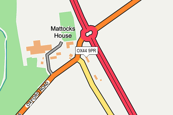
OX44 9PR is located in the Sandford & the Wittenhams electoral ward, within the local authority district of South Oxfordshire and the English Parliamentary constituency of Henley. The Sub Integrated Care Board (ICB) Location is NHS Buckinghamshire, Oxfordshire and Berkshire West ICB - 10Q and the police force is Thames Valley. This postcode has been in use since August 1992.


GetTheData
Source: OS OpenMap – Local (Ordnance Survey)
Source: OS VectorMap District (Ordnance Survey)
Licence: Open Government Licence (requires attribution)
| Easting | 456004 |
| Northing | 197527 |
| Latitude | 51.673734 |
| Longitude | -1.191488 |
GetTheData
Source: Open Postcode Geo
Licence: Open Government Licence
| Country | England |
| Postcode District | OX44 |
| ➜ OX44 open data dashboard ➜ See where OX44 is on a map | |
GetTheData
Source: Land Registry Price Paid Data
Licence: Open Government Licence
Elevation or altitude of OX44 9PR as distance above sea level:
| Metres | Feet | |
|---|---|---|
| Elevation | 70m | 230ft |
Elevation is measured from the approximate centre of the postcode, to the nearest point on an OS contour line from OS Terrain 50, which has contour spacing of ten vertical metres.
➜ How high above sea level am I? Find the elevation of your current position using your device's GPS.
GetTheData
Source: Open Postcode Elevation
Licence: Open Government Licence
| Ward | Sandford & The Wittenhams |
| Constituency | Henley |
GetTheData
Source: ONS Postcode Database
Licence: Open Government Licence
| May 2022 | Violence and sexual offences | On or near Oxford Road | 195m |
| May 2022 | Anti-social behaviour | On or near Oxford Road | 195m |
| April 2022 | Other theft | On or near Oxford Road | 195m |
| ➜ Get more crime data in our Crime section | |||
GetTheData
Source: data.police.uk
Licence: Open Government Licence
| Golden Balls Roundabout (A4074) | Golden Balls | 85m |
| Golden Balls Roundabout (A4074) | Golden Balls | 248m |
| Burcot Park (Abingdon Road) | Burcot | 1,412m |
| Burcot Park (Abingdon Road) | Burcot | 1,426m |
| Crutch Furlong (Fane Drive) | Berinsfield | 1,500m |
| Radley Station | 3.7km |
| Culham Station | 3.8km |
| Appleford Station | 5.2km |
GetTheData
Source: NaPTAN
Licence: Open Government Licence
| Percentage of properties with Next Generation Access | 100.0% |
| Percentage of properties with Superfast Broadband | 100.0% |
| Percentage of properties with Ultrafast Broadband | 0.0% |
| Percentage of properties with Full Fibre Broadband | 0.0% |
Superfast Broadband is between 30Mbps and 300Mbps
Ultrafast Broadband is > 300Mbps
| Percentage of properties unable to receive 2Mbps | 0.0% |
| Percentage of properties unable to receive 5Mbps | 0.0% |
| Percentage of properties unable to receive 10Mbps | 0.0% |
| Percentage of properties unable to receive 30Mbps | 0.0% |
GetTheData
Source: Ofcom
Licence: Ofcom Terms of Use (requires attribution)
GetTheData
Source: ONS Postcode Database
Licence: Open Government Licence


➜ Get more ratings from the Food Standards Agency
GetTheData
Source: Food Standards Agency
Licence: FSA terms & conditions
| Last Collection | |||
|---|---|---|---|
| Location | Mon-Fri | Sat | Distance |
| Berinsfield Post Ofice | 16:30 | 10:45 | 1,496m |
| Burcot | 16:15 | 09:15 | 1,717m |
| Baldon | 16:30 | 08:00 | 1,776m |
GetTheData
Source: Dracos
Licence: Creative Commons Attribution-ShareAlike
| Facility | Distance |
|---|---|
| The Oxford City Indoor Arena (Closed) Tower Road, Berinsfield, Wallingford Sports Hall | 1.7km |
| Abbey Sports Centre (Berinsfield) Green Furlong, Berinsfield, Wallingford Sports Hall, Swimming Pool, Health and Fitness Gym, Artificial Grass Pitch | 1.7km |
| Lay Avenue Recreation Ground Lay Avenue, Berinsfield, Wallingford Grass Pitches | 1.8km |
GetTheData
Source: Active Places
Licence: Open Government Licence
| School | Phase of Education | Distance |
|---|---|---|
| Abbey Woods Academy Wimblestraw Road, Berinsfield, Wallingford, OX10 7LZ | Primary | 2km |
| Marsh Baldon CofE Primary School The Green, Marsh Baldon, OX44 9LJ | Primary | 2.1km |
| Clifton Hampden Church of England Primary School High Street, Clifton Hampden, Abingdon, OX14 3EE | Primary | 2.4km |
GetTheData
Source: Edubase
Licence: Open Government Licence
The below table lists the International Territorial Level (ITL) codes (formerly Nomenclature of Territorial Units for Statistics (NUTS) codes) and Local Administrative Units (LAU) codes for OX44 9PR:
| ITL 1 Code | Name |
|---|---|
| TLJ | South East (England) |
| ITL 2 Code | Name |
| TLJ1 | Berkshire, Buckinghamshire and Oxfordshire |
| ITL 3 Code | Name |
| TLJ14 | Oxfordshire CC |
| LAU 1 Code | Name |
| E07000179 | South Oxfordshire |
GetTheData
Source: ONS Postcode Directory
Licence: Open Government Licence
The below table lists the Census Output Area (OA), Lower Layer Super Output Area (LSOA), and Middle Layer Super Output Area (MSOA) for OX44 9PR:
| Code | Name | |
|---|---|---|
| OA | E00145887 | |
| LSOA | E01028641 | South Oxfordshire 006D |
| MSOA | E02005963 | South Oxfordshire 006 |
GetTheData
Source: ONS Postcode Directory
Licence: Open Government Licence
| OX44 9PN | Nuneham Park | 474m |
| OX44 9PL | Nuneham Park | 688m |
| OX44 9PW | Nuneham Park | 728m |
| OX14 3DL | Burcot Farm Cottages | 823m |
| OX10 7NN | Crutch Furlong | 1440m |
| OX10 7NL | West Croft | 1446m |
| OX10 7NP | Barrington Close | 1461m |
| OX14 3BX | 1462m | |
| OX10 7NE | Fane Drive | 1487m |
| OX10 7NF | Fane Drive | 1488m |
GetTheData
Source: Open Postcode Geo; Land Registry Price Paid Data
Licence: Open Government Licence