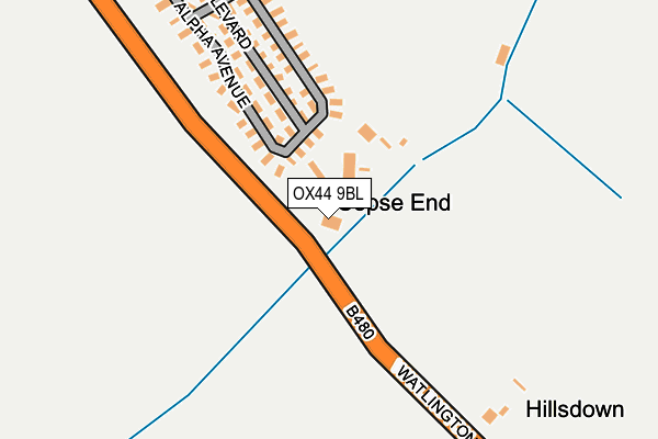
OX44 9BL is located in the Garsington & Horspath electoral ward, within the local authority district of South Oxfordshire and the English Parliamentary constituency of Henley. The Sub Integrated Care Board (ICB) Location is NHS Buckinghamshire, Oxfordshire and Berkshire West ICB - 10Q and the police force is Thames Valley. This postcode has been in use since August 1992.


GetTheData
Source: OS OpenMap – Local (Ordnance Survey)
Source: OS VectorMap District (Ordnance Survey)
Licence: Open Government Licence (requires attribution)
| Easting | 457217 |
| Northing | 201963 |
| Latitude | 51.713493 |
| Longitude | -1.173222 |
GetTheData
Source: Open Postcode Geo
Licence: Open Government Licence
| Country | England |
| Postcode District | OX44 |
| ➜ OX44 open data dashboard ➜ See where OX44 is on a map ➜ Where is Garsington? | |
GetTheData
Source: Land Registry Price Paid Data
Licence: Open Government Licence
Elevation or altitude of OX44 9BL as distance above sea level:
| Metres | Feet | |
|---|---|---|
| Elevation | 70m | 230ft |
Elevation is measured from the approximate centre of the postcode, to the nearest point on an OS contour line from OS Terrain 50, which has contour spacing of ten vertical metres.
➜ How high above sea level am I? Find the elevation of your current position using your device's GPS.
GetTheData
Source: Open Postcode Elevation
Licence: Open Government Licence
| Ward | Garsington & Horspath |
| Constituency | Henley |
GetTheData
Source: ONS Postcode Database
Licence: Open Government Licence
| June 2022 | Other crime | On or near Alpha Avenue | 222m |
| May 2022 | Other crime | On or near Beta Boulevard | 211m |
| March 2022 | Vehicle crime | On or near Beta Boulevard | 211m |
| ➜ Get more crime data in our Crime section | |||
GetTheData
Source: data.police.uk
Licence: Open Government Licence
| Kings Copse Caravan Park (Watlington Road) | Southend | 301m |
| Kings Copse Caravan Park (Watlington Road) | Southend | 311m |
| Oxford Road | Garsington | 821m |
| Oxford Road | Garsington | 822m |
| Poplar Close (Oxford Road) | Garsington | 858m |
| Radley Station | 5.6km |
GetTheData
Source: NaPTAN
Licence: Open Government Licence
Estimated total energy consumption in OX44 9BL by fuel type, 2015.
| Consumption (kWh) | 13,559 |
|---|---|
| Meter count | 6 |
| Mean (kWh/meter) | 2,260 |
| Median (kWh/meter) | 1,288 |
GetTheData
Source: Postcode level gas estimates: 2015 (experimental)
Source: Postcode level electricity estimates: 2015 (experimental)
Licence: Open Government Licence
GetTheData
Source: ONS Postcode Database
Licence: Open Government Licence


➜ Get more ratings from the Food Standards Agency
GetTheData
Source: Food Standards Agency
Licence: FSA terms & conditions
| Last Collection | |||
|---|---|---|---|
| Location | Mon-Fri | Sat | Distance |
| Kings Copse Park | 16:15 | 08:00 | 314m |
| Garsington Post Office | 16:45 | 09:15 | 959m |
| Garsington Memorial | 16:45 | 08:00 | 975m |
GetTheData
Source: Dracos
Licence: Creative Commons Attribution-ShareAlike
| Facility | Distance |
|---|---|
| Garsington Sports Club Denton Lane, Garsington, Oxford Grass Pitches | 1.4km |
| Pegasus Primary School Field Avenue, Oxford Grass Pitches | 1.6km |
| Blackbird Leys Park Cuddesdon Way, Oxford Grass Pitches | 1.9km |
GetTheData
Source: Active Places
Licence: Open Government Licence
| School | Phase of Education | Distance |
|---|---|---|
| Garsington Church of England Primary School Wheatley Road, Garsington, Oxford, OX44 9EW | Primary | 1km |
| Pegasus School Field Avenue, Blackbird Leys, Oxford, OX4 6RQ | Primary | 1.6km |
| Windale Primary School Windale Avenue, Oxford, OX4 6JD | Primary | 1.8km |
GetTheData
Source: Edubase
Licence: Open Government Licence
The below table lists the International Territorial Level (ITL) codes (formerly Nomenclature of Territorial Units for Statistics (NUTS) codes) and Local Administrative Units (LAU) codes for OX44 9BL:
| ITL 1 Code | Name |
|---|---|
| TLJ | South East (England) |
| ITL 2 Code | Name |
| TLJ1 | Berkshire, Buckinghamshire and Oxfordshire |
| ITL 3 Code | Name |
| TLJ14 | Oxfordshire CC |
| LAU 1 Code | Name |
| E07000179 | South Oxfordshire |
GetTheData
Source: ONS Postcode Directory
Licence: Open Government Licence
The below table lists the Census Output Area (OA), Lower Layer Super Output Area (LSOA), and Middle Layer Super Output Area (MSOA) for OX44 9BL:
| Code | Name | |
|---|---|---|
| OA | E00145885 | |
| LSOA | E01028641 | South Oxfordshire 006D |
| MSOA | E02005963 | South Oxfordshire 006 |
GetTheData
Source: ONS Postcode Directory
Licence: Open Government Licence
| OX44 9BG | Lower Road | 409m |
| OX44 9AR | Kiln Lane | 694m |
| OX44 9DB | Pettiwell | 720m |
| OX44 9BT | Combewell | 733m |
| OX44 9AD | Oxford Road | 793m |
| OX44 9AT | Oxford Road | 818m |
| OX44 9AE | Oxford Road | 838m |
| OX44 9DA | Oxford Road | 863m |
| OX44 9JT | Oxford Road | 864m |
| OX44 9AN | Willow Close | 866m |
GetTheData
Source: Open Postcode Geo; Land Registry Price Paid Data
Licence: Open Government Licence