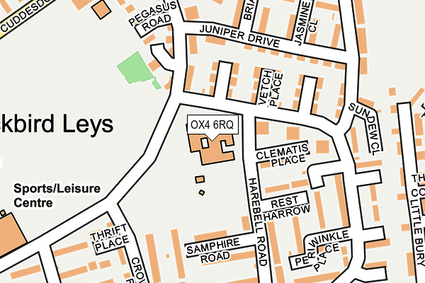
OX4 6RQ is located in the Blackbird Leys electoral ward, within the local authority district of Oxford and the English Parliamentary constituency of Oxford East. The Sub Integrated Care Board (ICB) Location is NHS Buckinghamshire, Oxfordshire and Berkshire West ICB - 10Q and the police force is Thames Valley. This postcode has been in use since June 2000.


GetTheData
Source: OS OpenMap – Local (Ordnance Survey)
Source: OS VectorMap District (Ordnance Survey)
Licence: Open Government Licence (requires attribution)
| Easting | 455848 |
| Northing | 202806 |
| Latitude | 51.721205 |
| Longitude | -1.192919 |
GetTheData
Source: Open Postcode Geo
Licence: Open Government Licence
| Country | England |
| Postcode District | OX4 |
| ➜ OX4 open data dashboard ➜ See where OX4 is on a map ➜ Where is Oxford? | |
GetTheData
Source: Land Registry Price Paid Data
Licence: Open Government Licence
Elevation or altitude of OX4 6RQ as distance above sea level:
| Metres | Feet | |
|---|---|---|
| Elevation | 70m | 230ft |
Elevation is measured from the approximate centre of the postcode, to the nearest point on an OS contour line from OS Terrain 50, which has contour spacing of ten vertical metres.
➜ How high above sea level am I? Find the elevation of your current position using your device's GPS.
GetTheData
Source: Open Postcode Elevation
Licence: Open Government Licence
| Ward | Blackbird Leys |
| Constituency | Oxford East |
GetTheData
Source: ONS Postcode Database
Licence: Open Government Licence
| January 2024 | Violence and sexual offences | On or near Chaffinch Walk | 445m |
| November 2023 | Violence and sexual offences | On or near Parking Area | 294m |
| November 2023 | Other crime | On or near Bryony Close | 408m |
| ➜ Get more crime data in our Crime section | |||
GetTheData
Source: data.police.uk
Licence: Open Government Licence
| Pegasus Court (Pegasus Road) | Blackbird Leys | 128m |
| Rampion Close (Field Avenue) | Blackbird Leys | 220m |
| Flaxfield Road (Field Avenue) | Blackbird Leys | 238m |
| Mercury Road (Field Avenue) | Blackbird Leys | 258m |
| Bulrush Road (Field Avenue) | Blackbird Leys | 316m |
| Radley Station | 5.1km |
GetTheData
Source: NaPTAN
Licence: Open Government Licence
GetTheData
Source: ONS Postcode Database
Licence: Open Government Licence


➜ Get more ratings from the Food Standards Agency
GetTheData
Source: Food Standards Agency
Licence: FSA terms & conditions
| Last Collection | |||
|---|---|---|---|
| Location | Mon-Fri | Sat | Distance |
| Pegasus Road North | 17:00 | 12:00 | 89m |
| Field Avenue | 17:00 | 12:00 | 246m |
| Greenhill | 16:00 | 12:00 | 436m |
GetTheData
Source: Dracos
Licence: Creative Commons Attribution-ShareAlike
| Facility | Distance |
|---|---|
| Pegasus Primary School Field Avenue, Oxford Grass Pitches | 0m |
| Blackbird Leys Park Cuddesdon Way, Oxford Grass Pitches | 259m |
| Leys Pools And Leisure Centre Pegasus Road, Oxford Sports Hall, Health and Fitness Gym, Studio, Swimming Pool, Artificial Grass Pitch | 412m |
GetTheData
Source: Active Places
Licence: Open Government Licence
| School | Phase of Education | Distance |
|---|---|---|
| Pegasus School Field Avenue, Blackbird Leys, Oxford, OX4 6RQ | Primary | 1m |
| Mabel Prichard School Cuddesdon Way, Oxford, OX4 6SB | Not applicable | 367m |
| Orchard Meadow Primary School Wesley Close, Oxford, OX4 6BG | Primary | 495m |
GetTheData
Source: Edubase
Licence: Open Government Licence
The below table lists the International Territorial Level (ITL) codes (formerly Nomenclature of Territorial Units for Statistics (NUTS) codes) and Local Administrative Units (LAU) codes for OX4 6RQ:
| ITL 1 Code | Name |
|---|---|
| TLJ | South East (England) |
| ITL 2 Code | Name |
| TLJ1 | Berkshire, Buckinghamshire and Oxfordshire |
| ITL 3 Code | Name |
| TLJ14 | Oxfordshire CC |
| LAU 1 Code | Name |
| E07000178 | Oxford |
GetTheData
Source: ONS Postcode Directory
Licence: Open Government Licence
The below table lists the Census Output Area (OA), Lower Layer Super Output Area (LSOA), and Middle Layer Super Output Area (MSOA) for OX4 6RQ:
| Code | Name | |
|---|---|---|
| OA | E00145295 | |
| LSOA | E01028520 | Oxford 018A |
| MSOA | E02005957 | Oxford 018 |
GetTheData
Source: ONS Postcode Directory
Licence: Open Government Licence
| OX4 6QZ | Woodruff Close | 87m |
| OX4 6RJ | Clematis Place | 100m |
| OX4 6PQ | Field Avenue | 114m |
| OX4 6QY | Vetch Place | 117m |
| OX4 6RL | Rest Harrow | 122m |
| OX4 6SY | Pegasus Road | 131m |
| OX4 6QX | Timothy Way | 138m |
| OX4 6RZ | Juniper Drive | 152m |
| OX4 6RF | Samphire Road | 170m |
| OX4 6RH | Harebell Road | 176m |
GetTheData
Source: Open Postcode Geo; Land Registry Price Paid Data
Licence: Open Government Licence