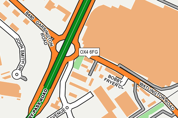
OX4 6FG is located in the Blackbird Leys electoral ward, within the local authority district of Oxford and the English Parliamentary constituency of Oxford East. The Sub Integrated Care Board (ICB) Location is NHS Buckinghamshire, Oxfordshire and Berkshire West ICB - 10Q and the police force is Thames Valley. This postcode has been in use since February 2015.


GetTheData
Source: OS OpenMap – Local (Ordnance Survey)
Source: OS VectorMap District (Ordnance Survey)
Licence: Open Government Licence (requires attribution)
| Easting | 455255 |
| Northing | 203715 |
| Latitude | 51.729436 |
| Longitude | -1.201359 |
GetTheData
Source: Open Postcode Geo
Licence: Open Government Licence
| Country | England |
| Postcode District | OX4 |
| ➜ OX4 open data dashboard ➜ See where OX4 is on a map ➜ Where is Oxford? | |
GetTheData
Source: Land Registry Price Paid Data
Licence: Open Government Licence
Elevation or altitude of OX4 6FG as distance above sea level:
| Metres | Feet | |
|---|---|---|
| Elevation | 70m | 230ft |
Elevation is measured from the approximate centre of the postcode, to the nearest point on an OS contour line from OS Terrain 50, which has contour spacing of ten vertical metres.
➜ How high above sea level am I? Find the elevation of your current position using your device's GPS.
GetTheData
Source: Open Postcode Elevation
Licence: Open Government Licence
| Ward | Blackbird Leys |
| Constituency | Oxford East |
GetTheData
Source: ONS Postcode Database
Licence: Open Government Licence
| June 2022 | Public order | On or near Shopping Area | 116m |
| June 2022 | Shoplifting | On or near Shopping Area | 116m |
| June 2022 | Shoplifting | On or near Shopping Area | 116m |
| ➜ Get more crime data in our Crime section | |||
GetTheData
Source: data.police.uk
Licence: Open Government Licence
| Car Factory Gate (Garsington Road) | Cowley | 119m |
| Car Factory Gate (Garsington Road) | Cowley | 134m |
| Tesco Store (Oxford Retail Park) | Cowley | 239m |
| The Longwall Ph (Garsington Road) | Cowley | 278m |
| The Longwall Ph (Garsington Road) | Cowley | 305m |
| Oxford Station | 5.5km |
| Radley Station | 5.5km |
GetTheData
Source: NaPTAN
Licence: Open Government Licence
| Percentage of properties with Next Generation Access | 100.0% |
| Percentage of properties with Superfast Broadband | 100.0% |
| Percentage of properties with Ultrafast Broadband | 0.0% |
| Percentage of properties with Full Fibre Broadband | 0.0% |
Superfast Broadband is between 30Mbps and 300Mbps
Ultrafast Broadband is > 300Mbps
| Percentage of properties unable to receive 2Mbps | 0.0% |
| Percentage of properties unable to receive 5Mbps | 0.0% |
| Percentage of properties unable to receive 10Mbps | 0.0% |
| Percentage of properties unable to receive 30Mbps | 0.0% |
GetTheData
Source: Ofcom
Licence: Ofcom Terms of Use (requires attribution)
GetTheData
Source: ONS Postcode Database
Licence: Open Government Licence


➜ Get more ratings from the Food Standards Agency
GetTheData
Source: Food Standards Agency
Licence: FSA terms & conditions
| Last Collection | |||
|---|---|---|---|
| Location | Mon-Fri | Sat | Distance |
| Garsington Road | 17:00 | 12:00 | 162m |
| Watlington Road | 17:00 | 11:45 | 552m |
| Balfour Road Post Office | 17:00 | 12:00 | 569m |
GetTheData
Source: Dracos
Licence: Creative Commons Attribution-ShareAlike
| Facility | Distance |
|---|---|
| David Lloyd (Oxford) John Smith Drive, Oxford Business Park South, Oxford Swimming Pool, Health and Fitness Gym, Indoor Tennis Centre, Studio, Outdoor Tennis Courts | 255m |
| Lovethegym (Closed) Sandy Lane, Oxford Studio, Health and Fitness Gym | 399m |
| Sandy Lane (Oxford) Amory Close, Oxford Grass Pitches | 483m |
GetTheData
Source: Active Places
Licence: Open Government Licence
| School | Phase of Education | Distance |
|---|---|---|
| Orchard Meadow Primary School Wesley Close, Oxford, OX4 6BG | Primary | 777m |
| Mabel Prichard School Cuddesdon Way, Oxford, OX4 6SB | Not applicable | 796m |
| Church Cowley St James Church of England Primary School Bartholomew Road, Cowley, Oxford, OX4 3QH | Primary | 814m |
GetTheData
Source: Edubase
Licence: Open Government Licence
The below table lists the International Territorial Level (ITL) codes (formerly Nomenclature of Territorial Units for Statistics (NUTS) codes) and Local Administrative Units (LAU) codes for OX4 6FG:
| ITL 1 Code | Name |
|---|---|
| TLJ | South East (England) |
| ITL 2 Code | Name |
| TLJ1 | Berkshire, Buckinghamshire and Oxfordshire |
| ITL 3 Code | Name |
| TLJ14 | Oxfordshire CC |
| LAU 1 Code | Name |
| E07000178 | Oxford |
GetTheData
Source: ONS Postcode Directory
Licence: Open Government Licence
The below table lists the Census Output Area (OA), Lower Layer Super Output Area (LSOA), and Middle Layer Super Output Area (MSOA) for OX4 6FG:
| Code | Name | |
|---|---|---|
| OA | E00145298 | |
| LSOA | E01028519 | Oxford 017C |
| MSOA | E02005956 | Oxford 017 |
GetTheData
Source: ONS Postcode Directory
Licence: Open Government Licence
| OX4 6NQ | Garsington Road | 172m |
| OX4 6TU | Ashville Way | 393m |
| OX4 6LR | Sandy Lane | 419m |
| OX4 6FD | Sandy Lane | 424m |
| OX4 2JR | Fernhill Road | 434m |
| OX4 6AS | Sandy Lane | 470m |
| OX4 6NF | Watlington Road | 475m |
| OX4 6AR | Sandy Lane | 476m |
| OX4 6LQ | Sandy Lane | 497m |
| OX4 6LL | Sandy Lane | 506m |
GetTheData
Source: Open Postcode Geo; Land Registry Price Paid Data
Licence: Open Government Licence