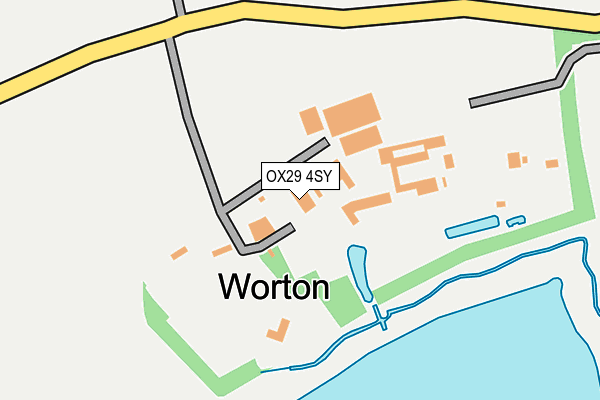
OX29 4SY is in Worton, Witney. OX29 4SY is located in the Eynsham and Cassington electoral ward, within the local authority district of West Oxfordshire and the English Parliamentary constituency of Witney. The Sub Integrated Care Board (ICB) Location is NHS Buckinghamshire, Oxfordshire and Berkshire West ICB - 10Q and the police force is Thames Valley. This postcode has been in use since June 2001.


GetTheData
Source: OS OpenMap – Local (Ordnance Survey)
Source: OS VectorMap District (Ordnance Survey)
Licence: Open Government Licence (requires attribution)
| Easting | 446336 |
| Northing | 211397 |
| Latitude | 51.799313 |
| Longitude | -1.329448 |
GetTheData
Source: Open Postcode Geo
Licence: Open Government Licence
| Locality | Worton |
| Town/City | Witney |
| Country | England |
| Postcode District | OX29 |
| ➜ OX29 open data dashboard ➜ See where OX29 is on a map ➜ Where is Worton? | |
GetTheData
Source: Land Registry Price Paid Data
Licence: Open Government Licence
Elevation or altitude of OX29 4SY as distance above sea level:
| Metres | Feet | |
|---|---|---|
| Elevation | 60m | 197ft |
Elevation is measured from the approximate centre of the postcode, to the nearest point on an OS contour line from OS Terrain 50, which has contour spacing of ten vertical metres.
➜ How high above sea level am I? Find the elevation of your current position using your device's GPS.
GetTheData
Source: Open Postcode Elevation
Licence: Open Government Licence
| Ward | Eynsham And Cassington |
| Constituency | Witney |
GetTheData
Source: ONS Postcode Database
Licence: Open Government Licence
| May 2022 | Violence and sexual offences | On or near Conference/Exhibition Centre | 63m |
| March 2021 | Bicycle theft | On or near Conference/Exhibition Centre | 63m |
| March 2021 | Other theft | On or near Conference/Exhibition Centre | 63m |
| ➜ Get more crime data in our Crime section | |||
GetTheData
Source: data.police.uk
Licence: Open Government Licence
| Red Lion Ph (The Green) | Cassington | 1,119m |
| Red Lion Ph (The Green) | Cassington | 1,120m |
| The Paddocks (Rutten Lane) | Yarnton | 1,492m |
| The Paddocks (Rutten Lane) | Yarnton | 1,501m |
| William Fletcher School (Rutten Lane) | Yarnton | 1,510m |
| Oxford Parkway Station | 3.8km |
| Hanborough Station | 4.2km |
| Combe (Oxon) Station | 5.8km |
GetTheData
Source: NaPTAN
Licence: Open Government Licence
| Percentage of properties with Next Generation Access | 100.0% |
| Percentage of properties with Superfast Broadband | 100.0% |
| Percentage of properties with Ultrafast Broadband | 0.0% |
| Percentage of properties with Full Fibre Broadband | 0.0% |
Superfast Broadband is between 30Mbps and 300Mbps
Ultrafast Broadband is > 300Mbps
| Percentage of properties unable to receive 2Mbps | 0.0% |
| Percentage of properties unable to receive 5Mbps | 0.0% |
| Percentage of properties unable to receive 10Mbps | 0.0% |
| Percentage of properties unable to receive 30Mbps | 0.0% |
GetTheData
Source: Ofcom
Licence: Ofcom Terms of Use (requires attribution)
GetTheData
Source: ONS Postcode Database
Licence: Open Government Licence


➜ Get more ratings from the Food Standards Agency
GetTheData
Source: Food Standards Agency
Licence: FSA terms & conditions
| Last Collection | |||
|---|---|---|---|
| Location | Mon-Fri | Sat | Distance |
| Cassington | 16:30 | 09:00 | 1,118m |
| Rutten Lane | 16:45 | 09:15 | 1,487m |
| Eynsham Road | 16:30 | 09:00 | 1,510m |
GetTheData
Source: Dracos
Licence: Creative Commons Attribution-ShareAlike
| Facility | Distance |
|---|---|
| Cassington Recreation Ground Elms Road, Cassington Grass Pitches, Outdoor Tennis Courts | 1.2km |
| Yarnton Park Rutten Lane, Yarnton Grass Pitches | 1.5km |
| Little Marsh Sports Ground Green Lane, Yarnton, Kidlington Grass Pitches | 2.3km |
GetTheData
Source: Active Places
Licence: Open Government Licence
| School | Phase of Education | Distance |
|---|---|---|
| St Peter's Church of England Primary School, Cassington The Green, Cassington, Witney, OX29 4DN | Primary | 1.1km |
| William Fletcher Primary School Rutten Lane, Yarnton, Oxford, OX5 1LW | Primary | 1.5km |
| LVS Oxford Spring Hill Road, Begbroke, Oxford, OX5 1RX | Not applicable | 2.4km |
GetTheData
Source: Edubase
Licence: Open Government Licence
The below table lists the International Territorial Level (ITL) codes (formerly Nomenclature of Territorial Units for Statistics (NUTS) codes) and Local Administrative Units (LAU) codes for OX29 4SY:
| ITL 1 Code | Name |
|---|---|
| TLJ | South East (England) |
| ITL 2 Code | Name |
| TLJ1 | Berkshire, Buckinghamshire and Oxfordshire |
| ITL 3 Code | Name |
| TLJ14 | Oxfordshire CC |
| LAU 1 Code | Name |
| E07000181 | West Oxfordshire |
GetTheData
Source: ONS Postcode Directory
Licence: Open Government Licence
The below table lists the Census Output Area (OA), Lower Layer Super Output Area (LSOA), and Middle Layer Super Output Area (MSOA) for OX29 4SY:
| Code | Name | |
|---|---|---|
| OA | E00146617 | |
| LSOA | E01028788 | West Oxfordshire 006A |
| MSOA | E02005998 | West Oxfordshire 006 |
GetTheData
Source: ONS Postcode Directory
Licence: Open Government Licence
| OX29 4SZ | 488m | |
| OX29 4ES | Lynton Lane | 881m |
| OX29 4DY | Yarnton Road | 885m |
| OX29 4EL | The Tennis | 922m |
| OX29 4DS | Bell Lane | 927m |
| OX29 4EP | Bell Close | 990m |
| OX29 4DX | St Peters Close | 1015m |
| OX29 4BU | Orchard Close | 1031m |
| OX29 4DP | Elms Road | 1072m |
| OX29 4DW | 1079m |
GetTheData
Source: Open Postcode Geo; Land Registry Price Paid Data
Licence: Open Government Licence