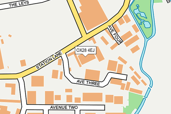
OX28 4EJ is located in the Witney South electoral ward, within the local authority district of West Oxfordshire and the English Parliamentary constituency of Witney. The Sub Integrated Care Board (ICB) Location is NHS Buckinghamshire, Oxfordshire and Berkshire West ICB - 10Q and the police force is Thames Valley. This postcode has been in use since June 2001.


GetTheData
Source: OS OpenMap – Local (Ordnance Survey)
Source: OS VectorMap District (Ordnance Survey)
Licence: Open Government Licence (requires attribution)
| Easting | 435749 |
| Northing | 208961 |
| Latitude | 51.778186 |
| Longitude | -1.483218 |
GetTheData
Source: Open Postcode Geo
Licence: Open Government Licence
| Country | England |
| Postcode District | OX28 |
| ➜ OX28 open data dashboard ➜ See where OX28 is on a map ➜ Where is Witney? | |
GetTheData
Source: Land Registry Price Paid Data
Licence: Open Government Licence
Elevation or altitude of OX28 4EJ as distance above sea level:
| Metres | Feet | |
|---|---|---|
| Elevation | 80m | 262ft |
Elevation is measured from the approximate centre of the postcode, to the nearest point on an OS contour line from OS Terrain 50, which has contour spacing of ten vertical metres.
➜ How high above sea level am I? Find the elevation of your current position using your device's GPS.
GetTheData
Source: Open Postcode Elevation
Licence: Open Government Licence
| Ward | Witney South |
| Constituency | Witney |
GetTheData
Source: ONS Postcode Database
Licence: Open Government Licence
| November 2022 | Criminal damage and arson | On or near Farm Mill Lane | 363m |
| November 2022 | Theft from the person | On or near Farm Mill Lane | 363m |
| June 2022 | Public order | On or near Avenue Four | 127m |
| ➜ Get more crime data in our Crime section | |||
GetTheData
Source: data.police.uk
Licence: Open Government Licence
| Sainsburys (Witan Way) | Witney | 258m |
| Langdale Gate | Witney | 624m |
| Market Square | Witney | 655m |
| Market Square | Witney | 669m |
| Market Square | Witney | 670m |
GetTheData
Source: NaPTAN
Licence: Open Government Licence
GetTheData
Source: ONS Postcode Database
Licence: Open Government Licence


➜ Get more ratings from the Food Standards Agency
GetTheData
Source: Food Standards Agency
Licence: FSA terms & conditions
| Last Collection | |||
|---|---|---|---|
| Location | Mon-Fri | Sat | Distance |
| St Mary's Meade | 16:15 | 08:00 | 476m |
| Church Green | 17:00 | 12:00 | 579m |
| Ducklington Lane | 16:00 | 09:00 | 665m |
GetTheData
Source: Dracos
Licence: Creative Commons Attribution-ShareAlike
| Facility | Distance |
|---|---|
| Two Tone Health And Fitness (Closed) Two Rivers Industrial Estate, Station Lane, Witney Health and Fitness Gym | 117m |
| Leys Recreation Ground The Leys, Witney Grass Pitches, Outdoor Tennis Courts | 274m |
| The Henry Box School Church Green, Witney Sports Hall, Grass Pitches | 441m |
GetTheData
Source: Active Places
Licence: Open Government Licence
| School | Phase of Education | Distance |
|---|---|---|
| The Henry Box School Church Green, Witney, OX28 4AX | Secondary | 441m |
| St Mary's Church of England Infant School 19 Church Green, Witney, OX28 4AZ | Primary | 457m |
| The Batt Church of England Primary School Marlborough Lane, Corn Street, Witney, OX28 6DY | Primary | 721m |
GetTheData
Source: Edubase
Licence: Open Government Licence
The below table lists the International Territorial Level (ITL) codes (formerly Nomenclature of Territorial Units for Statistics (NUTS) codes) and Local Administrative Units (LAU) codes for OX28 4EJ:
| ITL 1 Code | Name |
|---|---|
| TLJ | South East (England) |
| ITL 2 Code | Name |
| TLJ1 | Berkshire, Buckinghamshire and Oxfordshire |
| ITL 3 Code | Name |
| TLJ14 | Oxfordshire CC |
| LAU 1 Code | Name |
| E07000181 | West Oxfordshire |
GetTheData
Source: ONS Postcode Directory
Licence: Open Government Licence
The below table lists the Census Output Area (OA), Lower Layer Super Output Area (LSOA), and Middle Layer Super Output Area (MSOA) for OX28 4EJ:
| Code | Name | |
|---|---|---|
| OA | E00146768 | |
| LSOA | E01028818 | West Oxfordshire 010E |
| MSOA | E02006002 | West Oxfordshire 010 |
GetTheData
Source: ONS Postcode Directory
Licence: Open Government Licence
| OX28 4FH | Witan Park | 145m |
| OX28 4YL | Avenue Two | 154m |
| OX28 4BN | Avenue Four | 175m |
| OX28 4BT | Wessex Industrial Estate | 196m |
| OX28 4BB | Station Lane | 251m |
| OX28 4DZ | Buttercross Lane | 304m |
| OX28 4BA | Station Lane | 325m |
| OX28 4YN | Station Lane | 343m |
| OX28 4DG | Witan Way | 359m |
| OX28 4DN | Buttercross Lane | 371m |
GetTheData
Source: Open Postcode Geo; Land Registry Price Paid Data
Licence: Open Government Licence