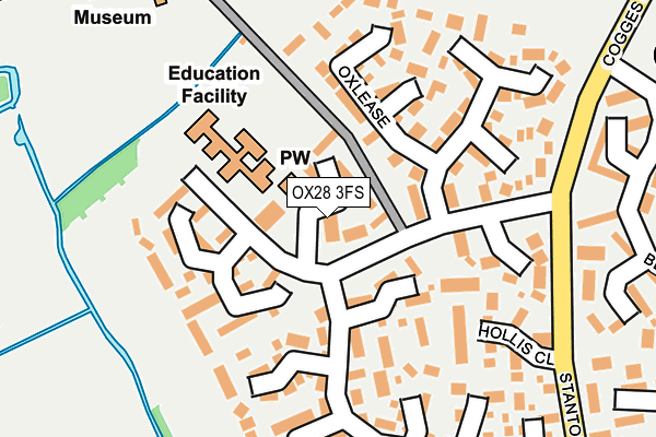
OX28 3FS is located in the Witney East electoral ward, within the local authority district of West Oxfordshire and the English Parliamentary constituency of Witney. The Sub Integrated Care Board (ICB) Location is NHS Buckinghamshire, Oxfordshire and Berkshire West ICB - 10Q and the police force is Thames Valley. This postcode has been in use since June 2001.


GetTheData
Source: OS OpenMap – Local (Ordnance Survey)
Source: OS VectorMap District (Ordnance Survey)
Licence: Open Government Licence (requires attribution)
| Easting | 436399 |
| Northing | 209420 |
| Latitude | 51.782265 |
| Longitude | -1.473765 |
GetTheData
Source: Open Postcode Geo
Licence: Open Government Licence
| Country | England |
| Postcode District | OX28 |
| ➜ OX28 open data dashboard ➜ See where OX28 is on a map ➜ Where is Witney? | |
GetTheData
Source: Land Registry Price Paid Data
Licence: Open Government Licence
Elevation or altitude of OX28 3FS as distance above sea level:
| Metres | Feet | |
|---|---|---|
| Elevation | 80m | 262ft |
Elevation is measured from the approximate centre of the postcode, to the nearest point on an OS contour line from OS Terrain 50, which has contour spacing of ten vertical metres.
➜ How high above sea level am I? Find the elevation of your current position using your device's GPS.
GetTheData
Source: Open Postcode Elevation
Licence: Open Government Licence
| Ward | Witney East |
| Constituency | Witney |
GetTheData
Source: ONS Postcode Database
Licence: Open Government Licence
| January 2024 | Other theft | On or near Eton Close | 467m |
| October 2023 | Violence and sexual offences | On or near Wadard'S Meadow | 323m |
| September 2023 | Violence and sexual offences | On or near Wadard'S Meadow | 323m |
| ➜ Get more crime data in our Crime section | |||
GetTheData
Source: data.police.uk
Licence: Open Government Licence
| Cogges Hill Road | Cogges | 216m |
| Manor Road | Cogges | 226m |
| Manor Road | Cogges | 237m |
| Wadards Meadow | Cogges | 359m |
| Blakes Avenue | Cogges | 359m |
GetTheData
Source: NaPTAN
Licence: Open Government Licence
GetTheData
Source: ONS Postcode Database
Licence: Open Government Licence


➜ Get more ratings from the Food Standards Agency
GetTheData
Source: Food Standards Agency
Licence: FSA terms & conditions
| Last Collection | |||
|---|---|---|---|
| Location | Mon-Fri | Sat | Distance |
| Cogges Hill Road | 16:45 | 08:30 | 121m |
| St Mary's Meade | 16:15 | 08:00 | 472m |
| Newlands Post Office | 16:45 | 11:30 | 746m |
GetTheData
Source: Dracos
Licence: Creative Commons Attribution-ShareAlike
| Facility | Distance |
|---|---|
| The Blake Church Of England Primary School Cogges Hill Road, Witney Sports Hall | 123m |
| Windrush Leisure Centre Witan Way, Witney Sports Hall, Swimming Pool, Health and Fitness Gym, Studio, Squash Courts | 526m |
| Two Tone Health And Fitness (Closed) Two Rivers Industrial Estate, Station Lane, Witney Health and Fitness Gym | 683m |
GetTheData
Source: Active Places
Licence: Open Government Licence
| School | Phase of Education | Distance |
|---|---|---|
| The Blake Church of England Primary School Cogges Hill Road, Cogges, Witney, OX28 3FR | Primary | 122m |
| St Mary's Church of England Infant School 19 Church Green, Witney, OX28 4AZ | Primary | 736m |
| The Batt Church of England Primary School Marlborough Lane, Corn Street, Witney, OX28 6DY | Primary | 932m |
GetTheData
Source: Edubase
Licence: Open Government Licence
The below table lists the International Territorial Level (ITL) codes (formerly Nomenclature of Territorial Units for Statistics (NUTS) codes) and Local Administrative Units (LAU) codes for OX28 3FS:
| ITL 1 Code | Name |
|---|---|
| TLJ | South East (England) |
| ITL 2 Code | Name |
| TLJ1 | Berkshire, Buckinghamshire and Oxfordshire |
| ITL 3 Code | Name |
| TLJ14 | Oxfordshire CC |
| LAU 1 Code | Name |
| E07000181 | West Oxfordshire |
GetTheData
Source: ONS Postcode Directory
Licence: Open Government Licence
The below table lists the Census Output Area (OA), Lower Layer Super Output Area (LSOA), and Middle Layer Super Output Area (MSOA) for OX28 3FS:
| Code | Name | |
|---|---|---|
| OA | E00146742 | |
| LSOA | E01028811 | West Oxfordshire 008B |
| MSOA | E02006000 | West Oxfordshire 008 |
GetTheData
Source: ONS Postcode Directory
Licence: Open Government Licence
| OX28 3FP | Cogges Hill Road | 39m |
| OX28 3QZ | Oxlease | 95m |
| OX28 3XU | Cogges Hill Road | 123m |
| OX28 3ST | Manor Road | 123m |
| OX28 3QX | Oxlease | 149m |
| OX28 3QY | Oxlease | 154m |
| OX28 3YN | Cogges Hill Road | 178m |
| OX28 3SW | Hollis Close | 187m |
| OX28 3UQ | Manor Road | 192m |
| OX28 3QU | Oxlease | 211m |
GetTheData
Source: Open Postcode Geo; Land Registry Price Paid Data
Licence: Open Government Licence