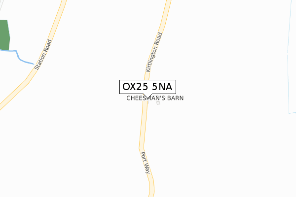
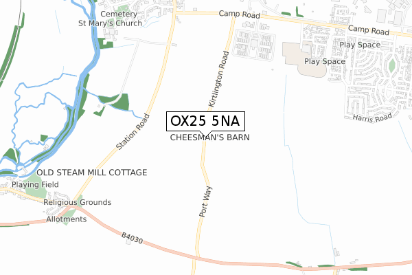
OX25 5NA lies on Kirtlington Road in Upper Heyford, Bicester. OX25 5NA is located in the Fringford and Heyfords electoral ward, within the local authority district of Cherwell and the English Parliamentary constituency of Banbury. The Sub Integrated Care Board (ICB) Location is NHS Buckinghamshire, Oxfordshire and Berkshire West ICB - 10Q and the police force is Thames Valley. This postcode has been in use since October 2000.


GetTheData
Source: OS Open Zoomstack (Ordnance Survey)
Licence: Open Government Licence (requires attribution)
Attribution: Contains OS data © Crown copyright and database right 2024
Source: Open Postcode Geo
Licence: Open Government Licence (requires attribution)
Attribution: Contains OS data © Crown copyright and database right 2024; Contains Royal Mail data © Royal Mail copyright and database right 2024; Source: Office for National Statistics licensed under the Open Government Licence v.3.0
| Easting | 450059 |
| Northing | 225168 |
| Latitude | 51.922791 |
| Longitude | -1.273490 |
GetTheData
Source: Open Postcode Geo
Licence: Open Government Licence
| Street | Kirtlington Road |
| Locality | Upper Heyford |
| Town/City | Bicester |
| Country | England |
| Postcode District | OX25 |
| ➜ OX25 open data dashboard ➜ See where OX25 is on a map | |
GetTheData
Source: Land Registry Price Paid Data
Licence: Open Government Licence
Elevation or altitude of OX25 5NA as distance above sea level:
| Metres | Feet | |
|---|---|---|
| Elevation | 120m | 394ft |
Elevation is measured from the approximate centre of the postcode, to the nearest point on an OS contour line from OS Terrain 50, which has contour spacing of ten vertical metres.
➜ How high above sea level am I? Find the elevation of your current position using your device's GPS.
GetTheData
Source: Open Postcode Elevation
Licence: Open Government Licence
| Ward | Fringford And Heyfords |
| Constituency | Banbury |
GetTheData
Source: ONS Postcode Database
Licence: Open Government Licence
| Portway Crossroads (Lower Heyford Road) | Lower Heyford | 725m |
| Portway Crossroads (Lower Heyford Road) | Lower Heyford | 738m |
| Camp Road West End (Camp Road) | Upper Heyford | 765m |
| Camp Road West End (Camp Road) | Upper Heyford | 772m |
| Kingdom Hall (Station Road) | Lower Heyford | 857m |
| Heyford Station | 1.8km |
| Tackley Station | 4.9km |
GetTheData
Source: NaPTAN
Licence: Open Government Licence
| Percentage of properties with Next Generation Access | 100.0% |
| Percentage of properties with Superfast Broadband | 0.0% |
| Percentage of properties with Ultrafast Broadband | 0.0% |
| Percentage of properties with Full Fibre Broadband | 0.0% |
Superfast Broadband is between 30Mbps and 300Mbps
Ultrafast Broadband is > 300Mbps
| Percentage of properties unable to receive 2Mbps | 0.0% |
| Percentage of properties unable to receive 5Mbps | 0.0% |
| Percentage of properties unable to receive 10Mbps | 0.0% |
| Percentage of properties unable to receive 30Mbps | 100.0% |
GetTheData
Source: Ofcom
Licence: Ofcom Terms of Use (requires attribution)
GetTheData
Source: ONS Postcode Database
Licence: Open Government Licence


➜ Get more ratings from the Food Standards Agency
GetTheData
Source: Food Standards Agency
Licence: FSA terms & conditions
| Last Collection | |||
|---|---|---|---|
| Location | Mon-Fri | Sat | Distance |
| High Street | 16:45 | 07:30 | 867m |
| Cherwell Bank | 16:45 | 09:15 | 987m |
| The Leys | 16:45 | 09:00 | 1,048m |
GetTheData
Source: Dracos
Licence: Creative Commons Attribution-ShareAlike
| Facility | Distance |
|---|---|
| Heyford Park Free School Izzard Road, Upper Heyford, Bicester Outdoor Tennis Courts, Sports Hall, Grass Pitches, Health and Fitness Gym, Squash Courts | 786m |
| National Sports Training Centre @ Upper Heyford (Closed) Heyford Park, Camp Road, Upper Heyford, Bicester Athletics, Sports Hall, Grass Pitches, Squash Courts | 814m |
| Upper Heyford Playing Field Somerton Road, Upper Heyford, Bicester Grass Pitches | 987m |
GetTheData
Source: Active Places
Licence: Open Government Licence
| School | Phase of Education | Distance |
|---|---|---|
| Heyford Park School 74 Camp Road, Heyford Park, Bicester, OX25 5HD | All-through | 1.7km |
| Dr Radcliffe's Church of England Primary School Fir Lane, Steeple Aston, Bicester, OX25 4SF | Primary | 2.7km |
| Tackley Church of England Primary School St John's Road, Tackley, Kidlington, OX5 3AP | Primary | 5km |
GetTheData
Source: Edubase
Licence: Open Government Licence
The below table lists the International Territorial Level (ITL) codes (formerly Nomenclature of Territorial Units for Statistics (NUTS) codes) and Local Administrative Units (LAU) codes for OX25 5NA:
| ITL 1 Code | Name |
|---|---|
| TLJ | South East (England) |
| ITL 2 Code | Name |
| TLJ1 | Berkshire, Buckinghamshire and Oxfordshire |
| ITL 3 Code | Name |
| TLJ14 | Oxfordshire CC |
| LAU 1 Code | Name |
| E07000177 | Cherwell |
GetTheData
Source: ONS Postcode Directory
Licence: Open Government Licence
The below table lists the Census Output Area (OA), Lower Layer Super Output Area (LSOA), and Middle Layer Super Output Area (MSOA) for OX25 5NA:
| Code | Name | |
|---|---|---|
| OA | E00145229 | |
| LSOA | E01028505 | Cherwell 010C |
| MSOA | E02005930 | Cherwell 010 |
GetTheData
Source: ONS Postcode Directory
Licence: Open Government Licence
| OX25 5JX | Orchard Place | 802m |
| OX25 5LJ | Camp Road | 812m |
| OX25 5LD | Orchard Lane | 842m |
| OX25 5AE | Bourne End | 848m |
| OX25 5JU | Somerton Road | 855m |
| OX25 5PF | Station Road | 857m |
| OX25 5LG | The Green | 866m |
| OX25 5AB | Izzard Road | 883m |
| OX25 5AD | Broad Way | 893m |
| OX25 5LT | School Lane | 911m |
GetTheData
Source: Open Postcode Geo; Land Registry Price Paid Data
Licence: Open Government Licence